A Memorable Road Trip to Arunachal and Meghalaya – Part 2
In this second part of the three-part series of my road trip to Arunachal and Meghalaya, I will cover the journey with my family in Arunachal.
Below is the link to the first part, where I covered the journey with my younger daughter from Coimbatore to Guwahati.
A Road Trip to Scenic Arunachal and Meghalaya – Part 1
Use the Table of Contents below to skip to the desired section. Use the “Back to TOC” link at the end of each section to come back to the Table of Contents.
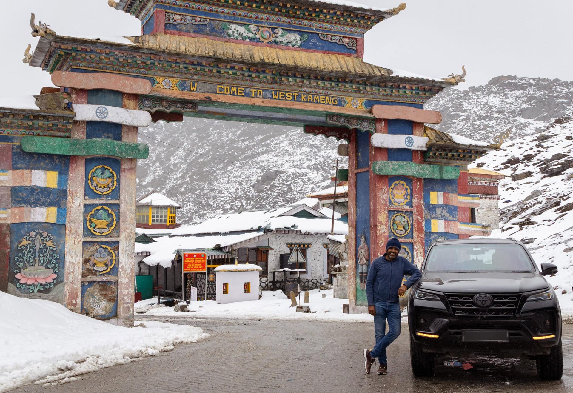
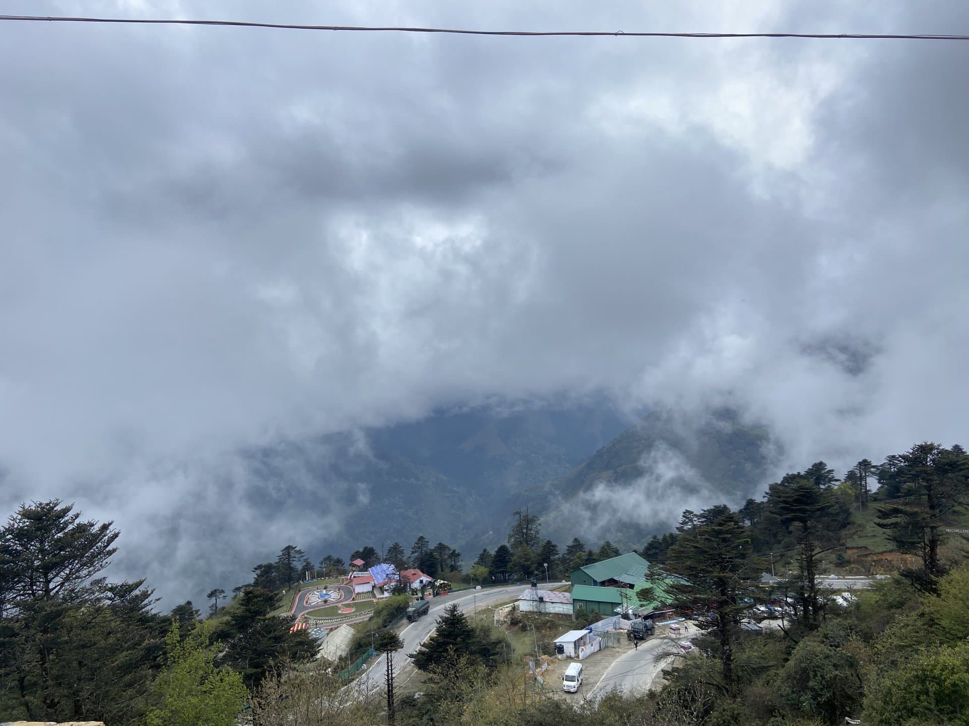
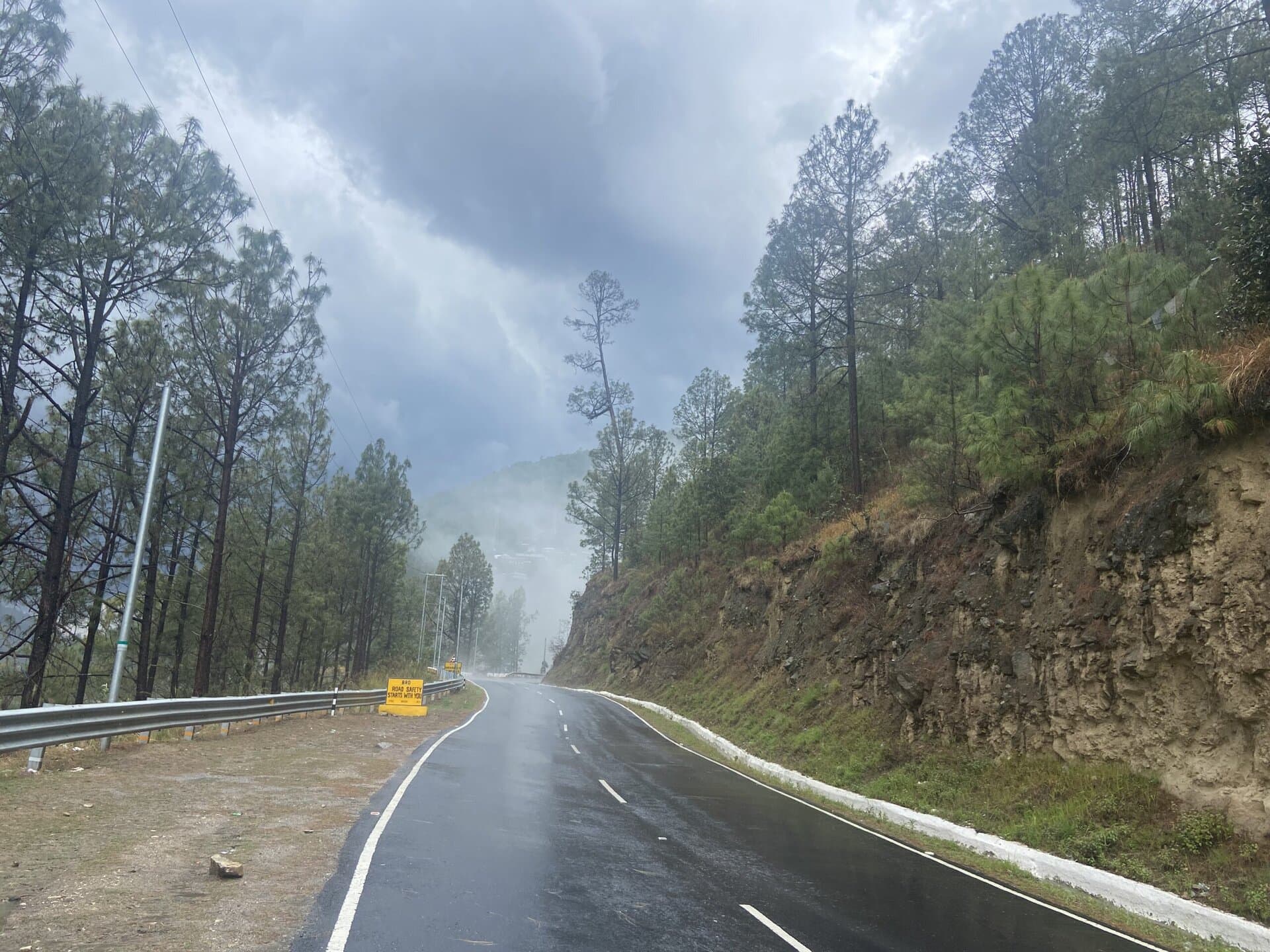
Day – 8: Guwahati to Dirang
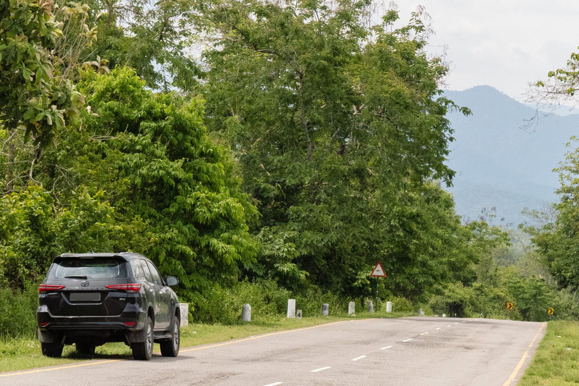
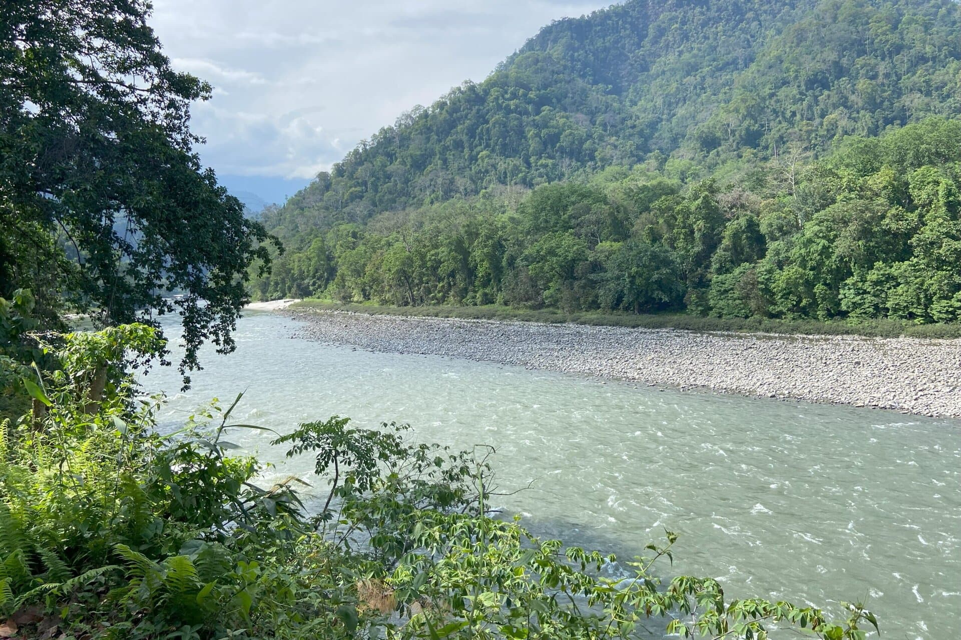
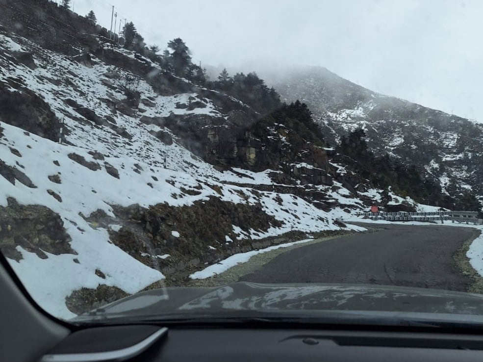
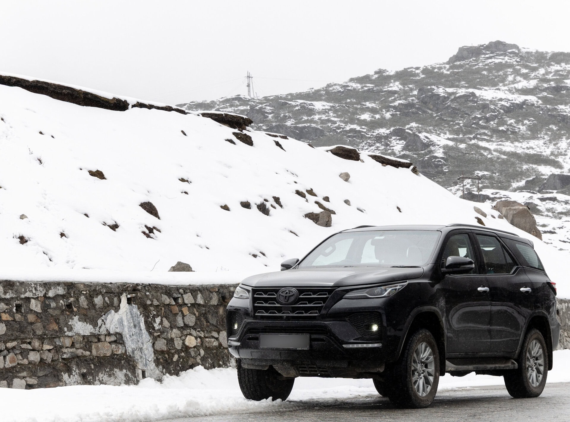
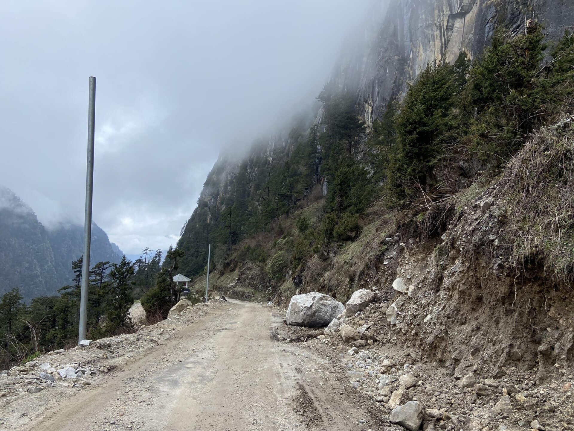
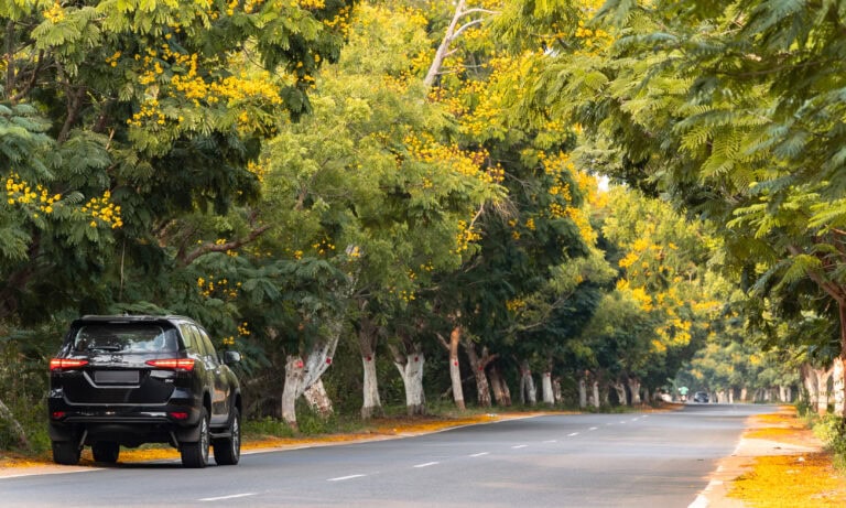
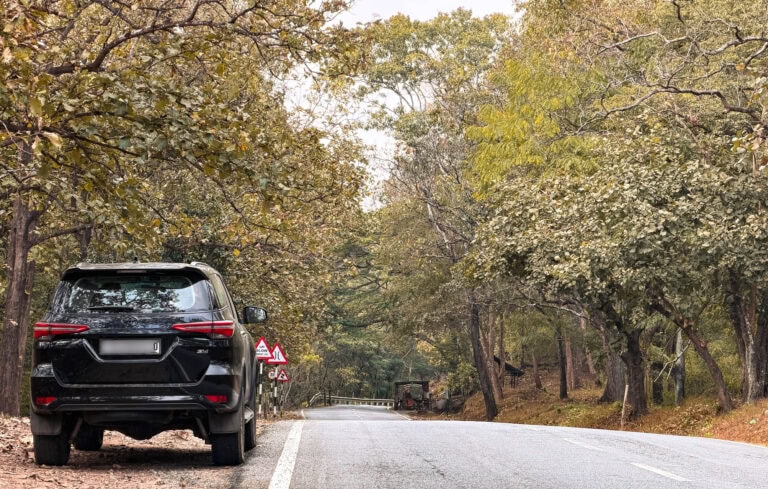
On Day #8, we left our hotel in Guwahati after breakfast at 9:00 AM. It was a brisk drive on 4-lane roads till Tezpur. After bypassing Tezpur, we made an exit from the highway and took the 2-lane road and drove through scenic forest and mountain roads. Except for some narrow sections while crossing towns like Bhalukpong and Dirang, roads are excellent all the way to Tawang. Below are a few pictures of the type of roads we drove on.
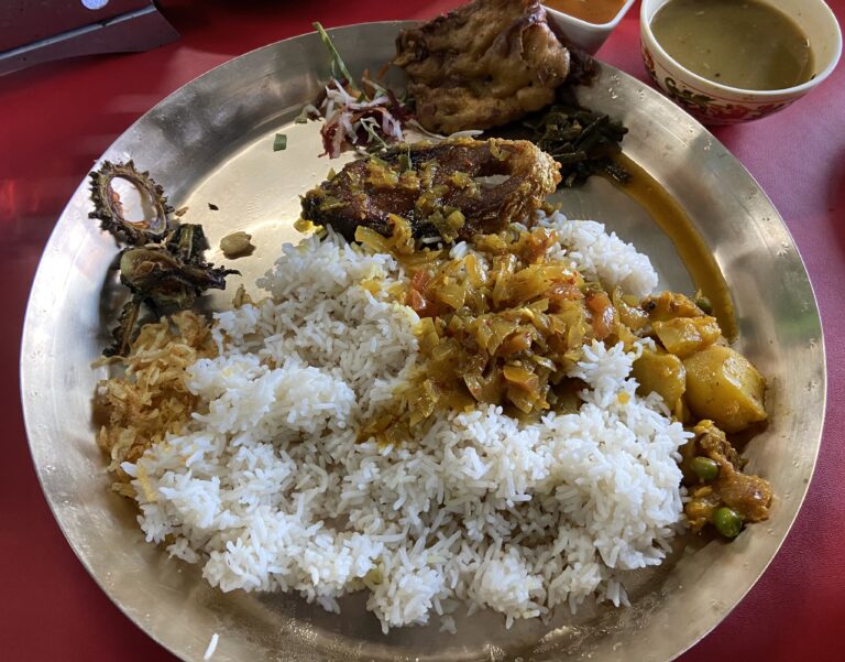
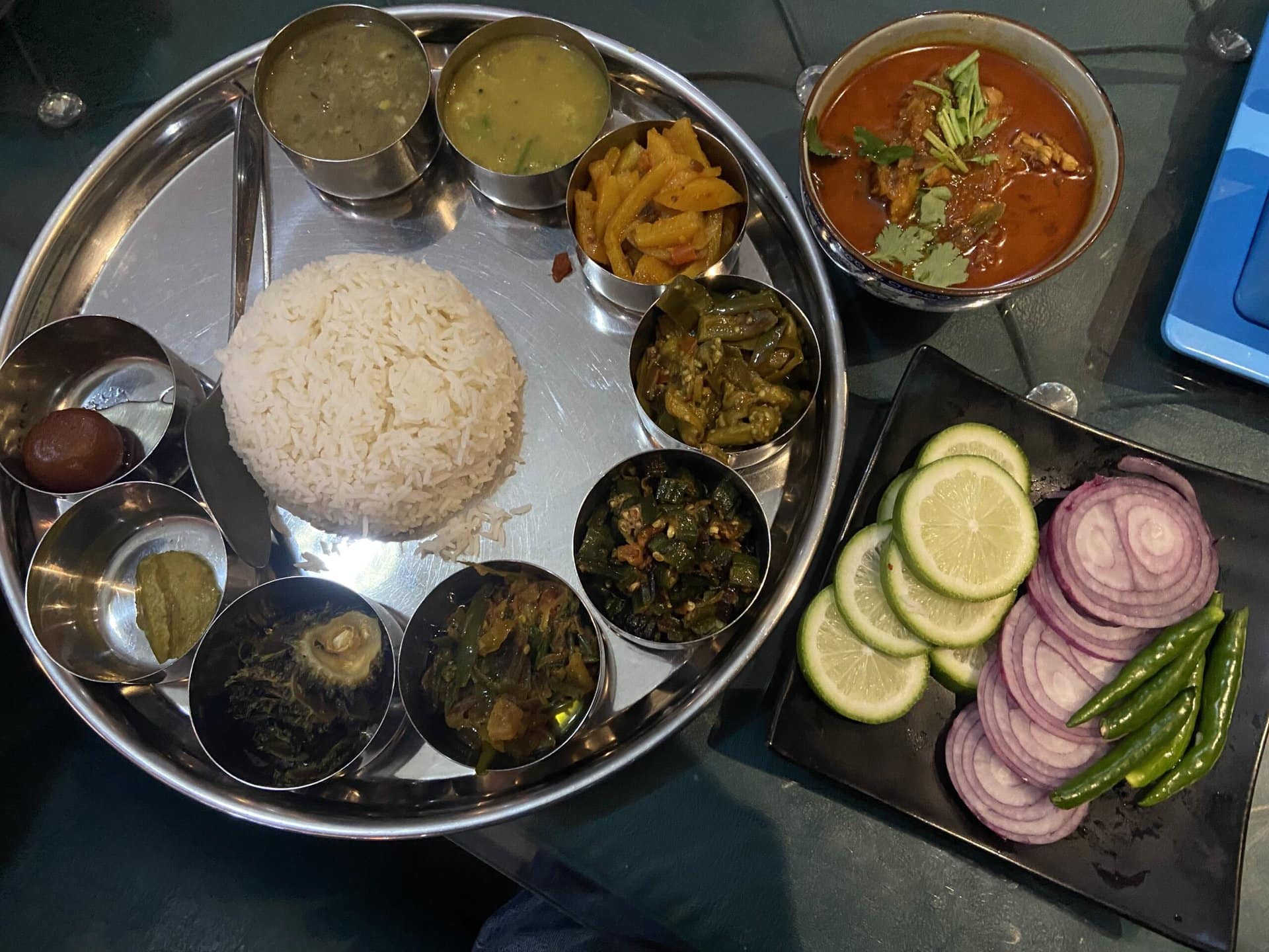
We crossed the checkpoint at Bhalukpong, where we had to submit a hard copy of the ILP. We then had lunch in a small restaurant after the checkpoint. We had tasty Assamese thali with fish.
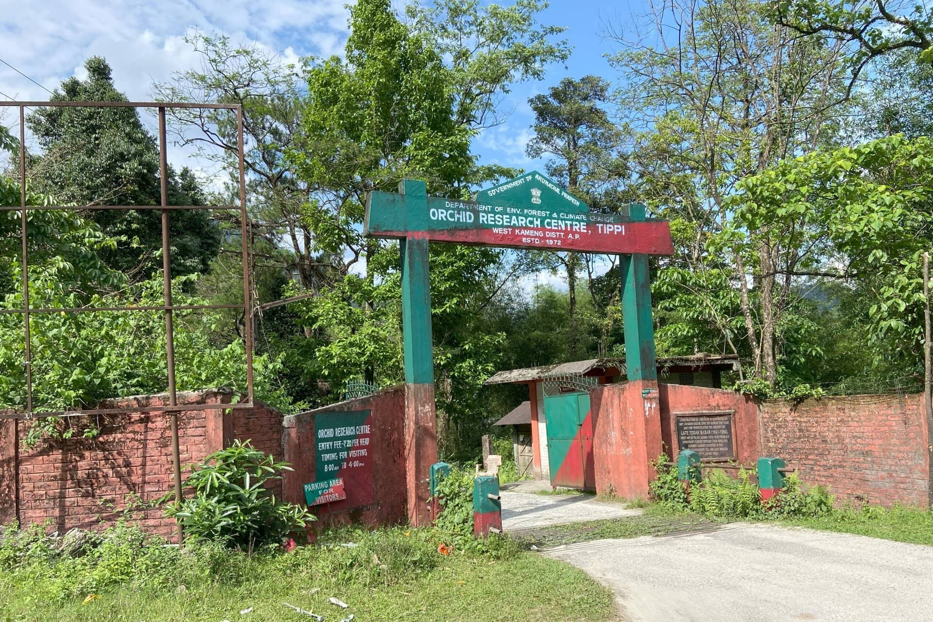
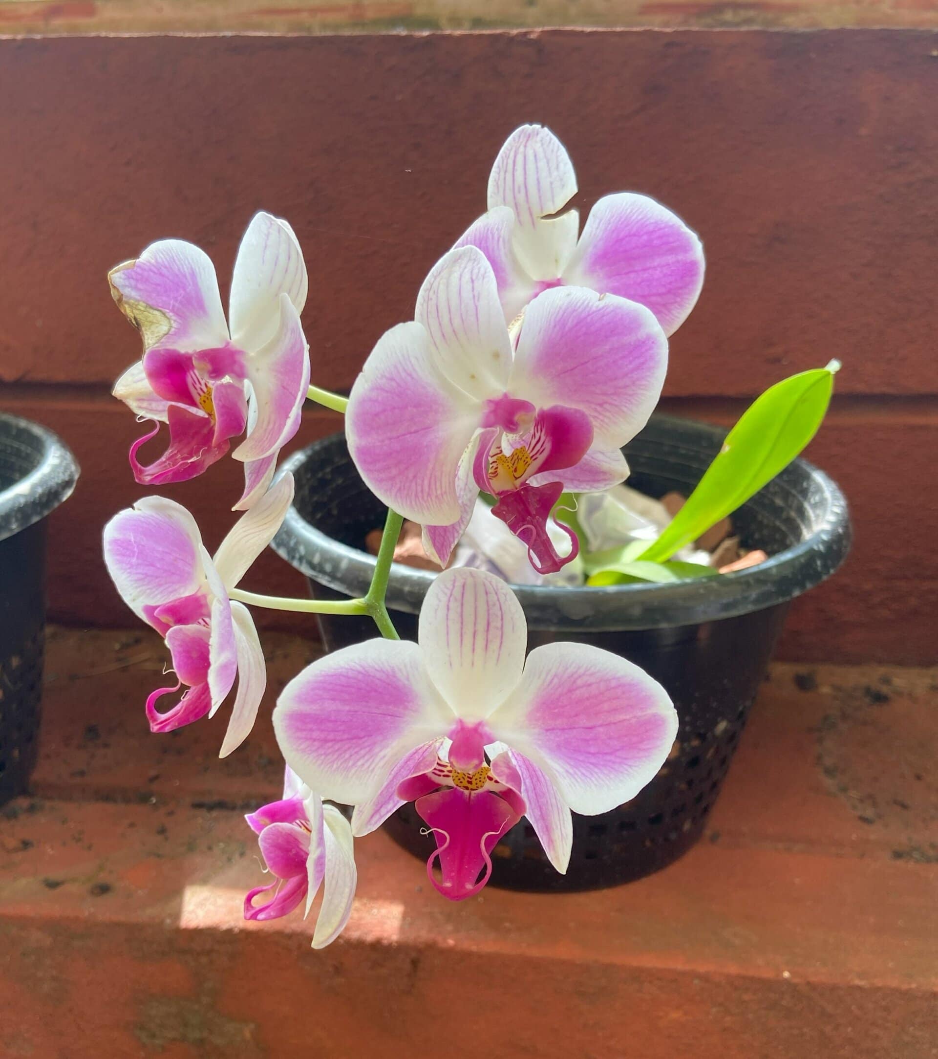
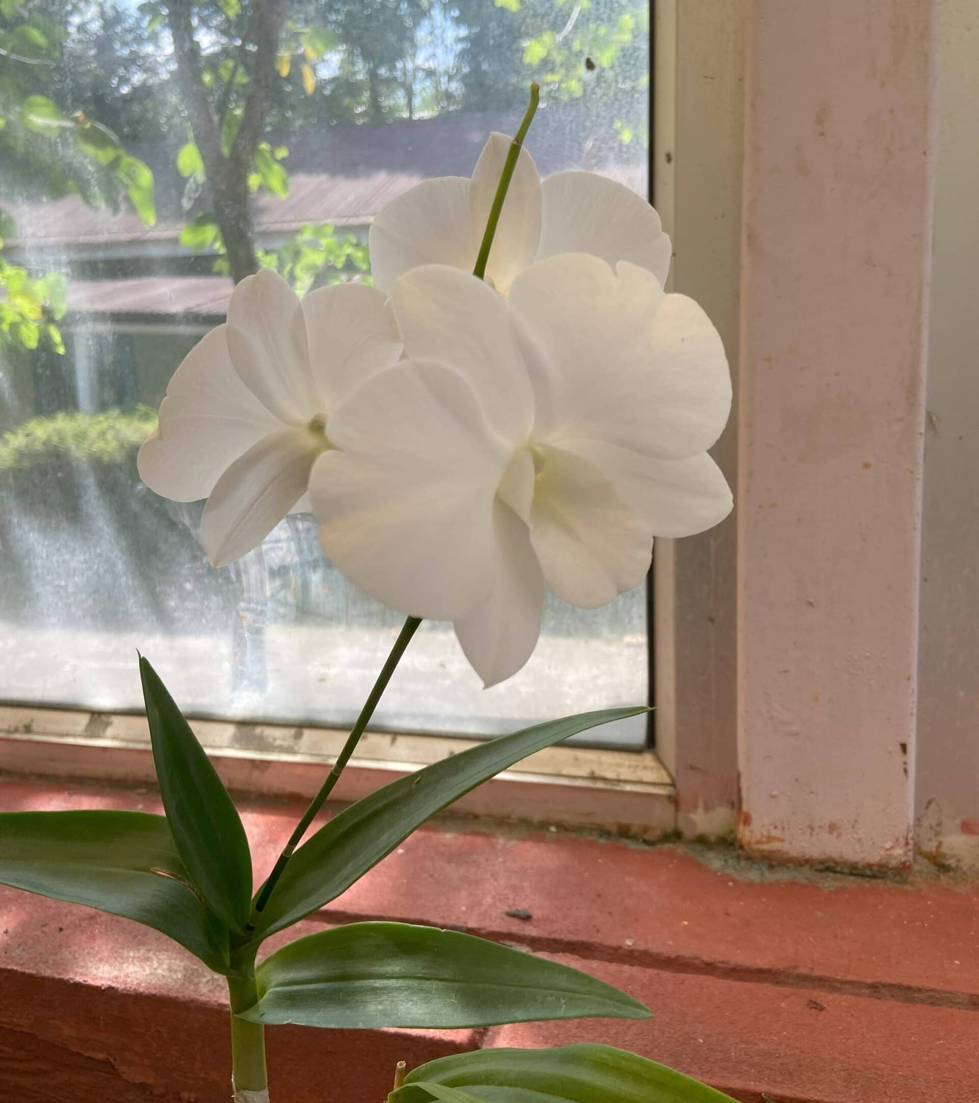
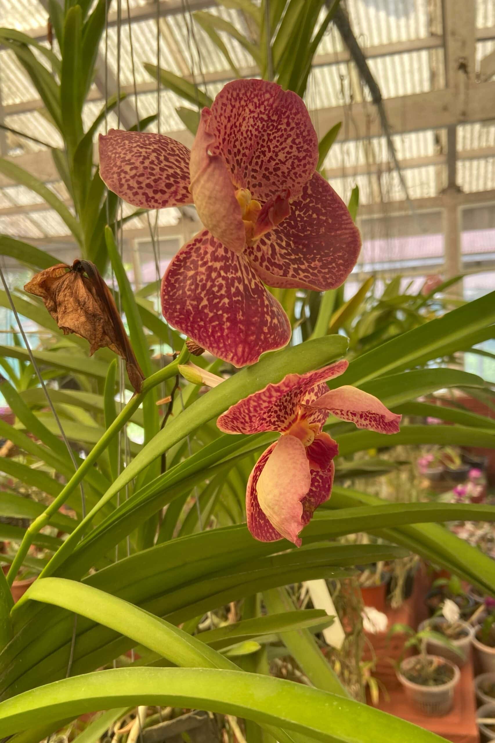
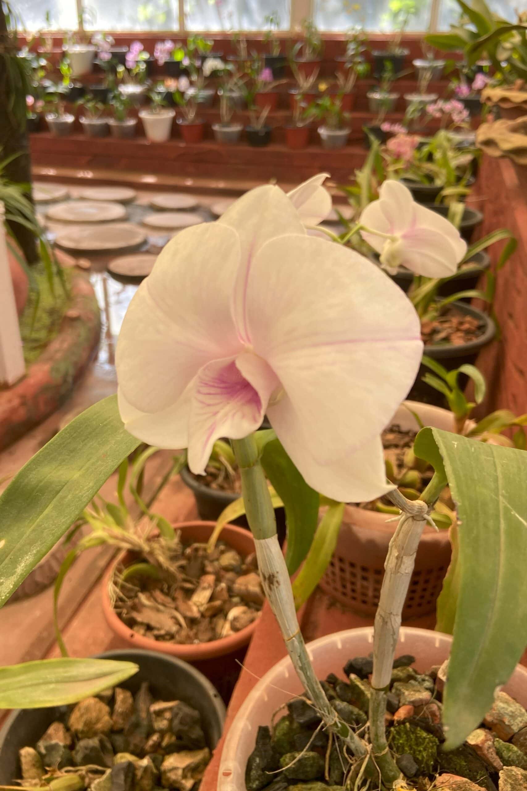
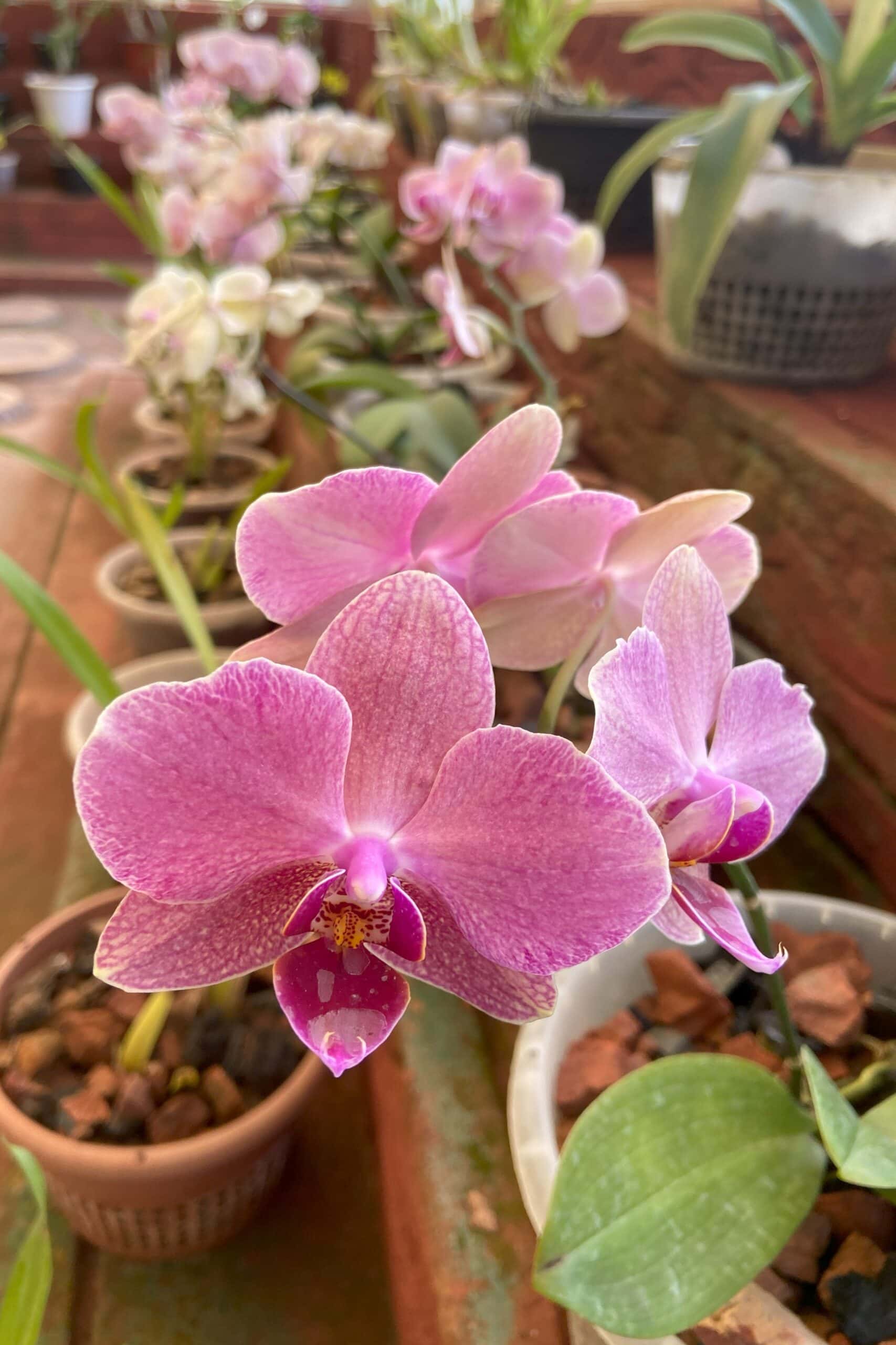
Tippi Orchidarium
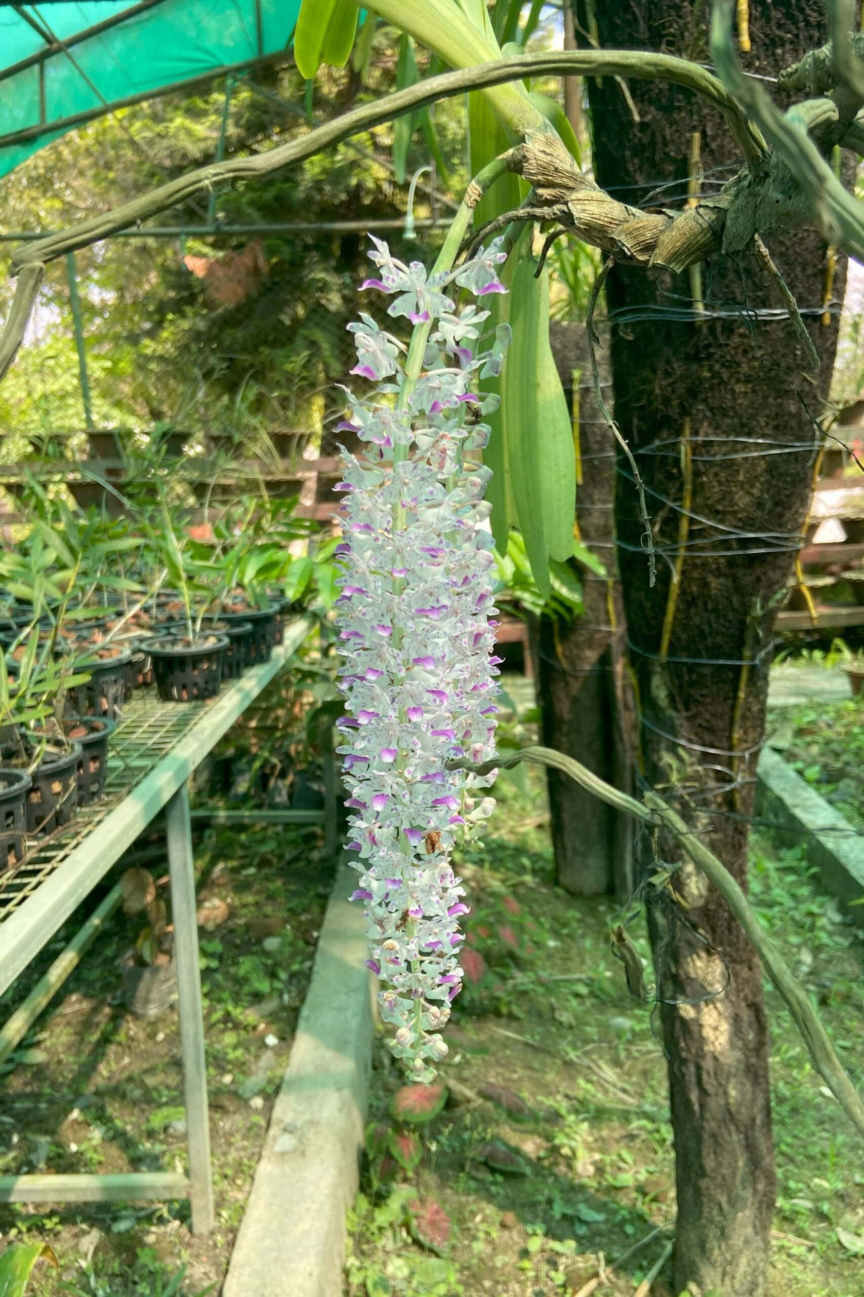
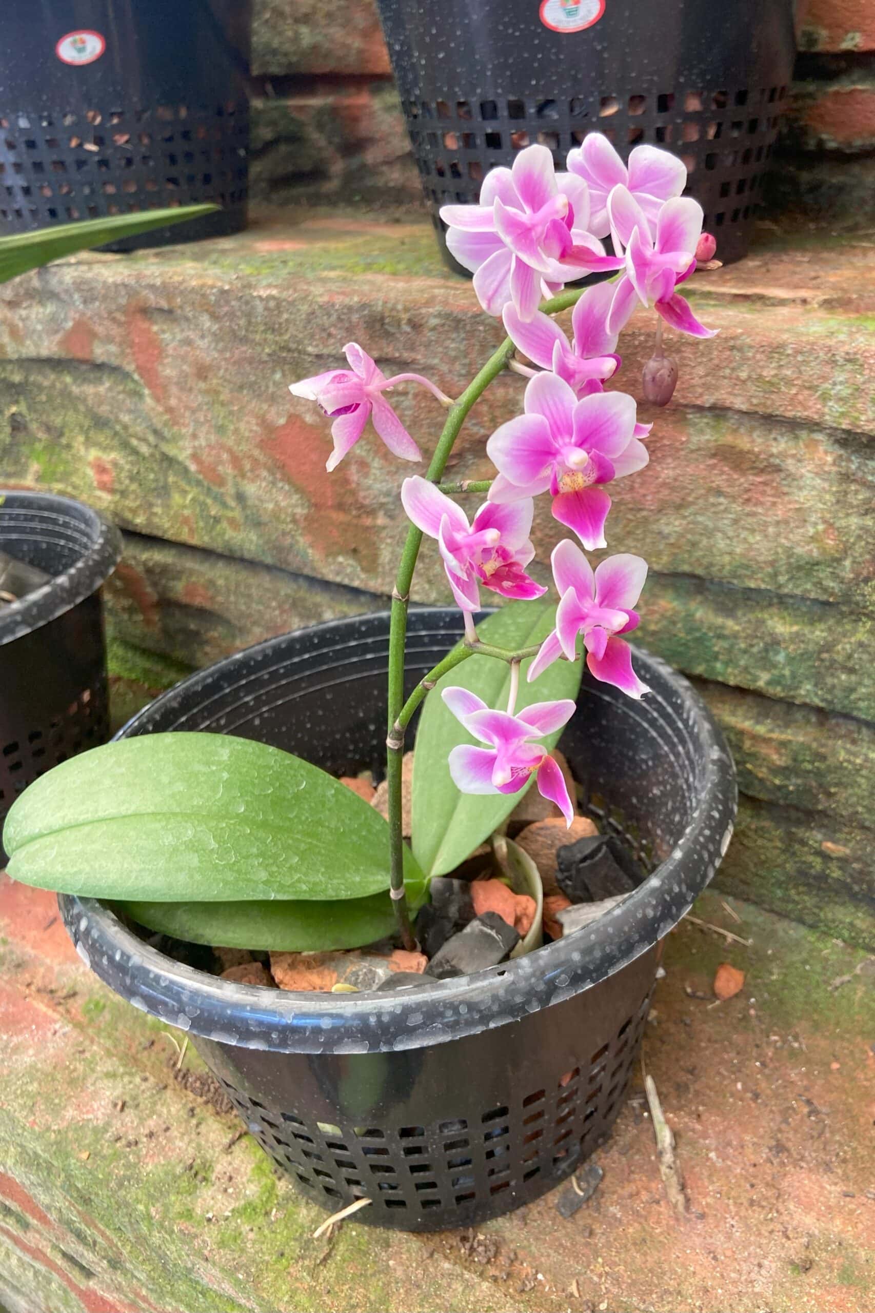
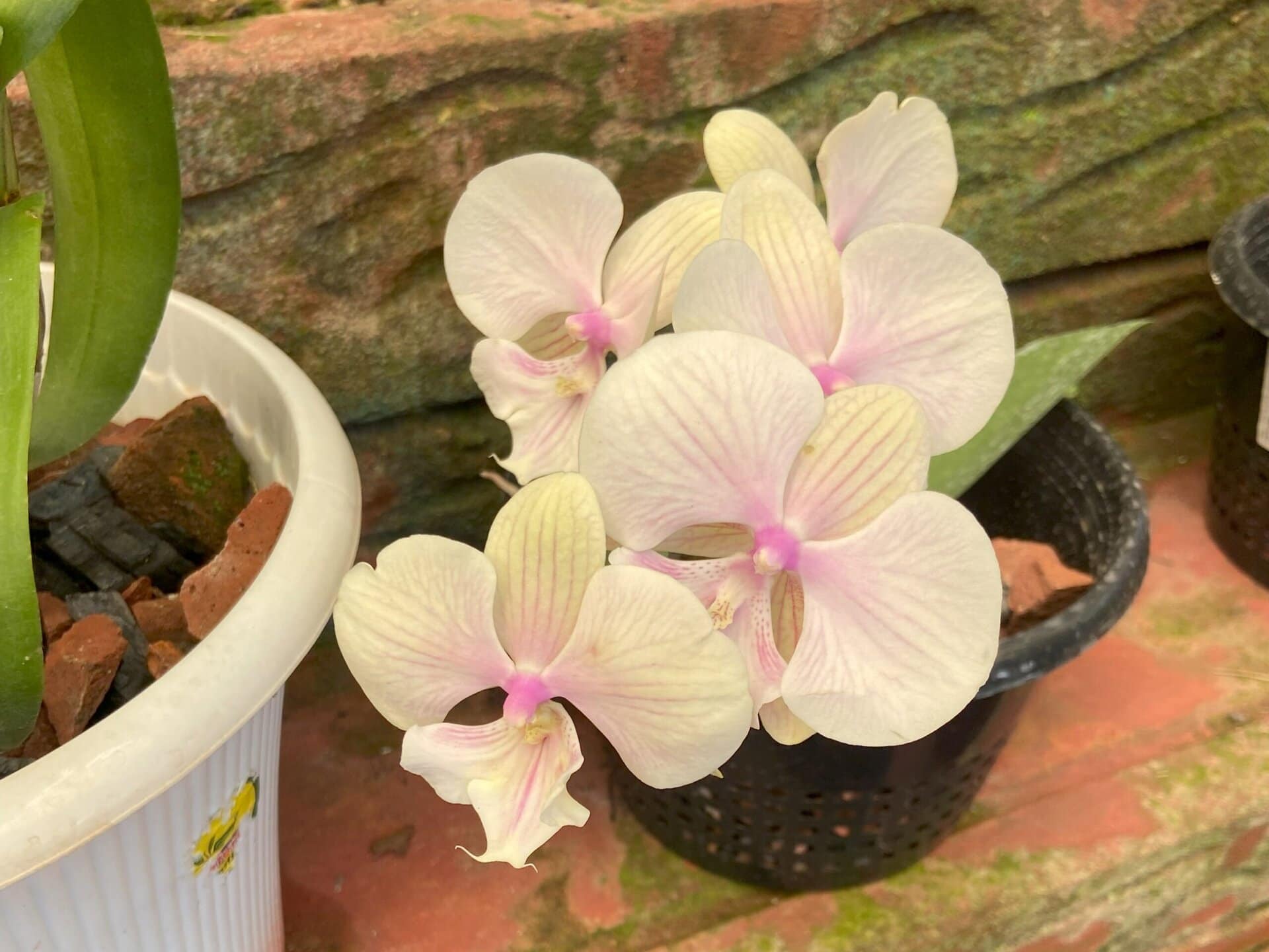
After lunch, we visited the Tippi Orchidarium..
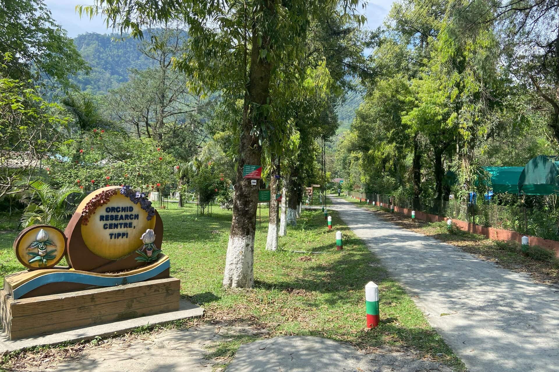
Tippi Orchidarium is a greenhouse complex located near the village of Tippi in Arunachal Pradesh, on the banks of the Kameng River. It is located about 5 kilometers from the Bhalukpong checkpoint. The Botanical Survey of India (BSI), established this Orchid Research Center to conserve and study the diverse orchid species native to the region.
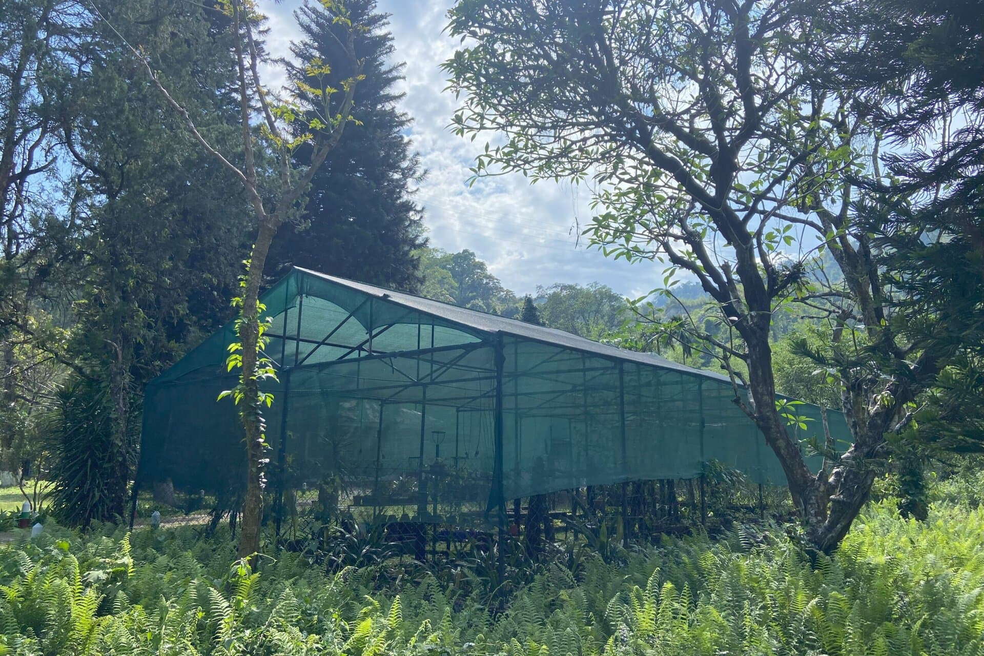
This orchidarium has an area of about 10 hectares and has several greenhouses that showcase over 500 species of orchids, many of which are rare and endemic to Arunachal Pradesh. It has very well-maintained pathways with beautiful trees and gardens. There is also a nice viewpoint of the Kameng River.
From the internet, I learned that the best time to visit is from March to May, when many species are in bloom. And we were lucky to see several beautiful species in full bloom in the main greenhouse.
Below are some pictures from the orchidarium.
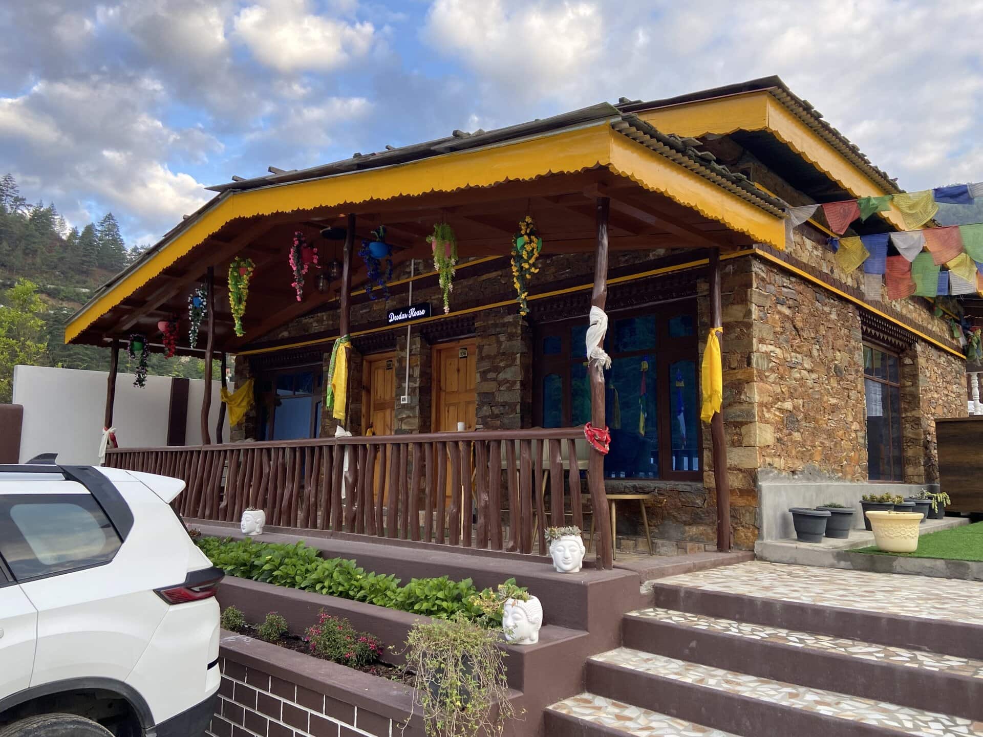
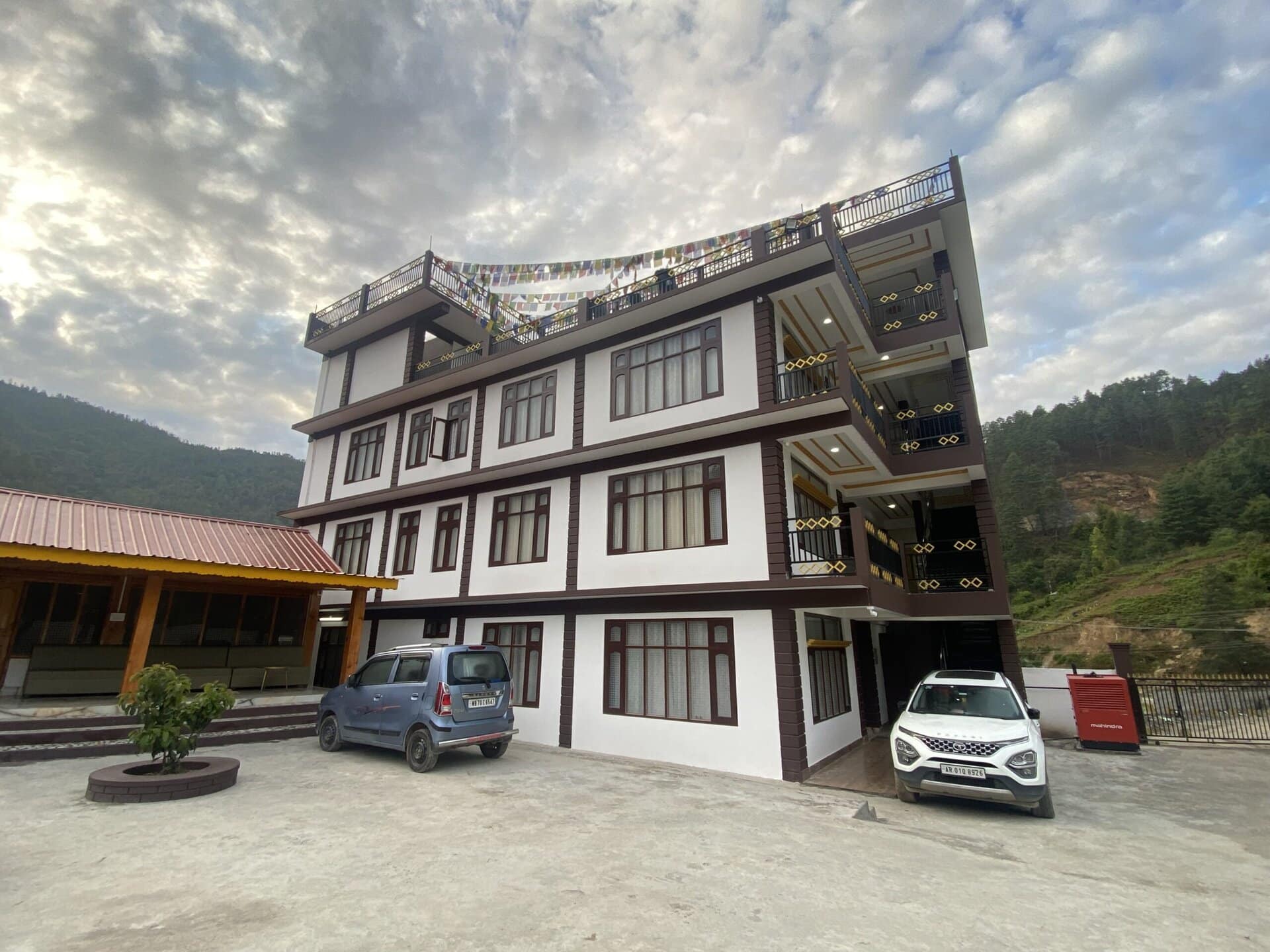
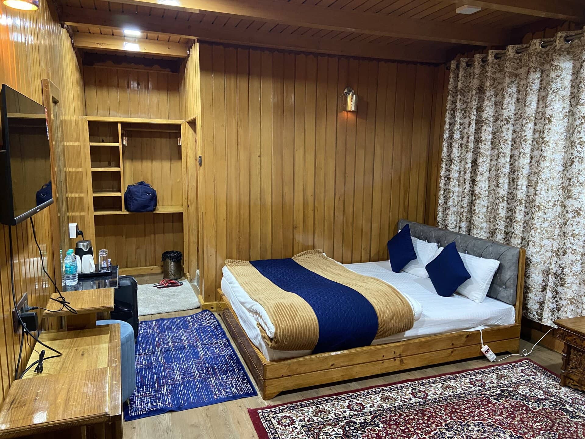
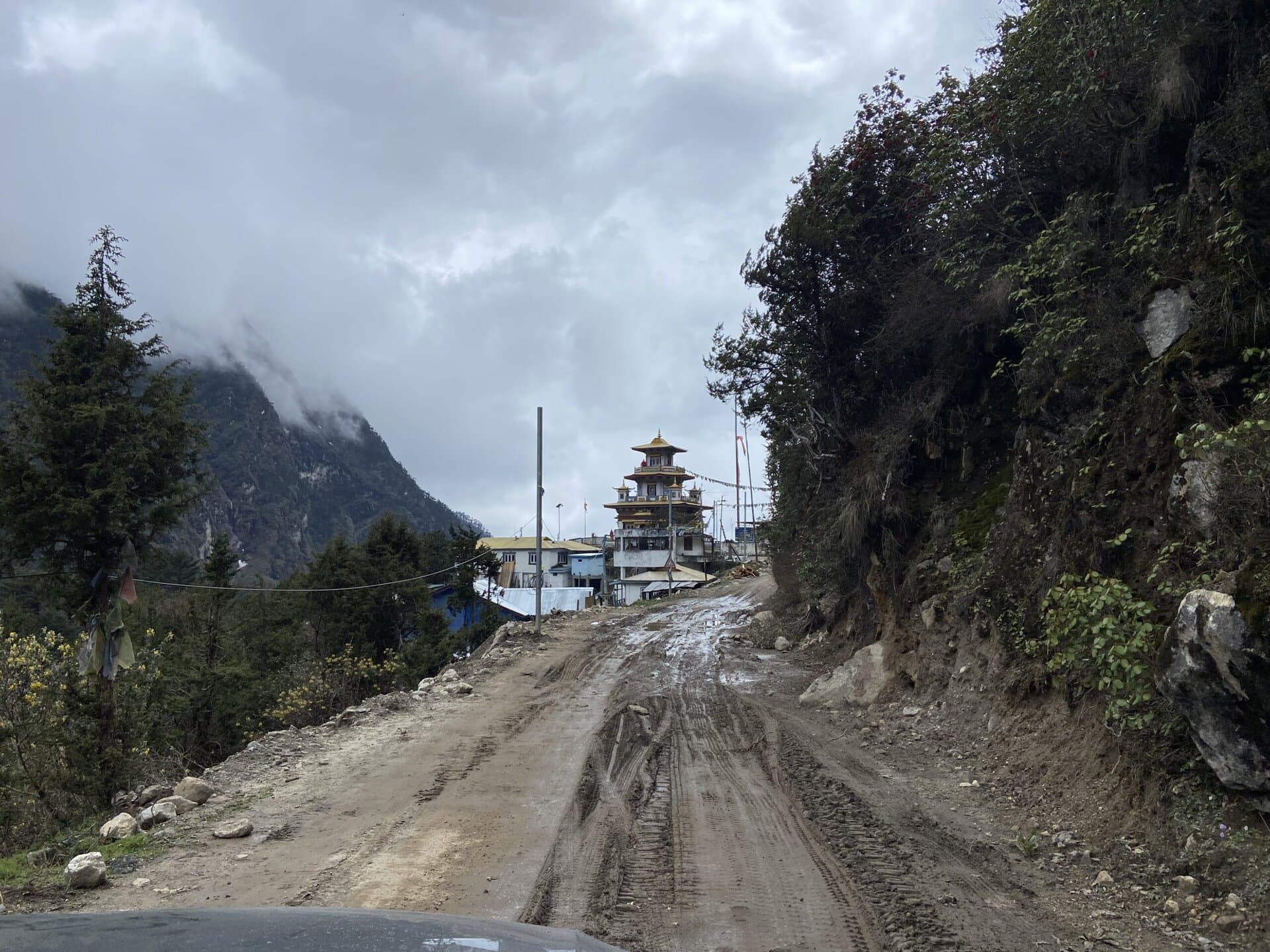
After this, we drove to Dirang. We reached Dirang late in the evening. The roads inside Dirang were quite broken and narrow. But with the Fortuner, it was totally stress-free tackling these roads. It was tricky finding our place of stay. I had booked our stay in a place called MyVillage Cottages. The owner had contacted me in the afternoon and told me not to follow Google maps, as it shows the wrong location, and sent me the right directions.
I followed his instructions and found a very narrow bridge that I had to cross. This is the first time I have seen such a narrow bridge. There was just a few inches of clearance on either side for the Fortuner.
I knew that it was possible to cross this comfortably, but I was not confident enough to do this in the dark. Thankfully, a local in a WagonR crossed the bridge, and I just followed him. He was kind enough to get out of his car and guide me off the bridge. He mentioned that all locals use this bridge every day, and I, too, would get used to this if I took this a couple of times. The video below shows the crossing of this bridge.
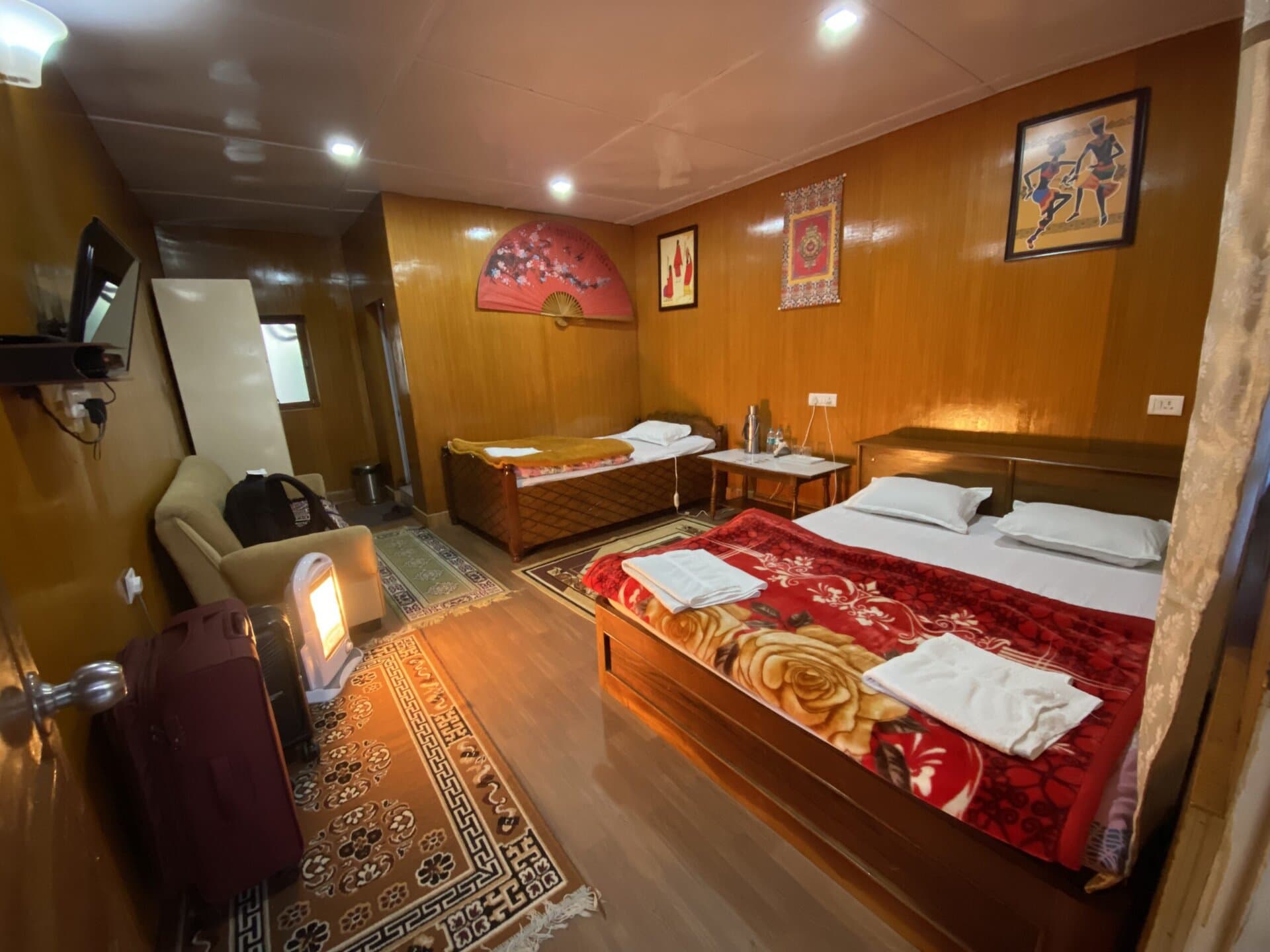
We then easily reached the place of stay, had our dinner, and called it a day. Below are a few pictures of the property. Except for that narrow bridge that we had to cross, the property itself was quite good, with cozy rooms and tasty food.
Day – 9 Dirang to Tawang
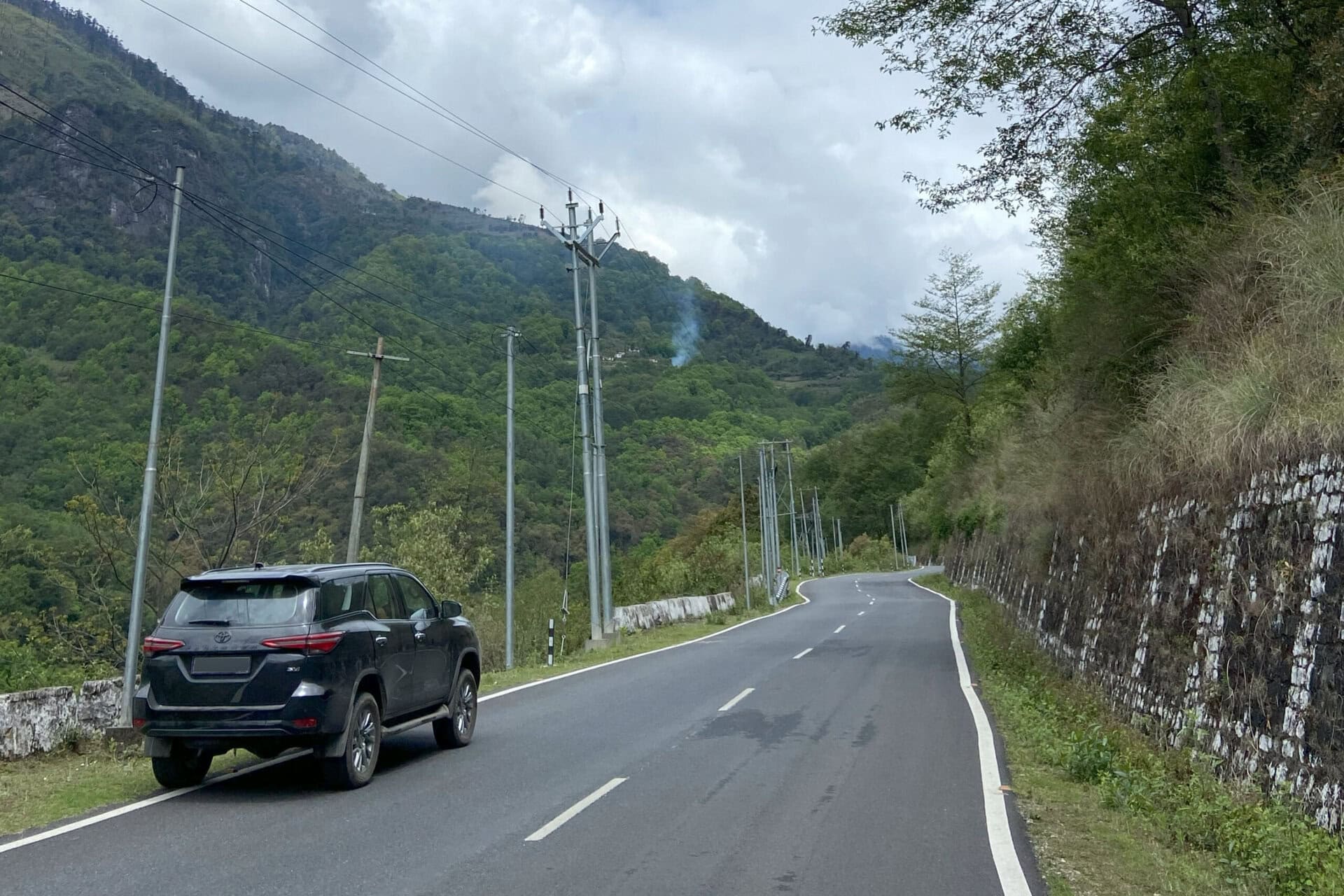
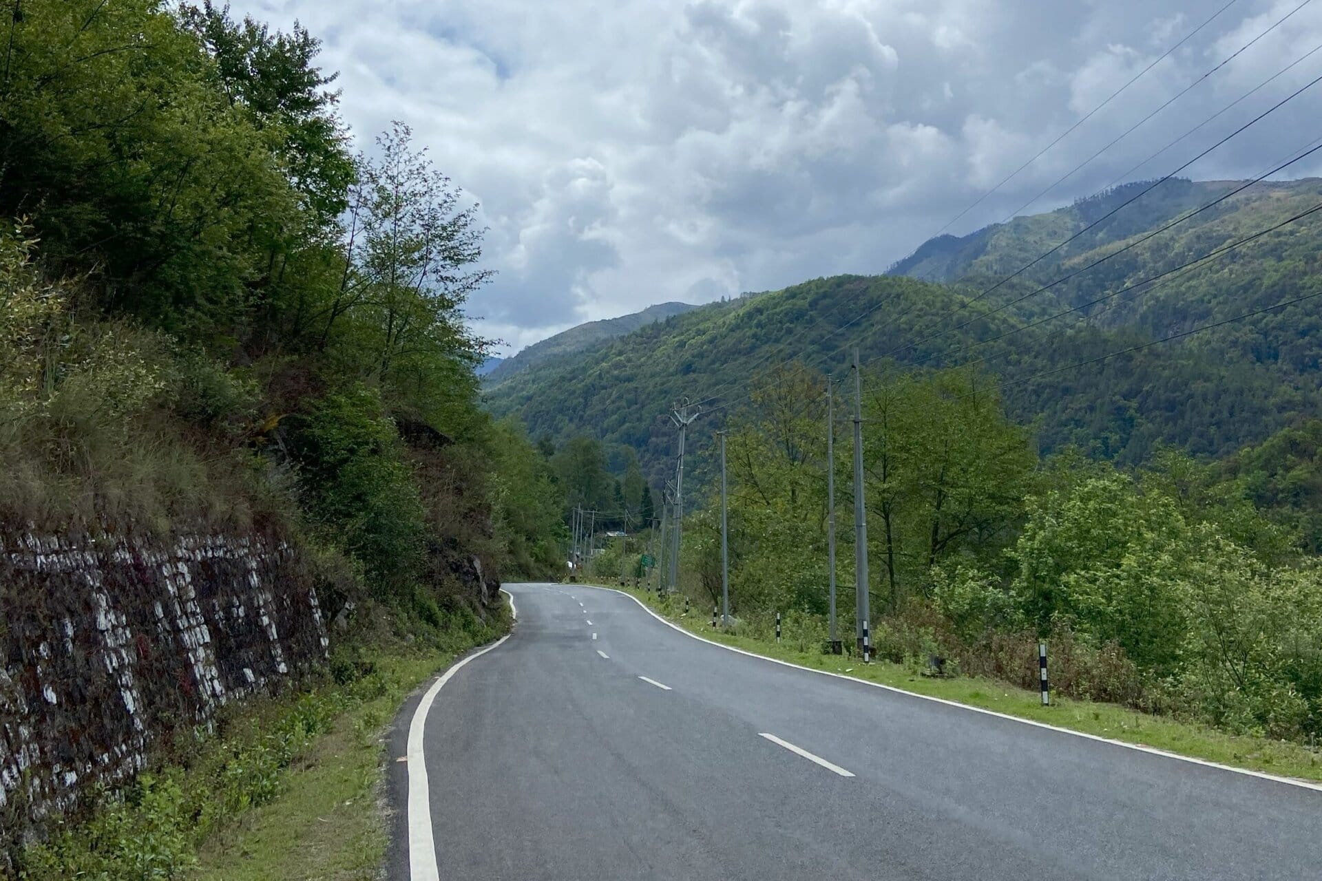
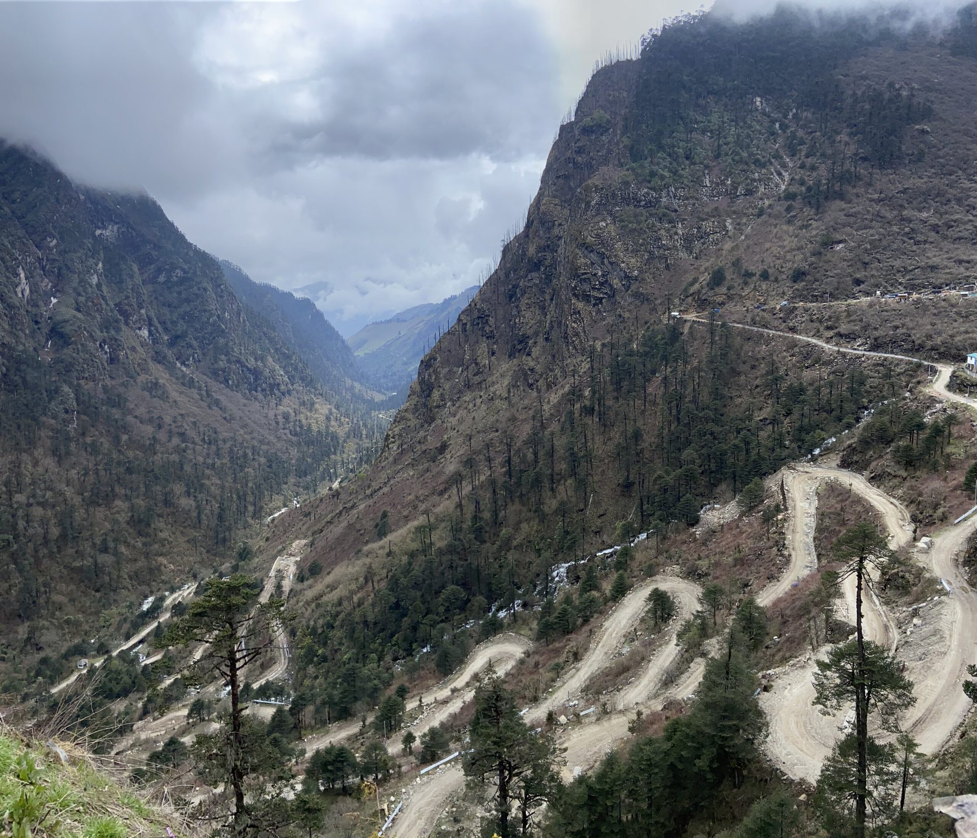
On Day #9, we left MyVillage cottages after breakfast. The first few kilometers was an unpaved, broken road, after which the road joined the main 2 lane highway. After this, it was smooth roads all the way to Tawang.
Crossing Sela Pass
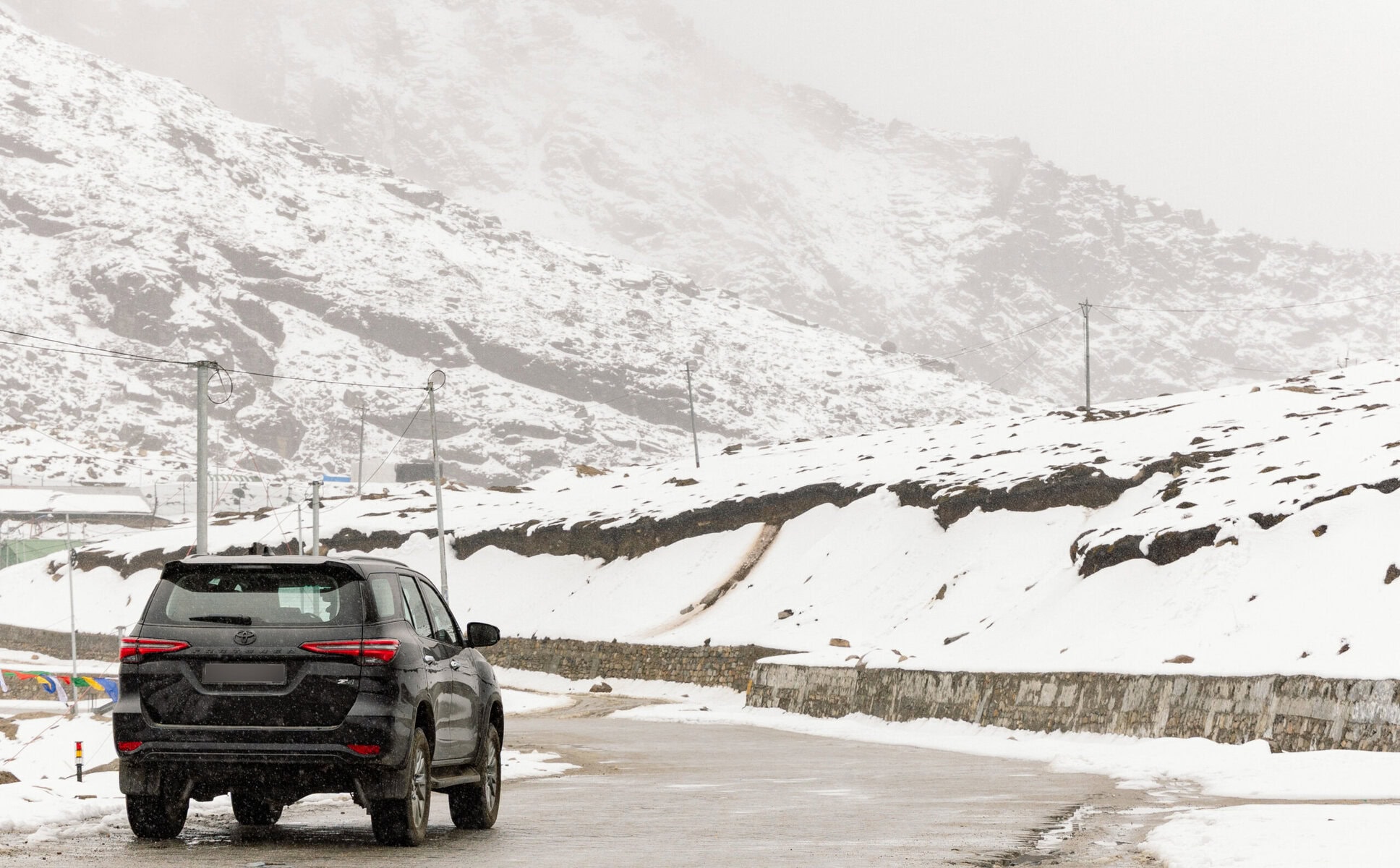
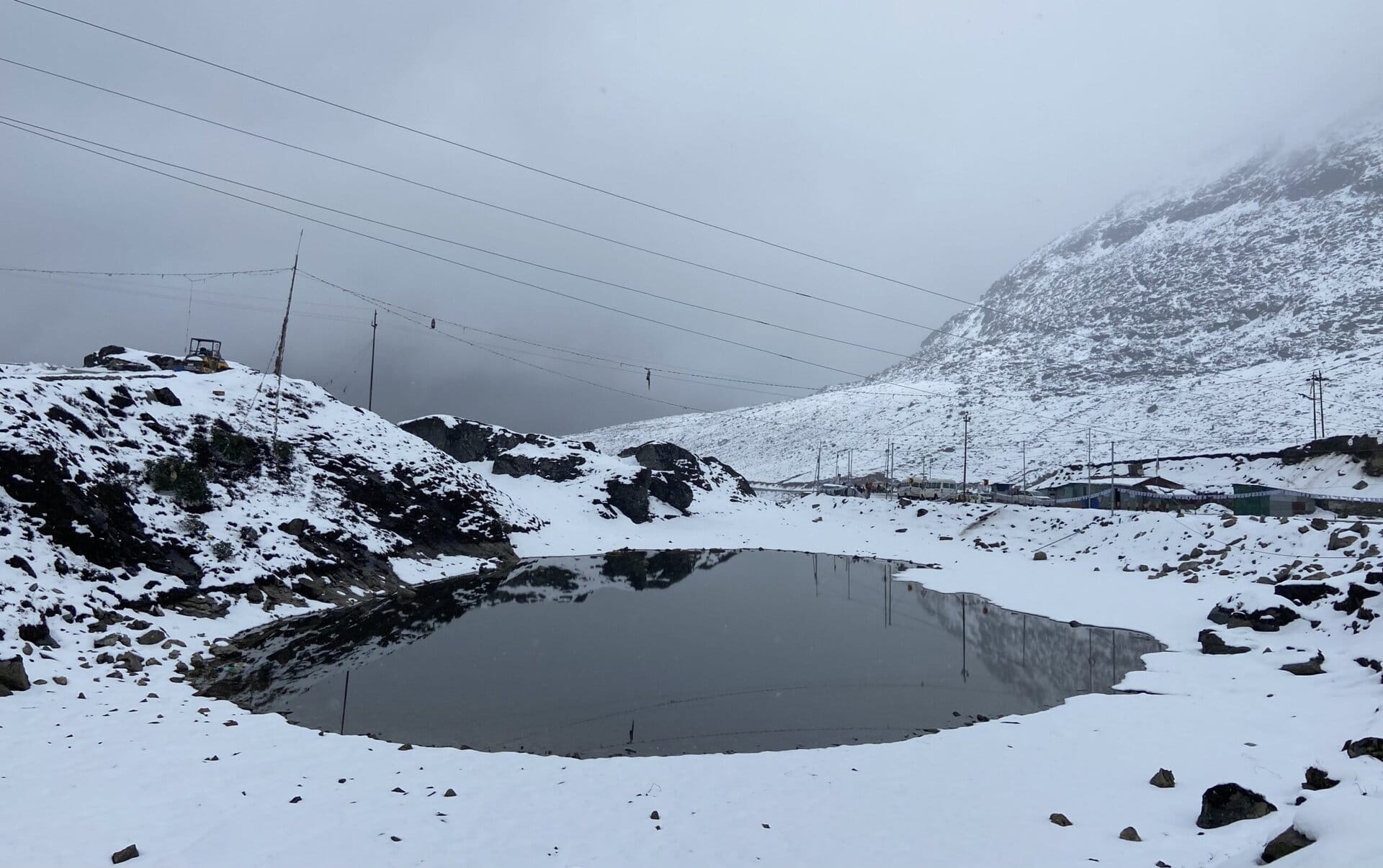
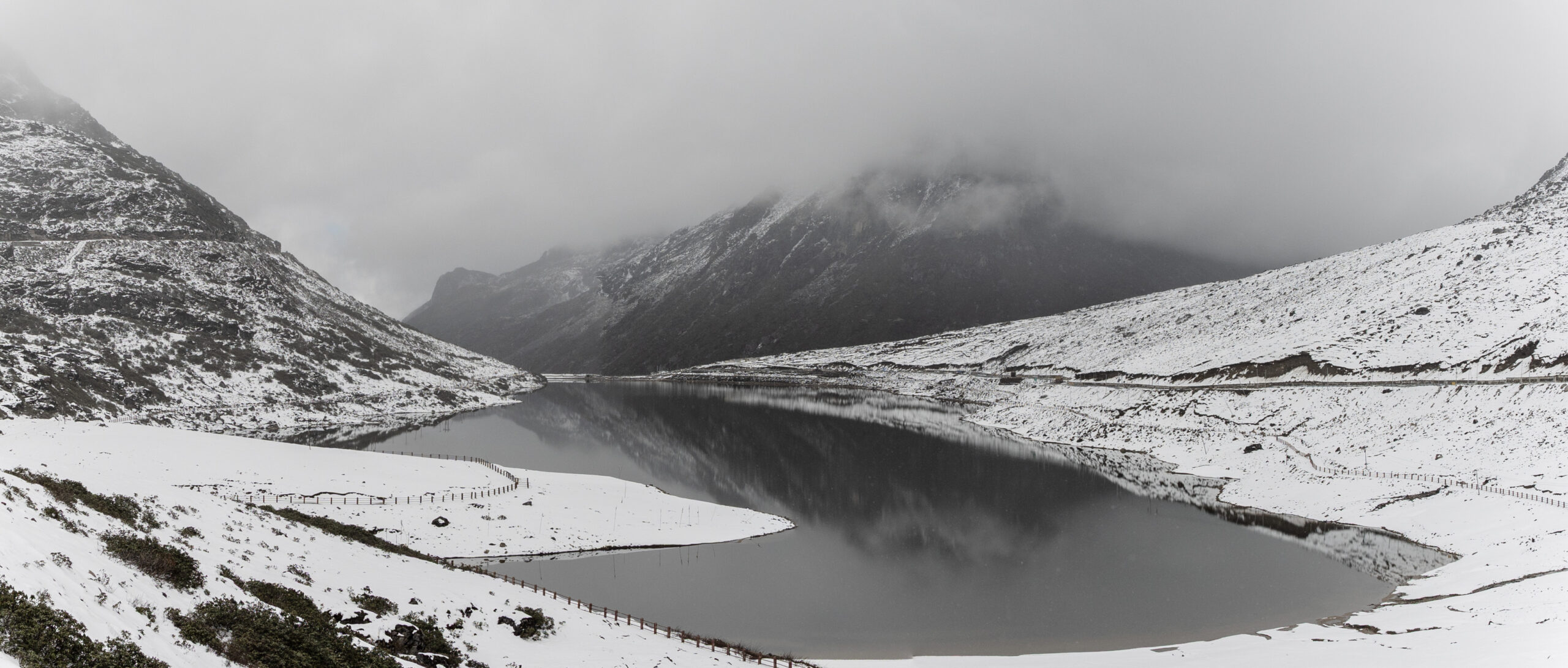
One of the highlights of this journey was the drive through Sela pass. As we drove from Dirang to Tawang, we reached a fork in the road. The right one goes through Sela pass, and the left through the tunnel. As I wanted to drive through Sela pass, I took the right.
A little further, there was a barricade manned by a jawan. He told me the weather was expected to worsen—might even snow at the top—and asked me to consider the tunnel. I told him I’d be fine, that I had a Fortuner with 4×4 and could handle broken roads, and some snow. He thought for a moment, smiled, and said, “Okay, just don’t stop for long. Go straight through.”
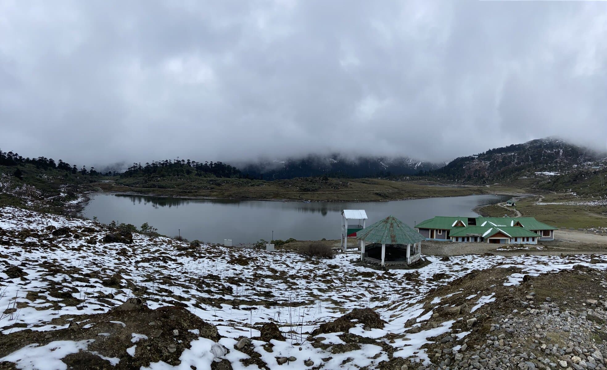
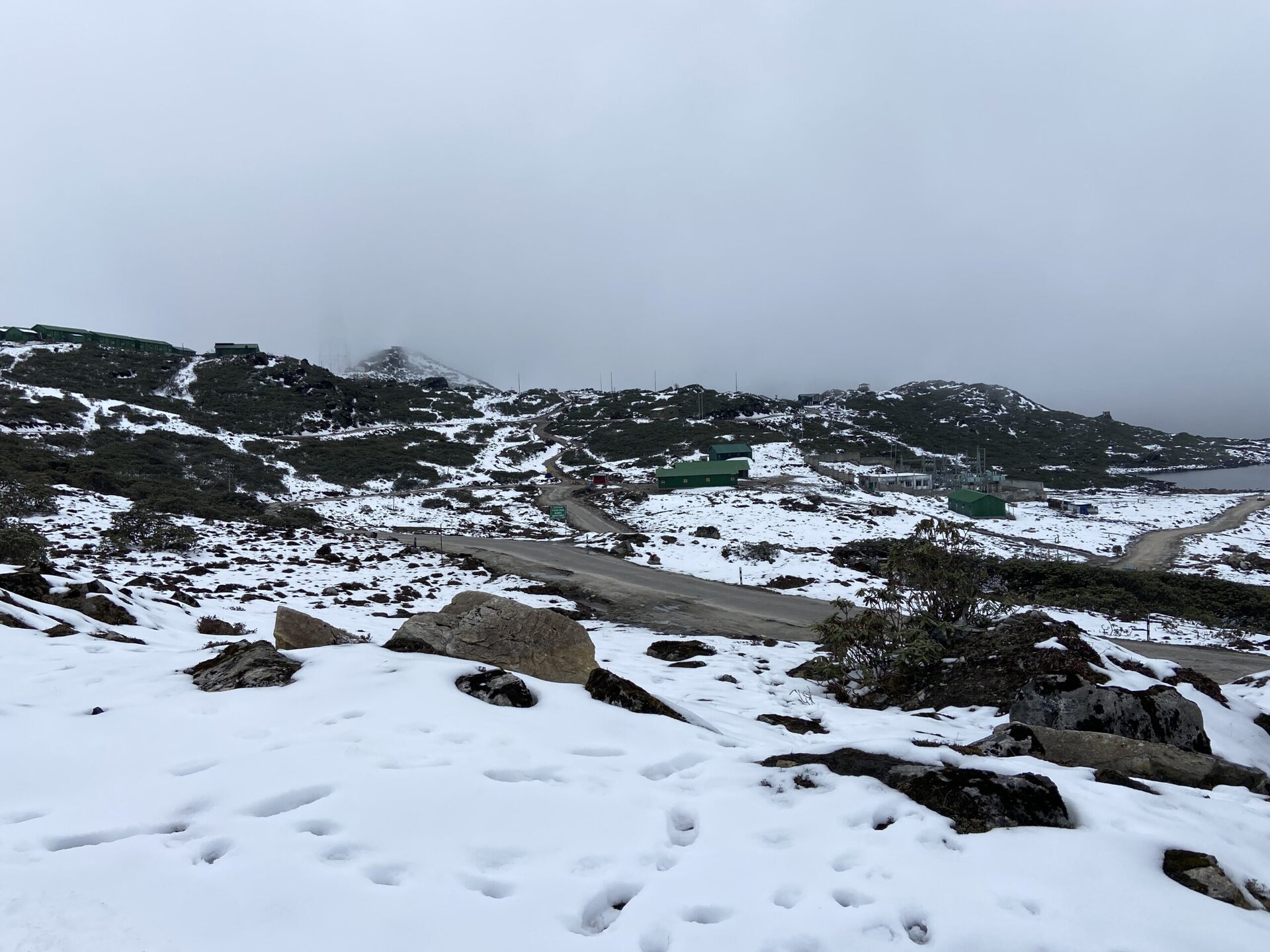
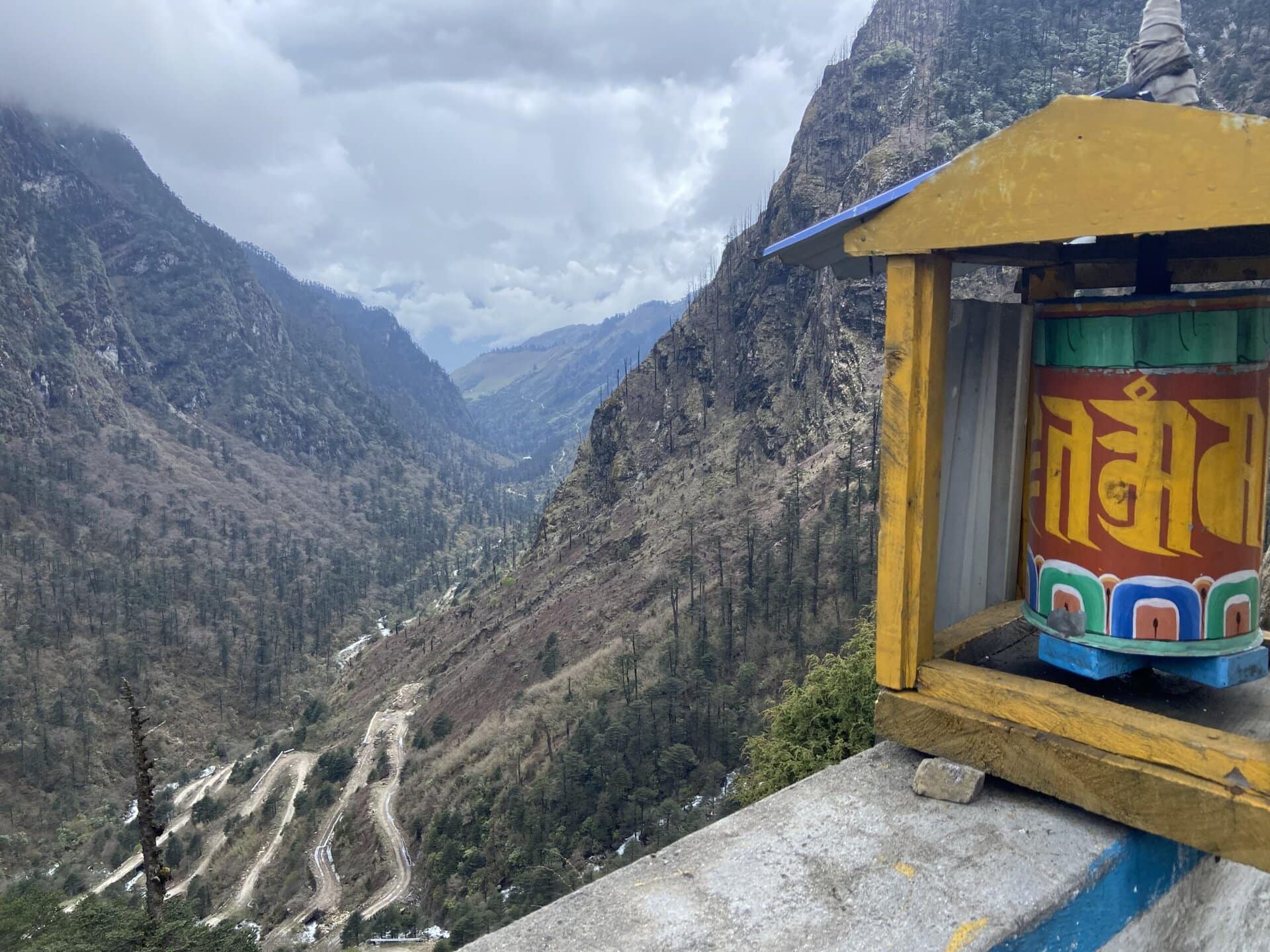
The road was broken, and had lots of switchbacks. And as we climbed, snow started appearing on the sides, and before long, it was everywhere. At the summit, there was light snow fall. We stopeed at the summit, and spent some time enjoying the beautiful scenery of snow covered mountains, and the beautiful Sela lake. We then had some hot tea. A cup of piping hot tea in that weather felt like heaven.
Below are a few pictures of the scenery at the pass.

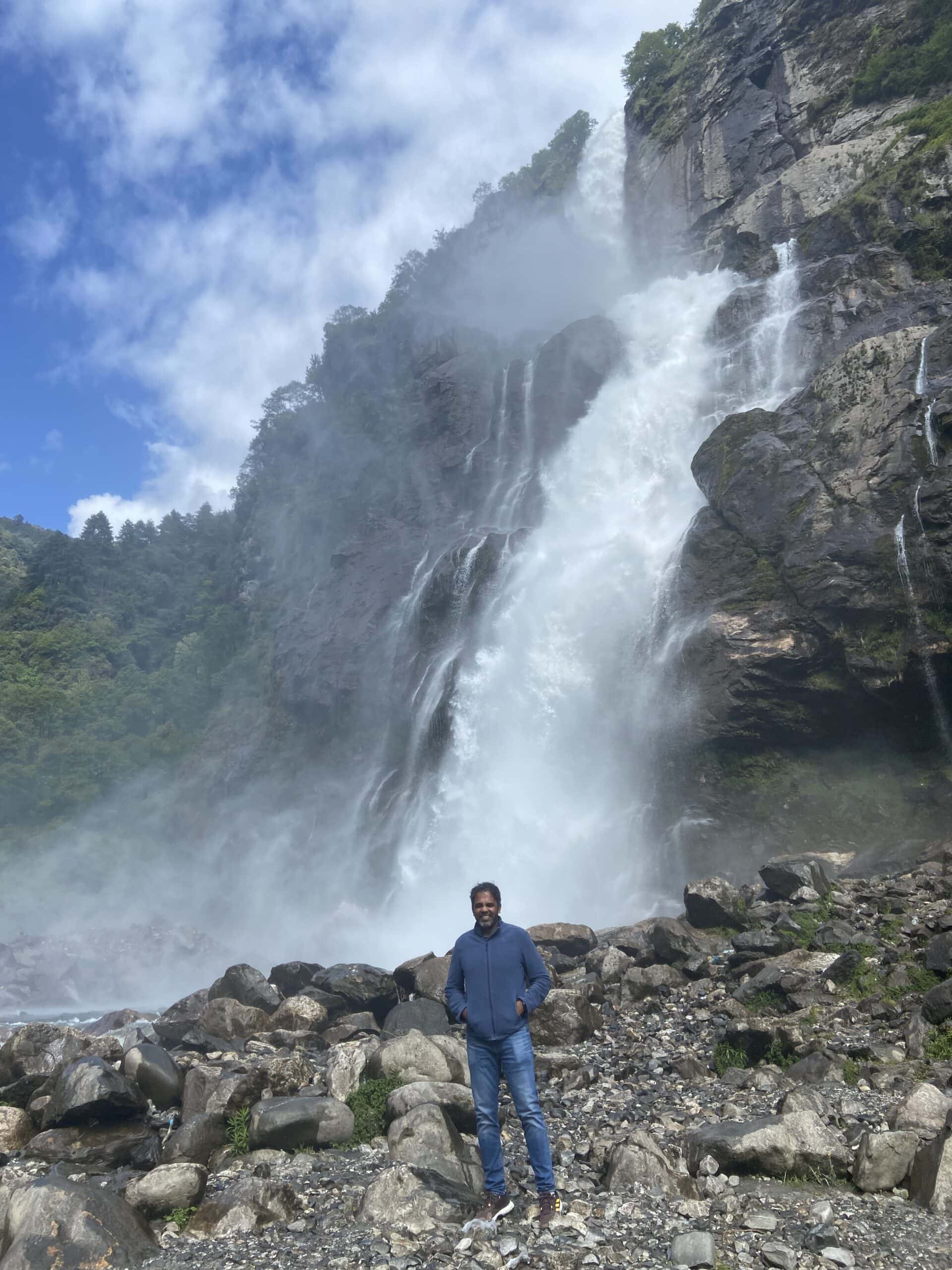
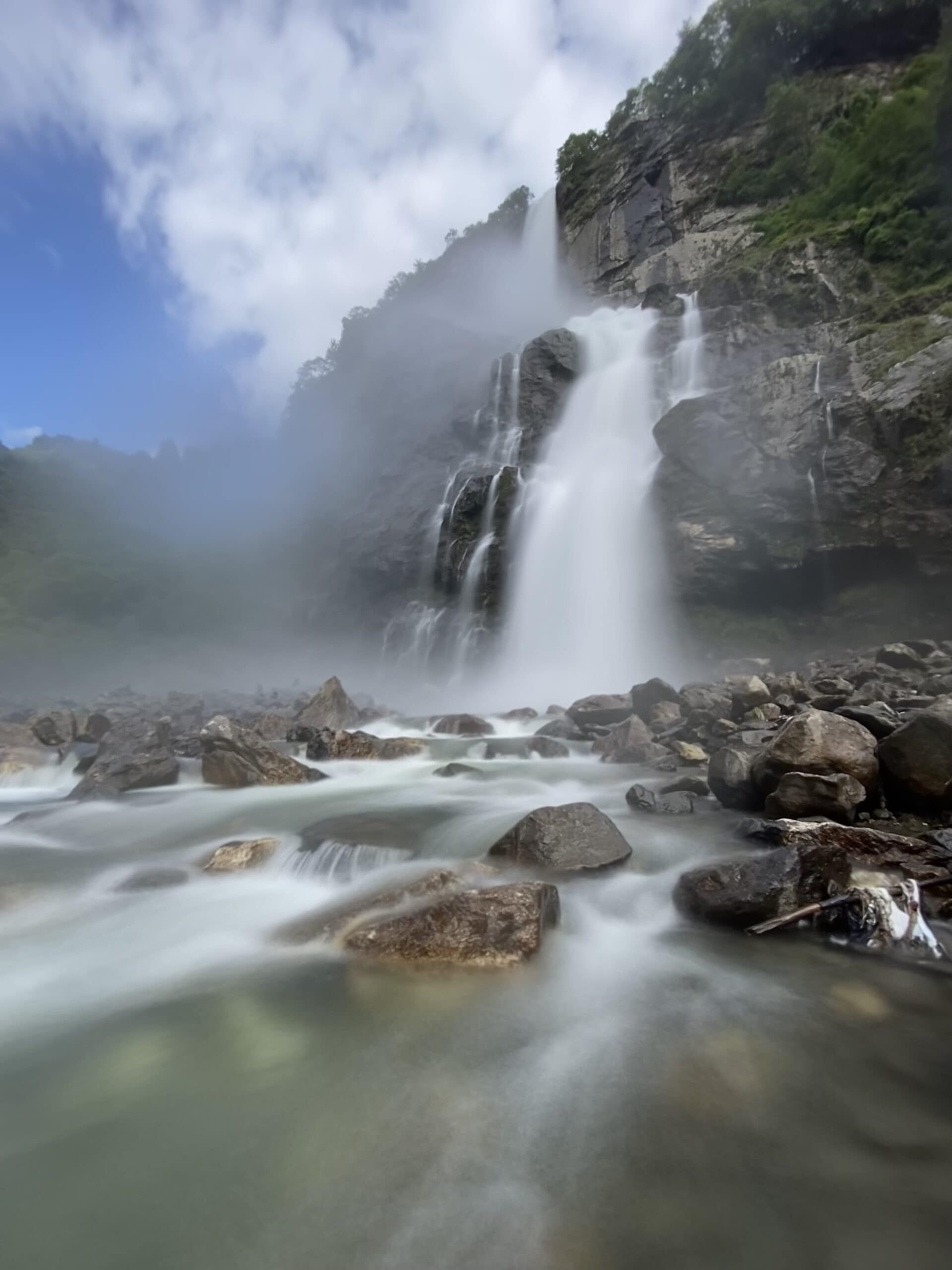
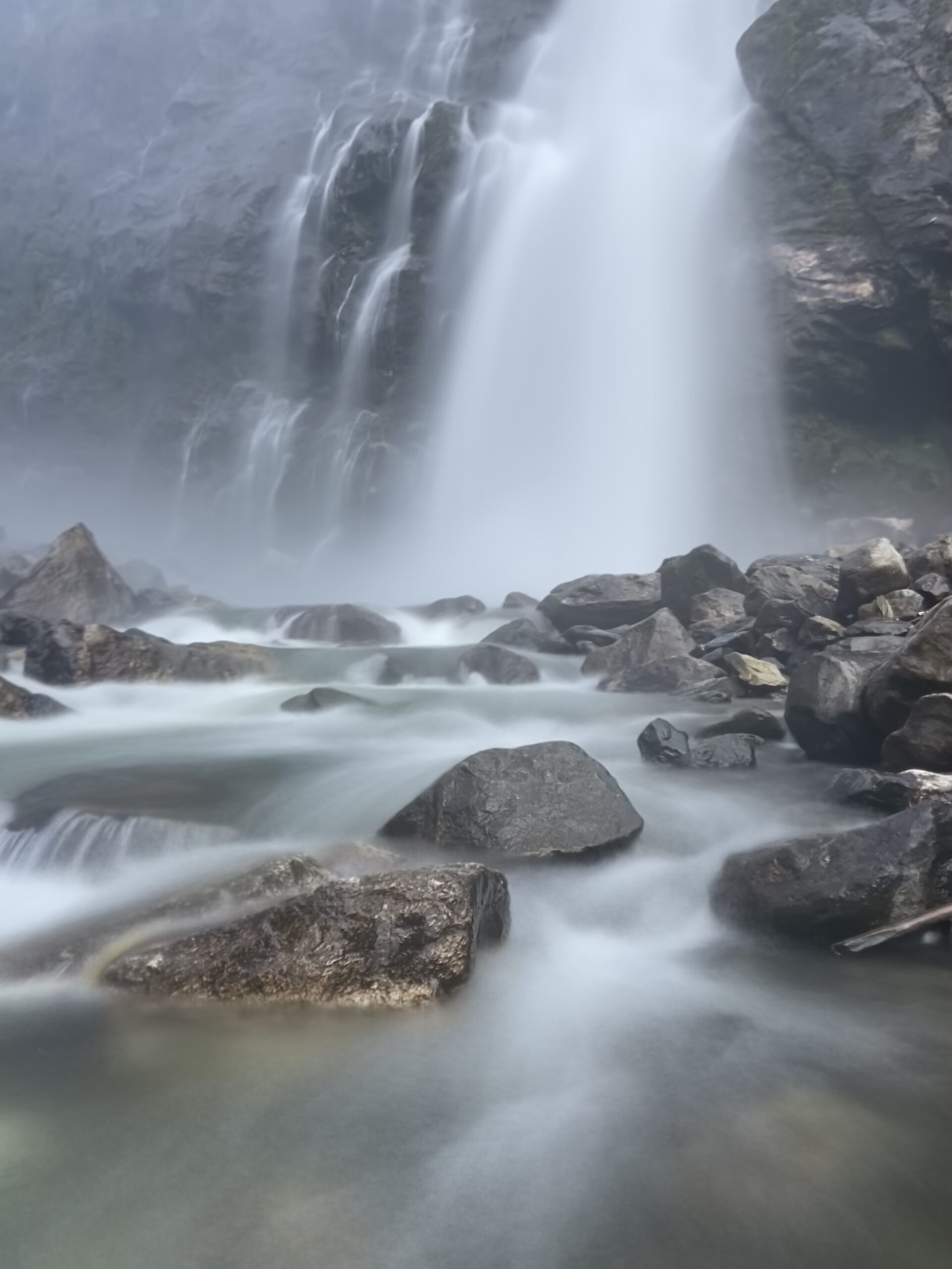
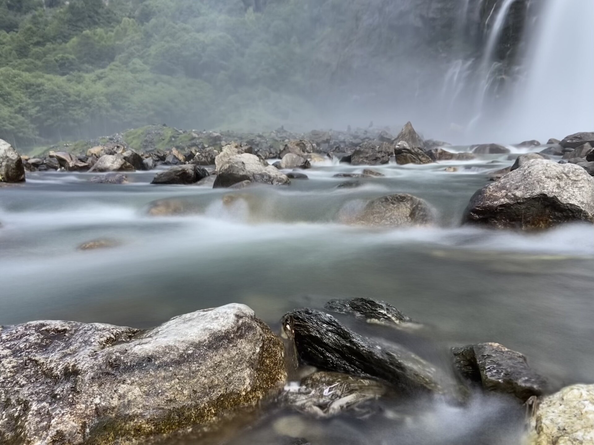
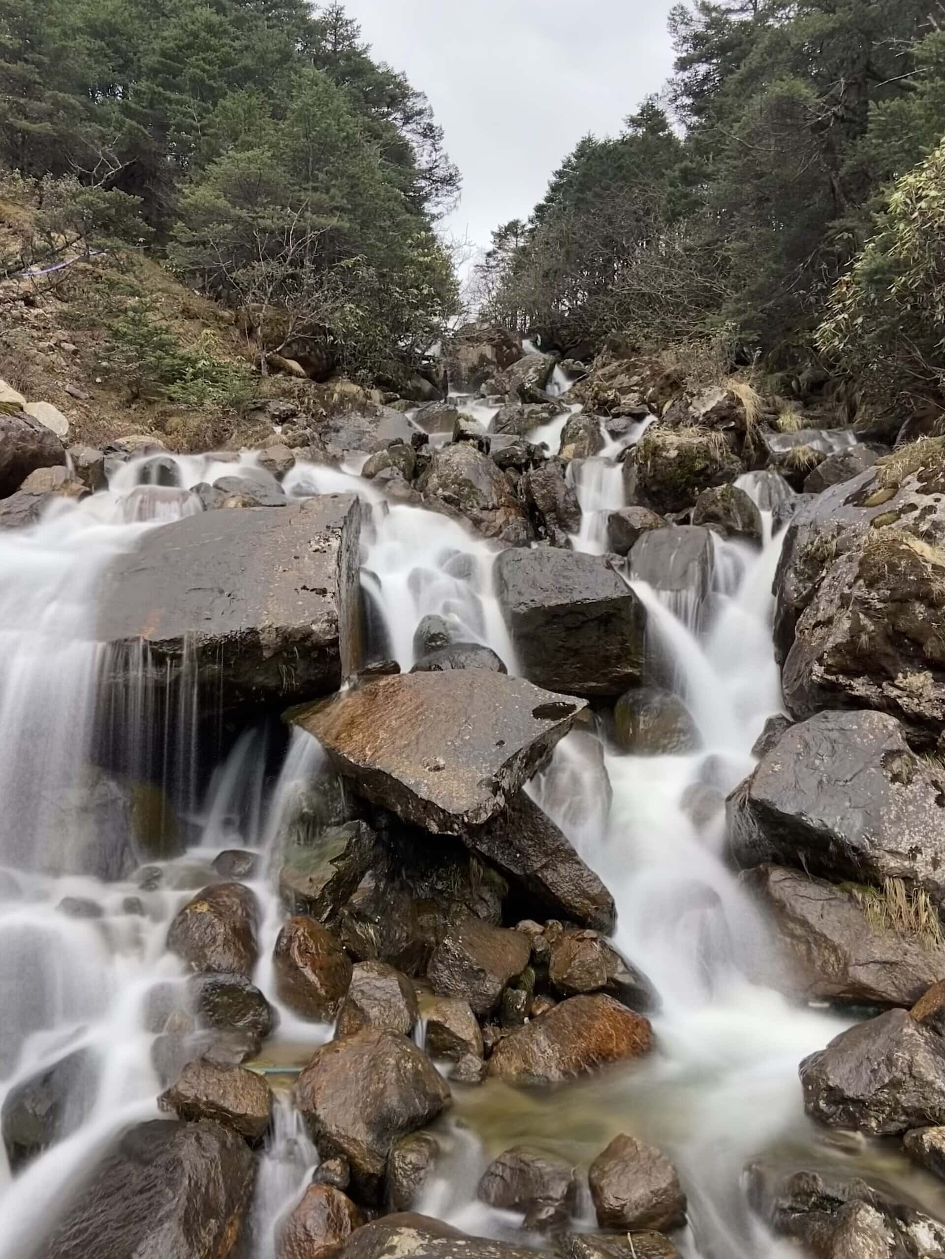
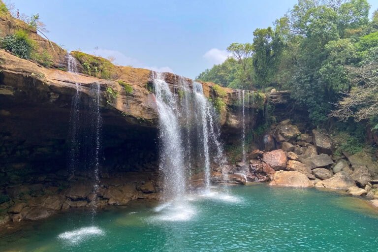
Nuranang Waterfalls
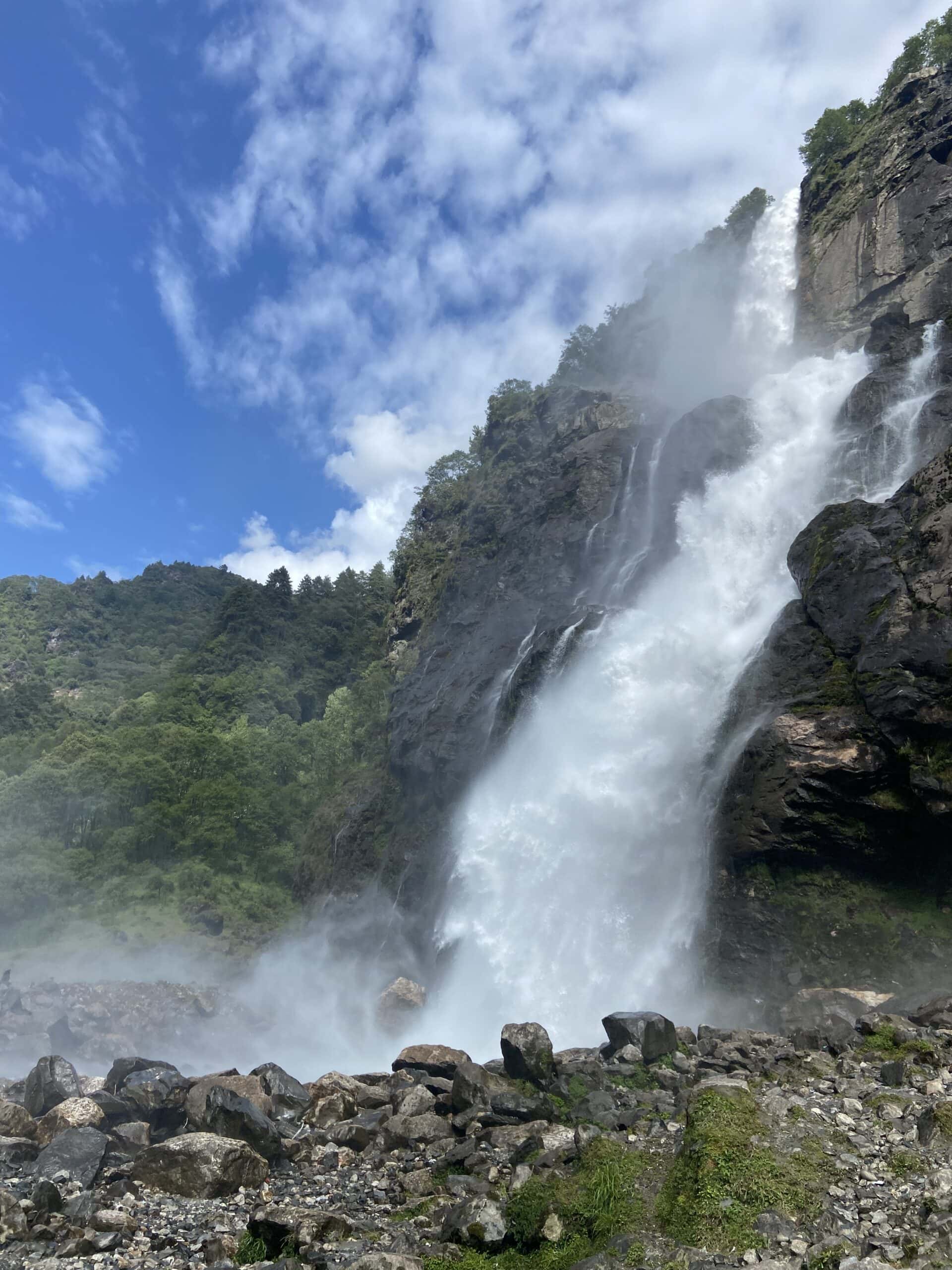
A few long exposure shots of the falls.
And a couple of animated GIFs.
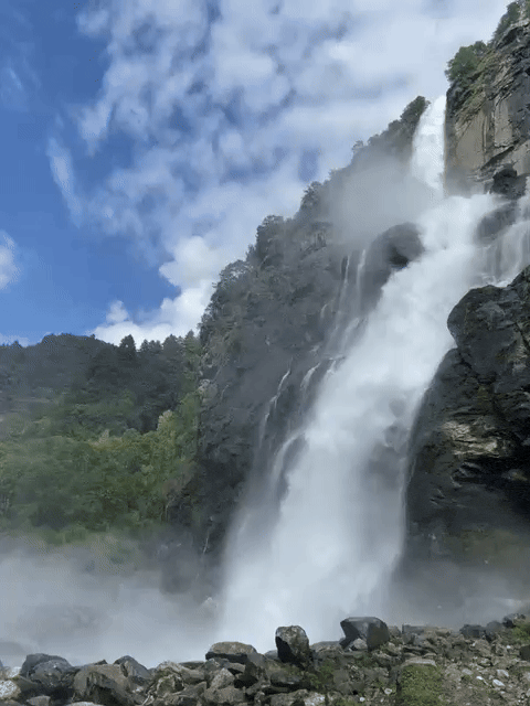
The waterfalls 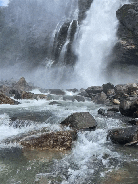
The stream below
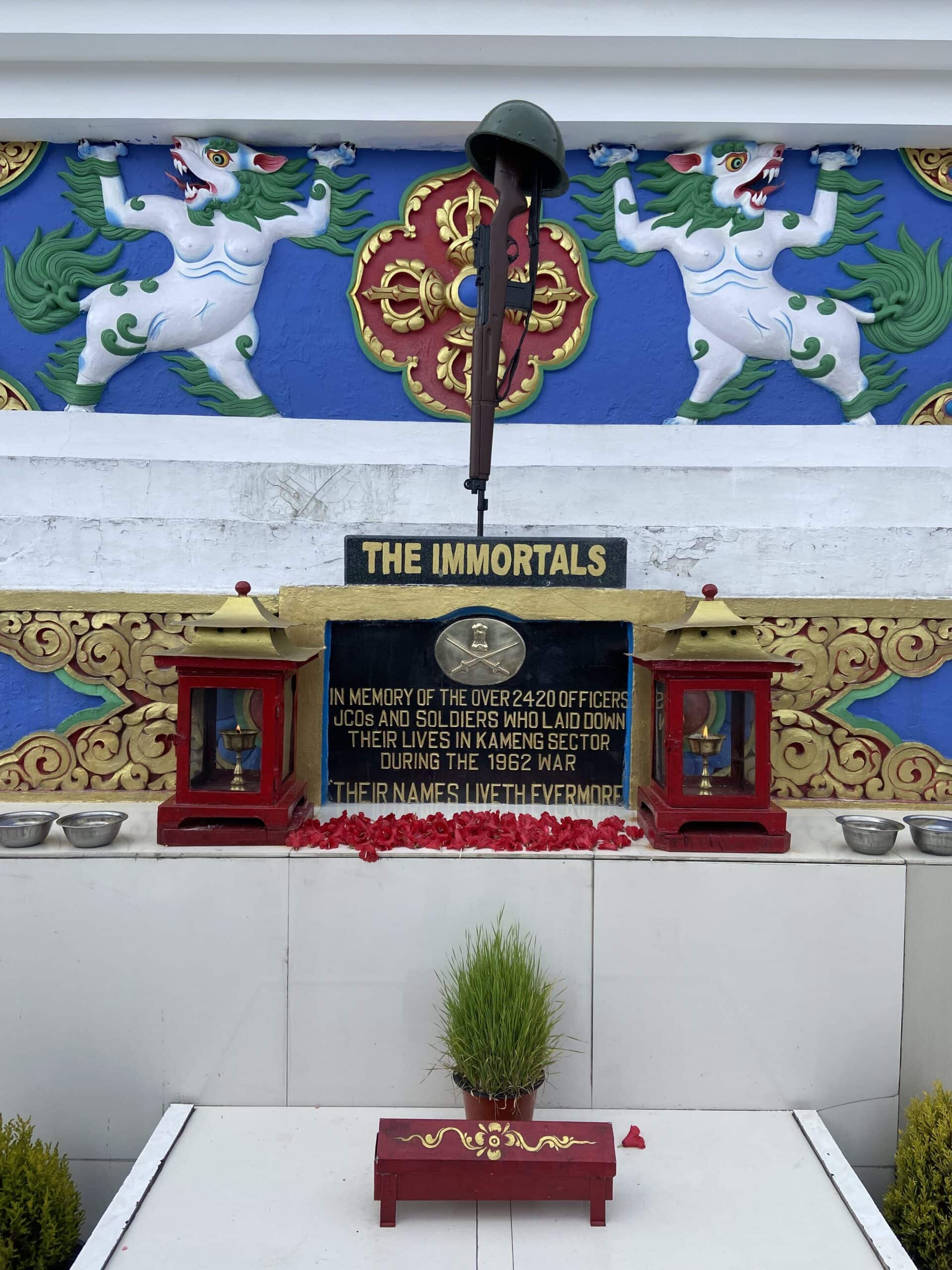
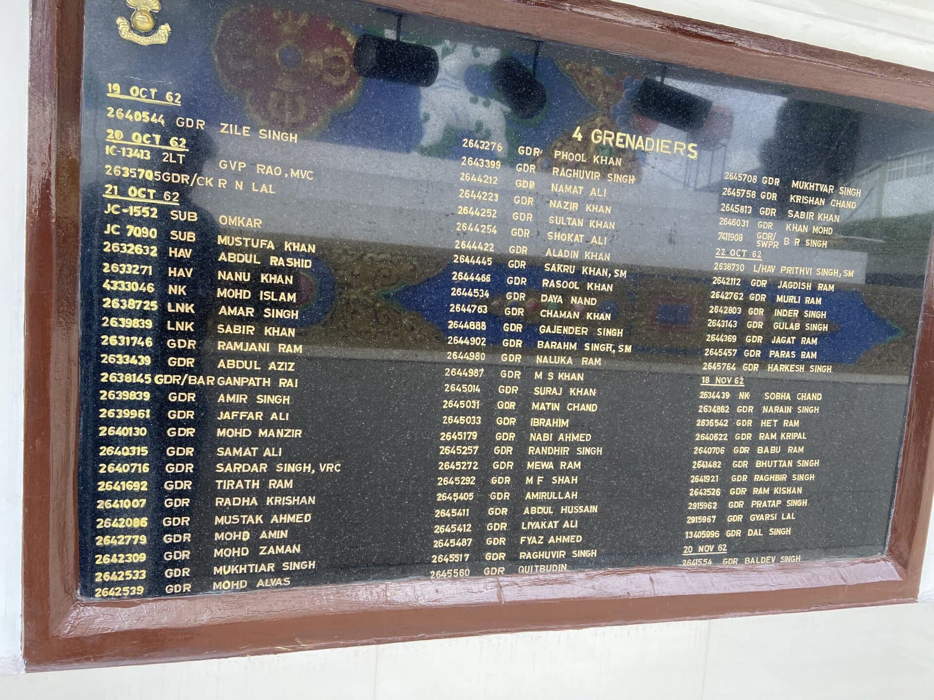
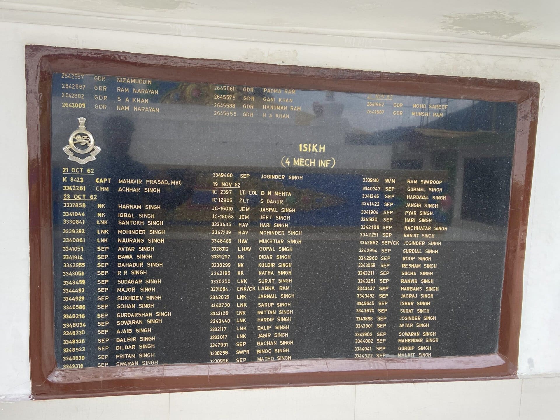
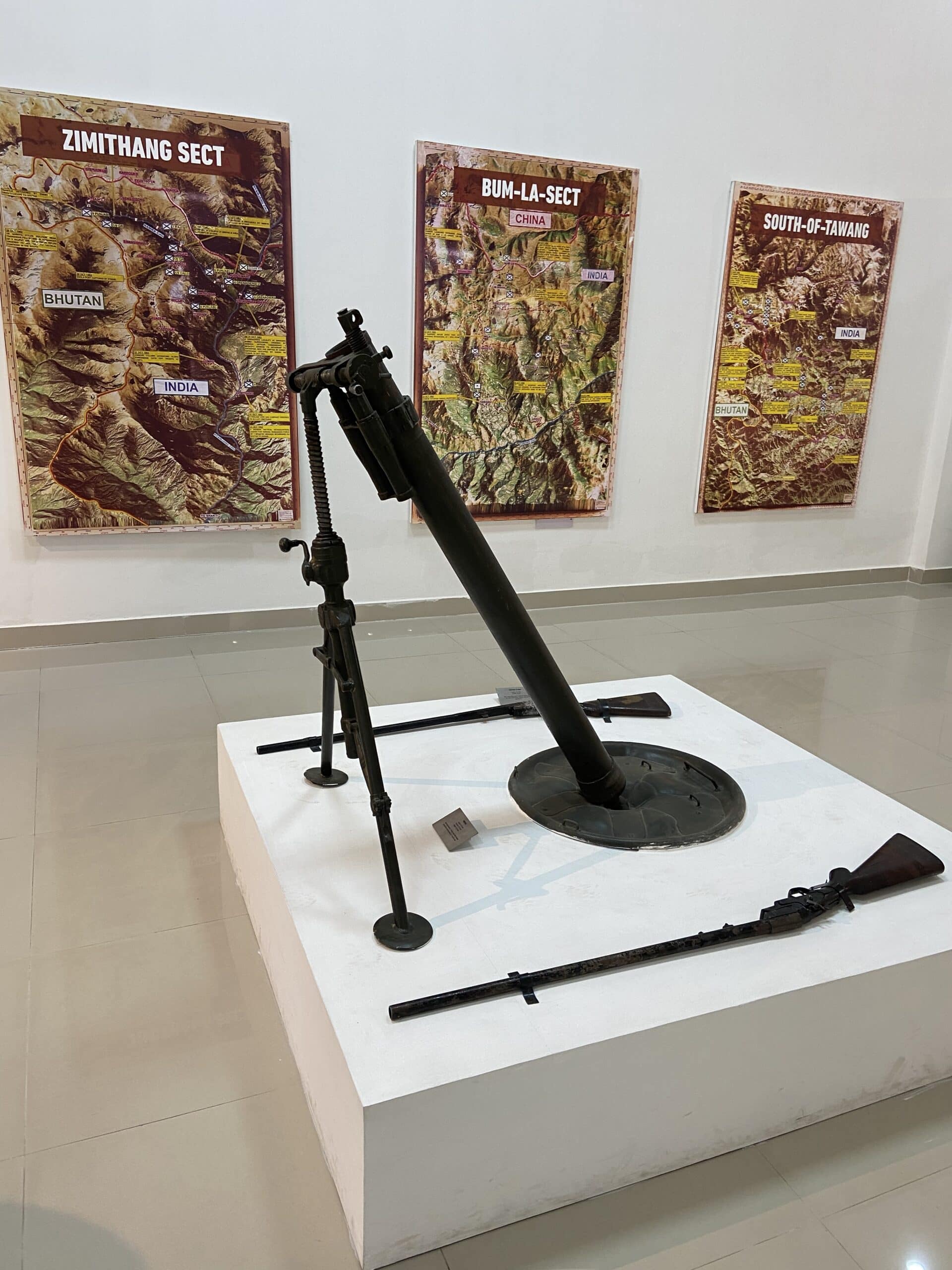
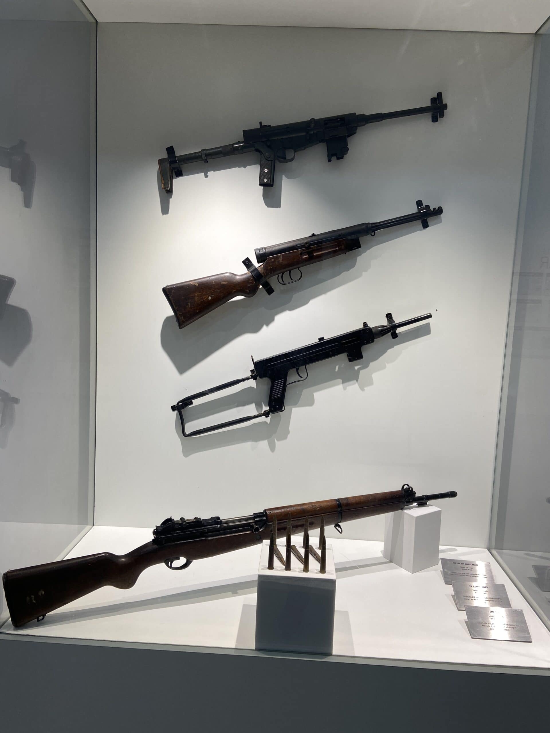
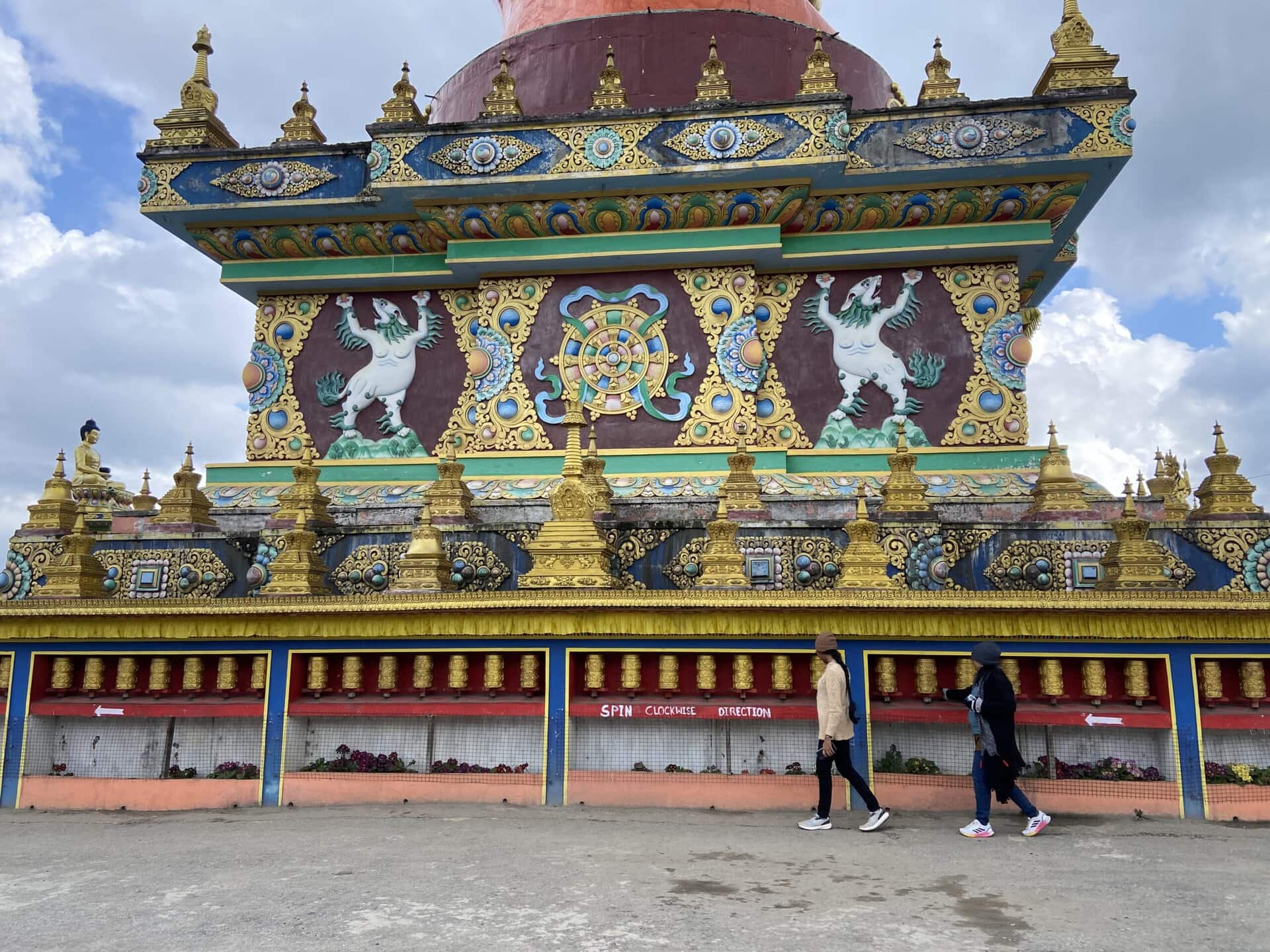
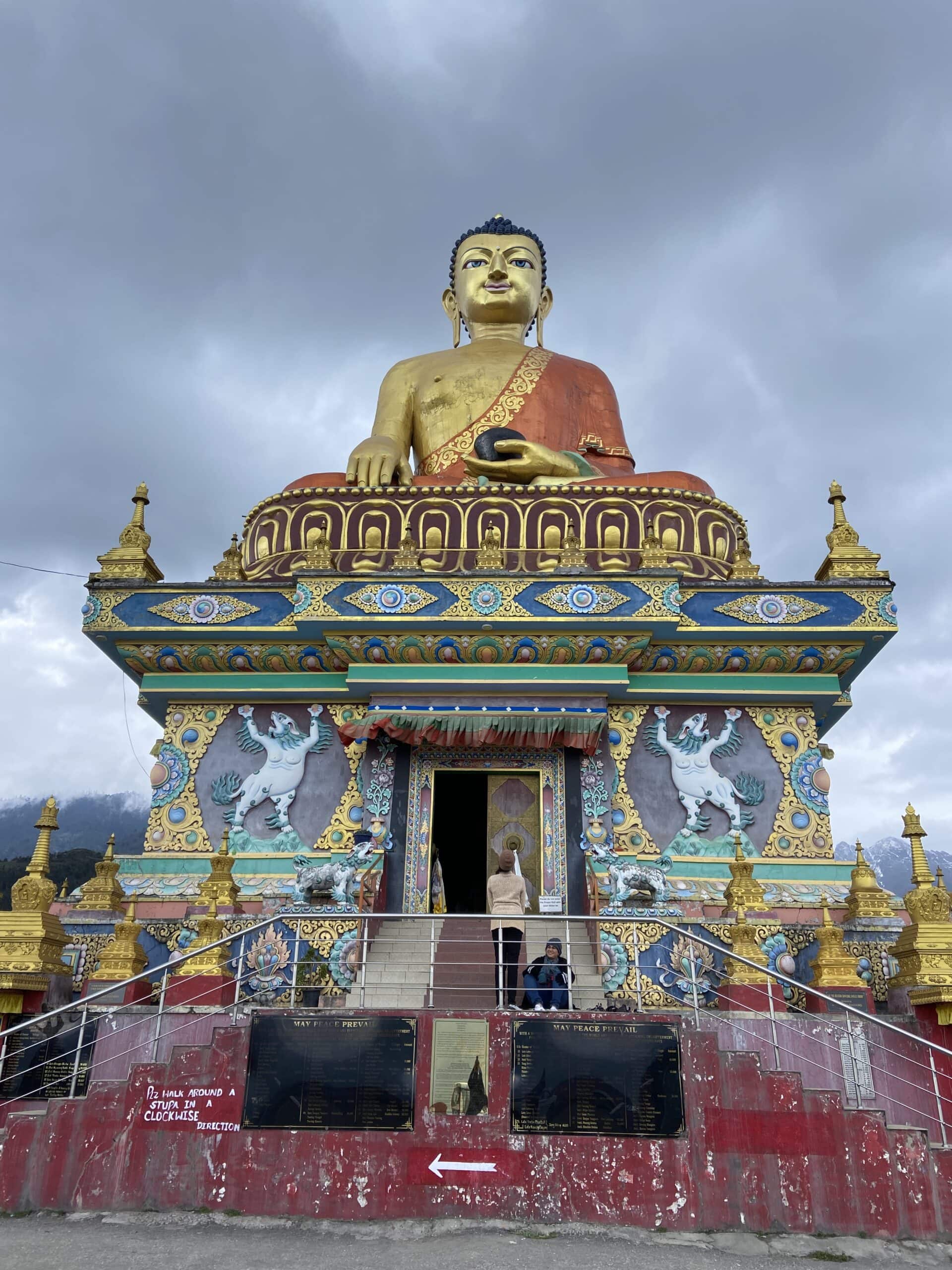
Tawang War Memorial
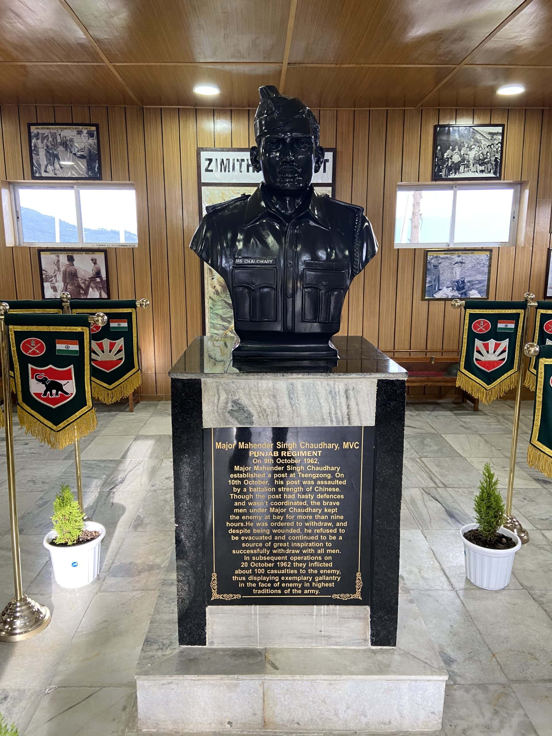
After Nuranang Waterfalls, our next stop in Tawang was the Tawang War Memorial, also known as Namgyal Chorten. This 40-foot-tall stupa-shaped monument was built in memory of 2,420 Indian soldiers who lost their lives in the 1962 Indo-China war, particularly in the Kameng sector of Arunachal Pradesh. The structure follows a stupa design, reflecting the region’s Buddhist heritage.
At the entrance, there’s a simple but symbolic arrangement—a soldier’s gun and helmet, two lamps, and a plaque with a short message. Inside, the walls display boards with the names of the soldiers, along with maps, photos, and brief notes about different battles and regions involved in the war.
Reading these names and stories of sacrifice made the heart heavy and brought tears in the eyes, even though the events happened 60 years ago. Below are a few pictures from the memorial.

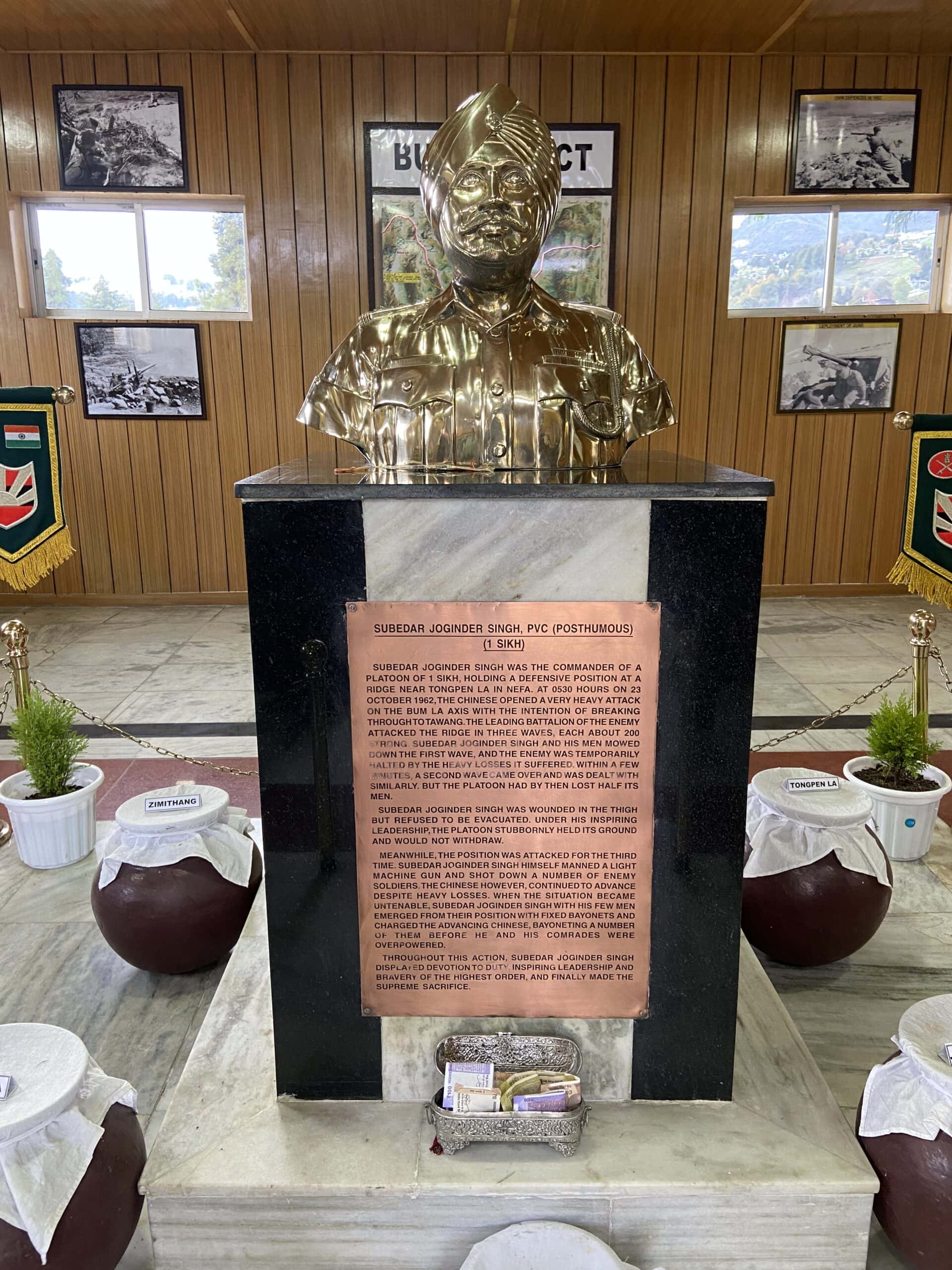


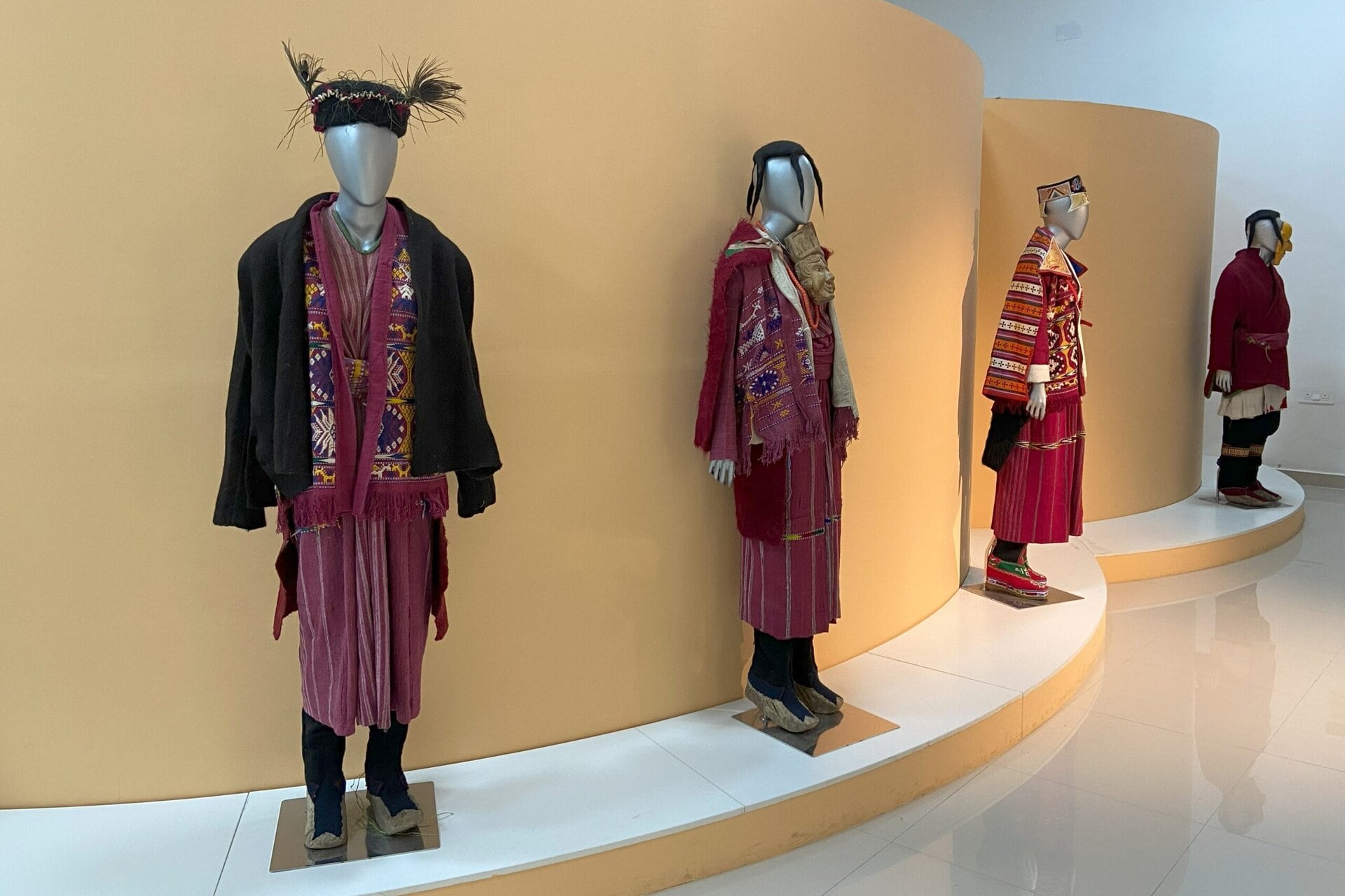
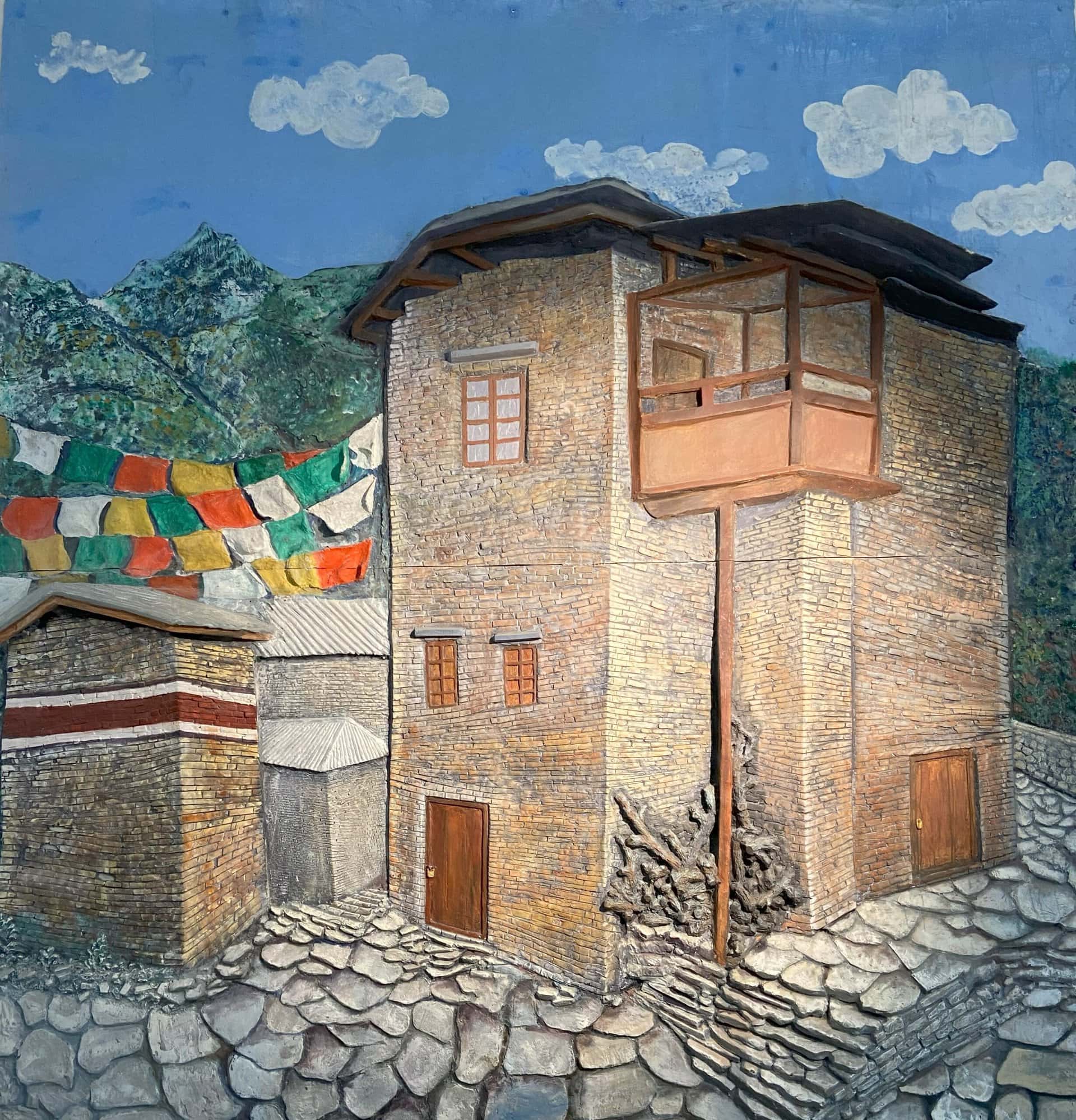
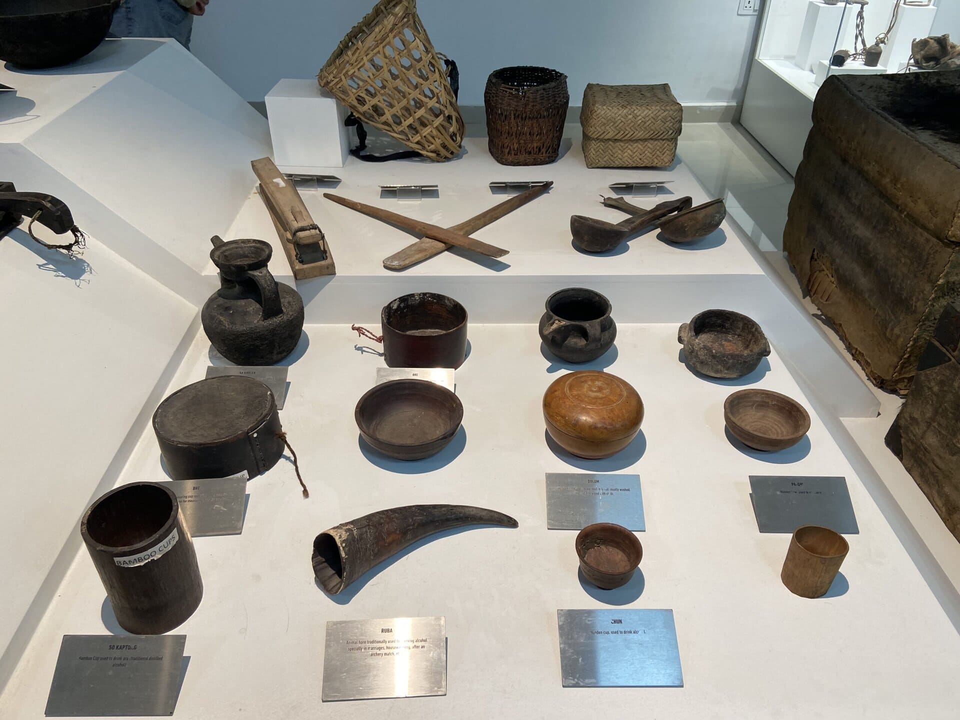
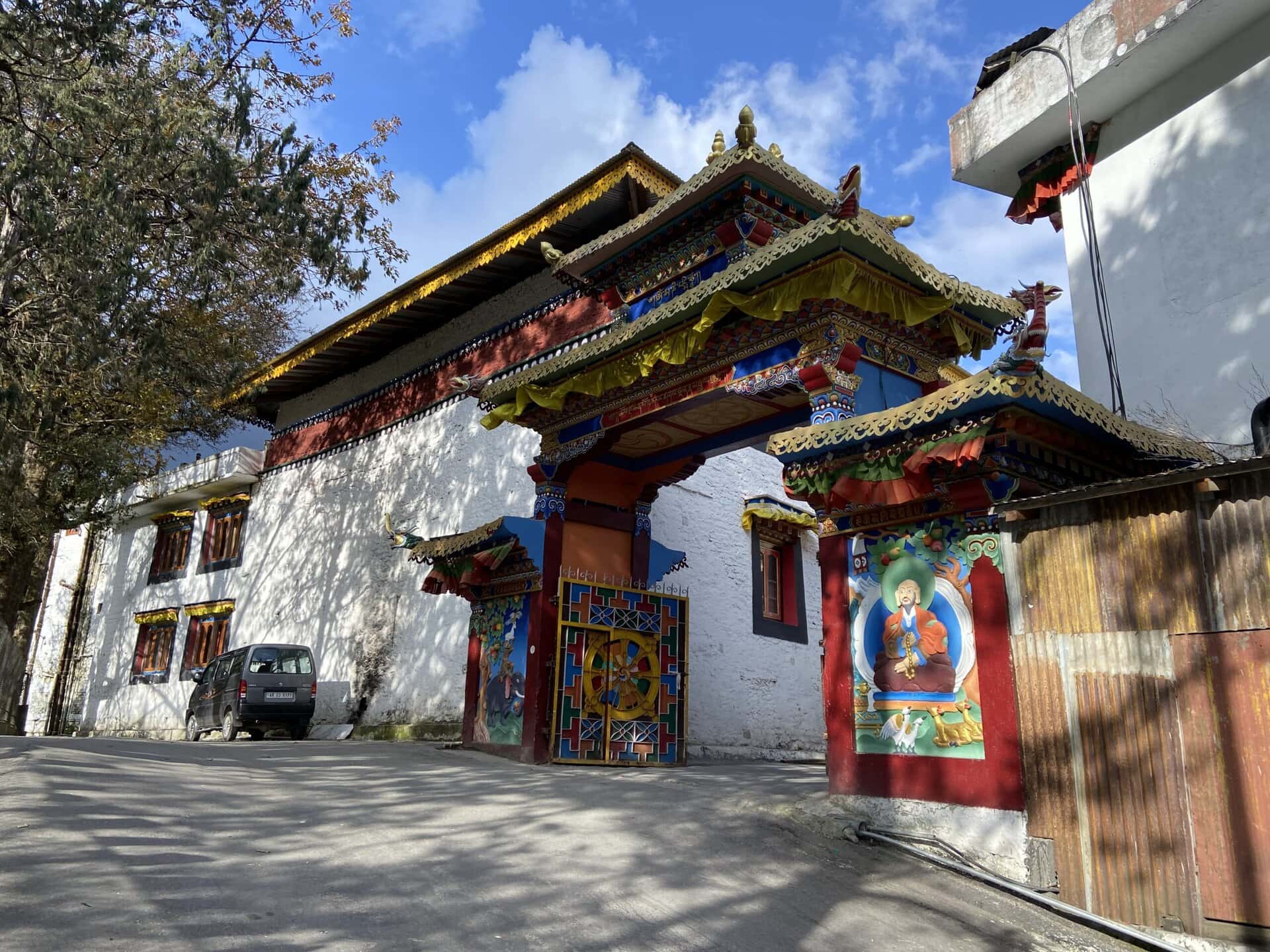
Major Khathing Museum
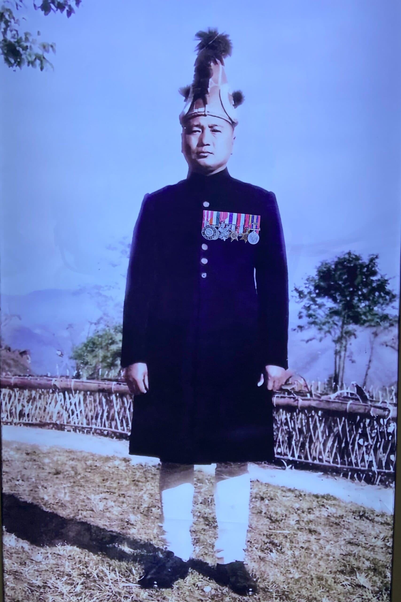
Just across from the Tawang War Memorial, we visited the Major Khathing Museum. This museum is dedicated to Major Bob Khathing, who played a key role in the peaceful integration of Tawang with India in 1951. His efforts helped establish Indian administration in the region well before the 1962 conflict with China.
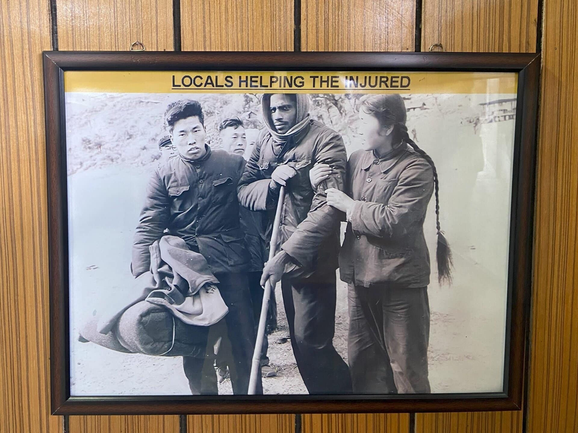
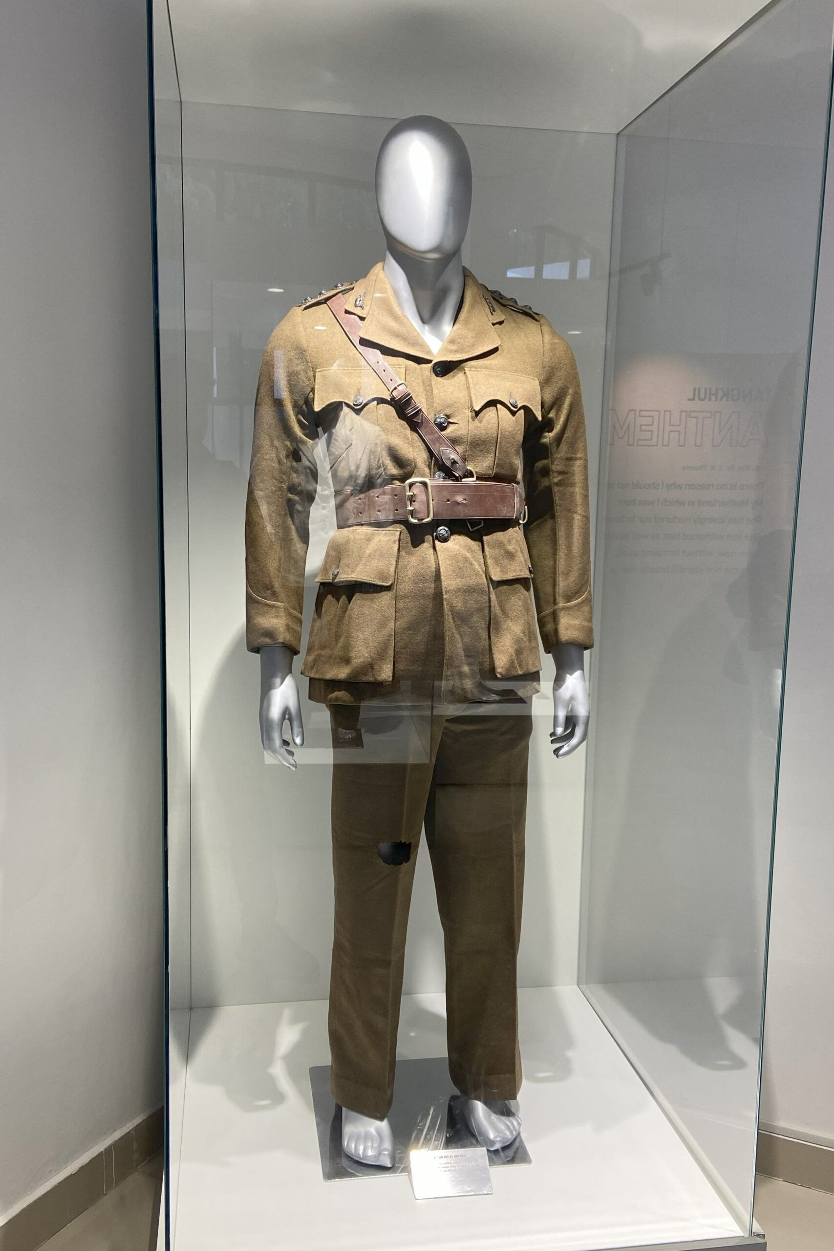
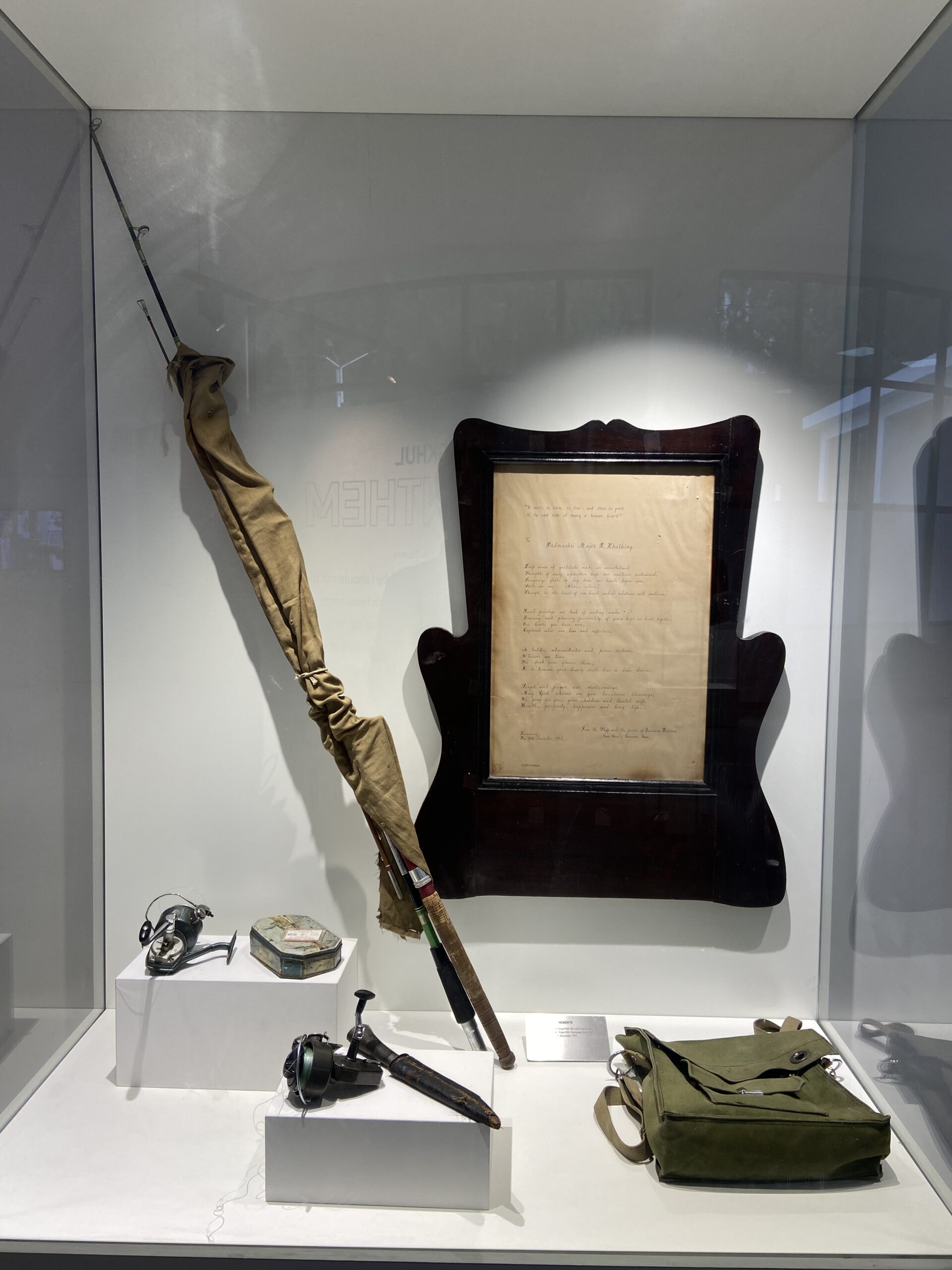
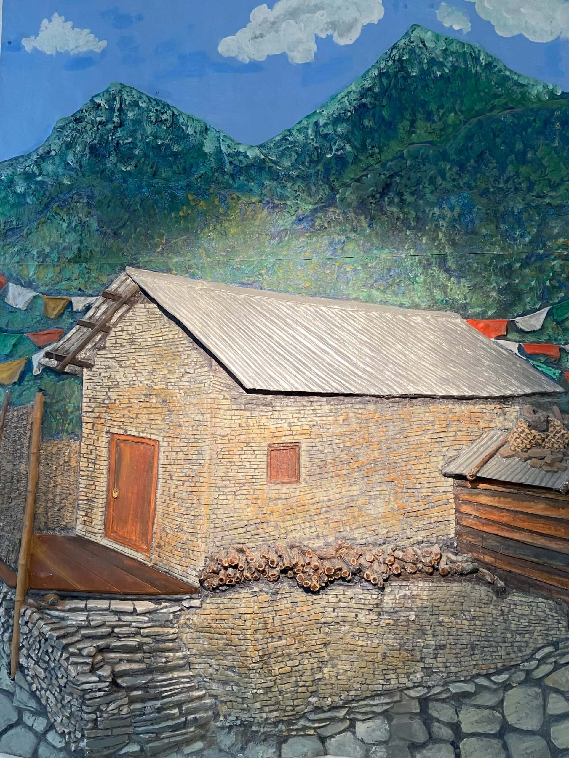
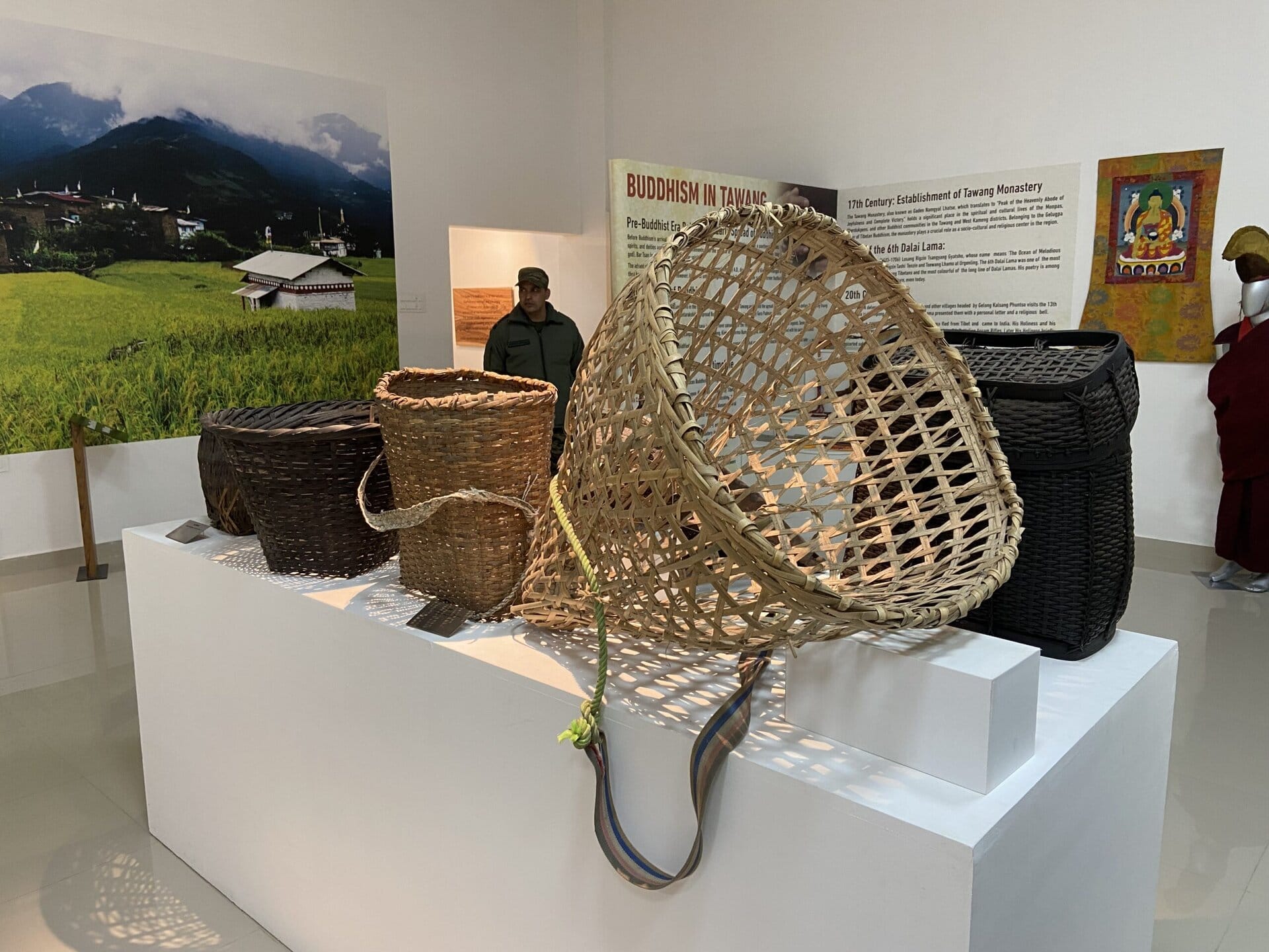
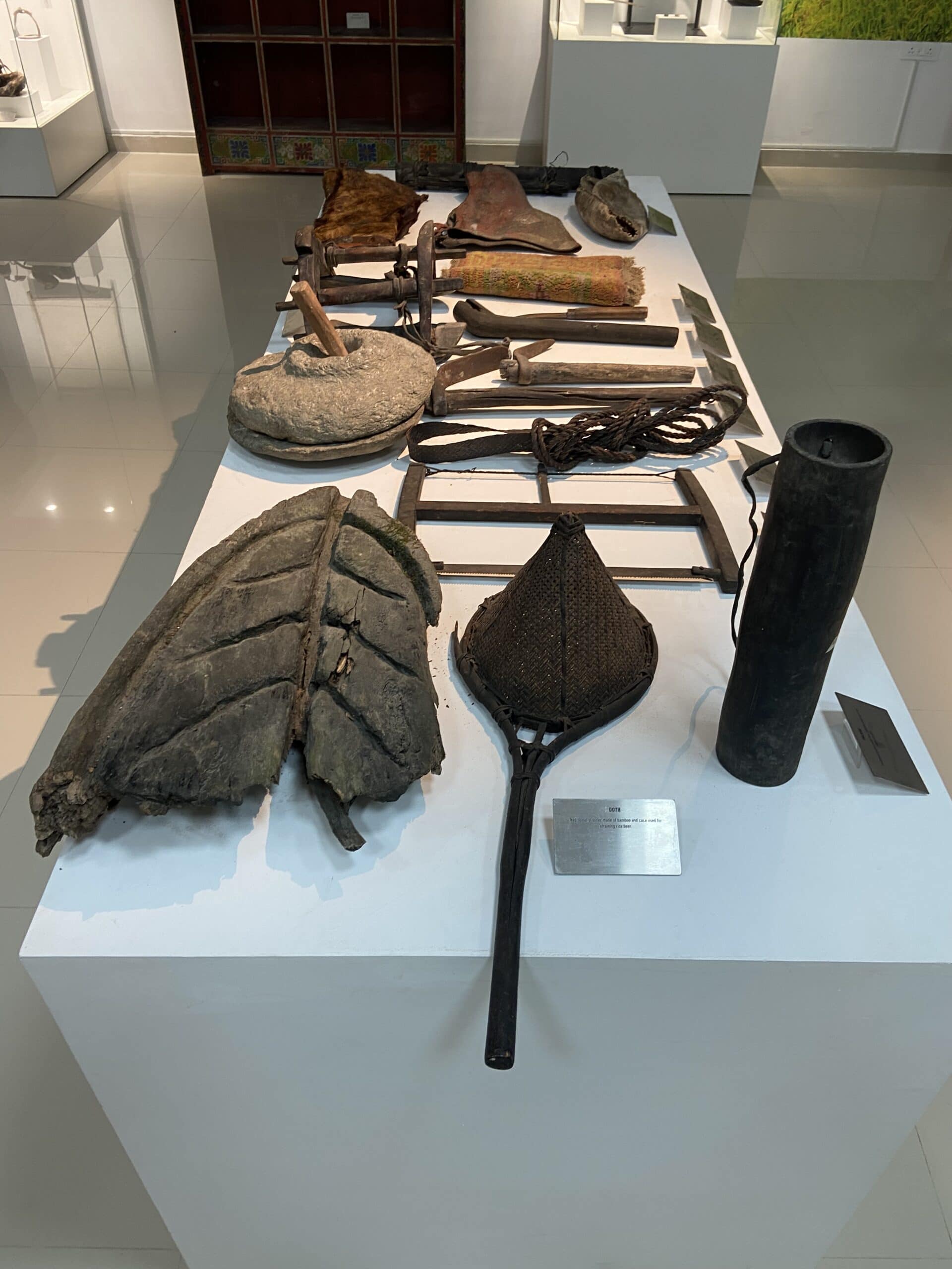
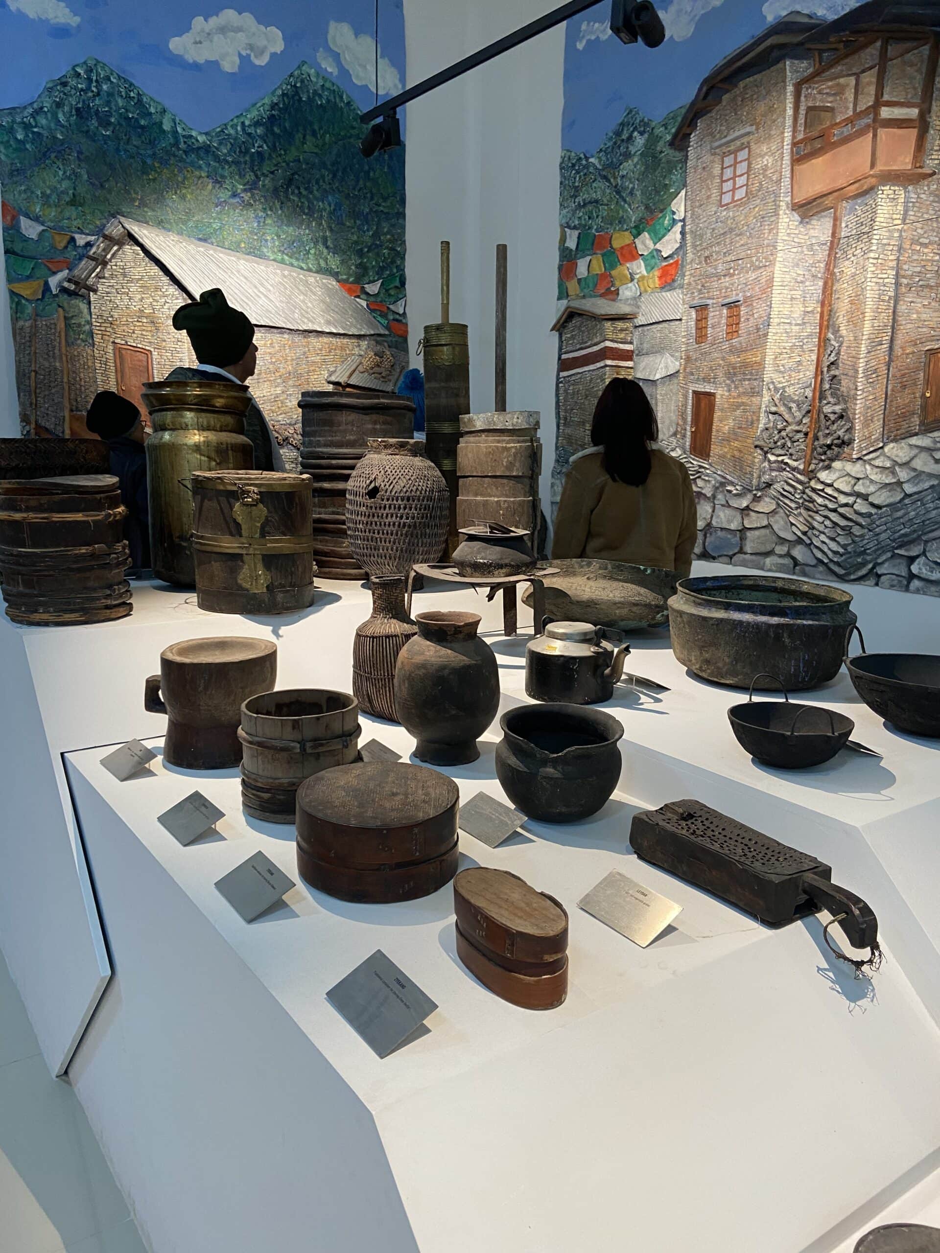
The museum has a number of exhibits from Major Khathing’s life—some of his personal belongings, a few documents, and a timeline that explains how Tawang became part of India. One section focuses on the Monpa tribe, the local community in this region, with displays of traditional clothing, tools, and other items from daily life. There’s also a small section about the 1962 Indo-China war, which adds some context to the history of the area.
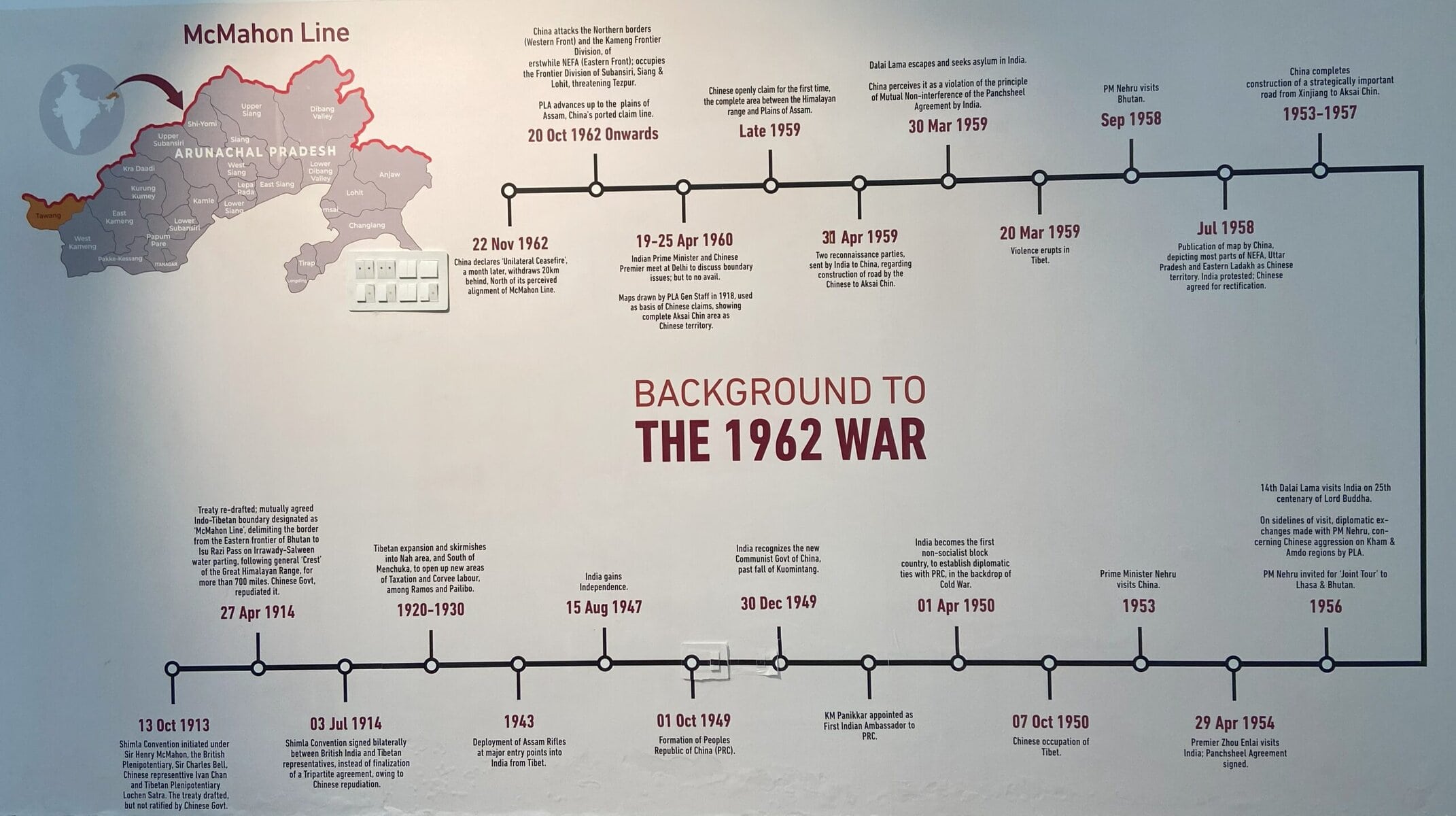
Defence minister Rajnath Singh inaugurated this museum in October 2024. Below is an excerpt from one of the information boards that explained the role of Major Khathing in Tawang’s inclusion into India.
With the signing of 1914 Shimla Accord, Tawang and all areas in Arunachal Pradesh became a part of British India. However, for various reasons, the British could not bring the region under their administrative control.
At the end of 1950, three years after independence, the area till Dirang was under Tibetan administration. Two Dzongpens (Governors) were appointed by Tibet for the Tawang region. One supervised the monastic activities and the other was responsible for administration and taxation.
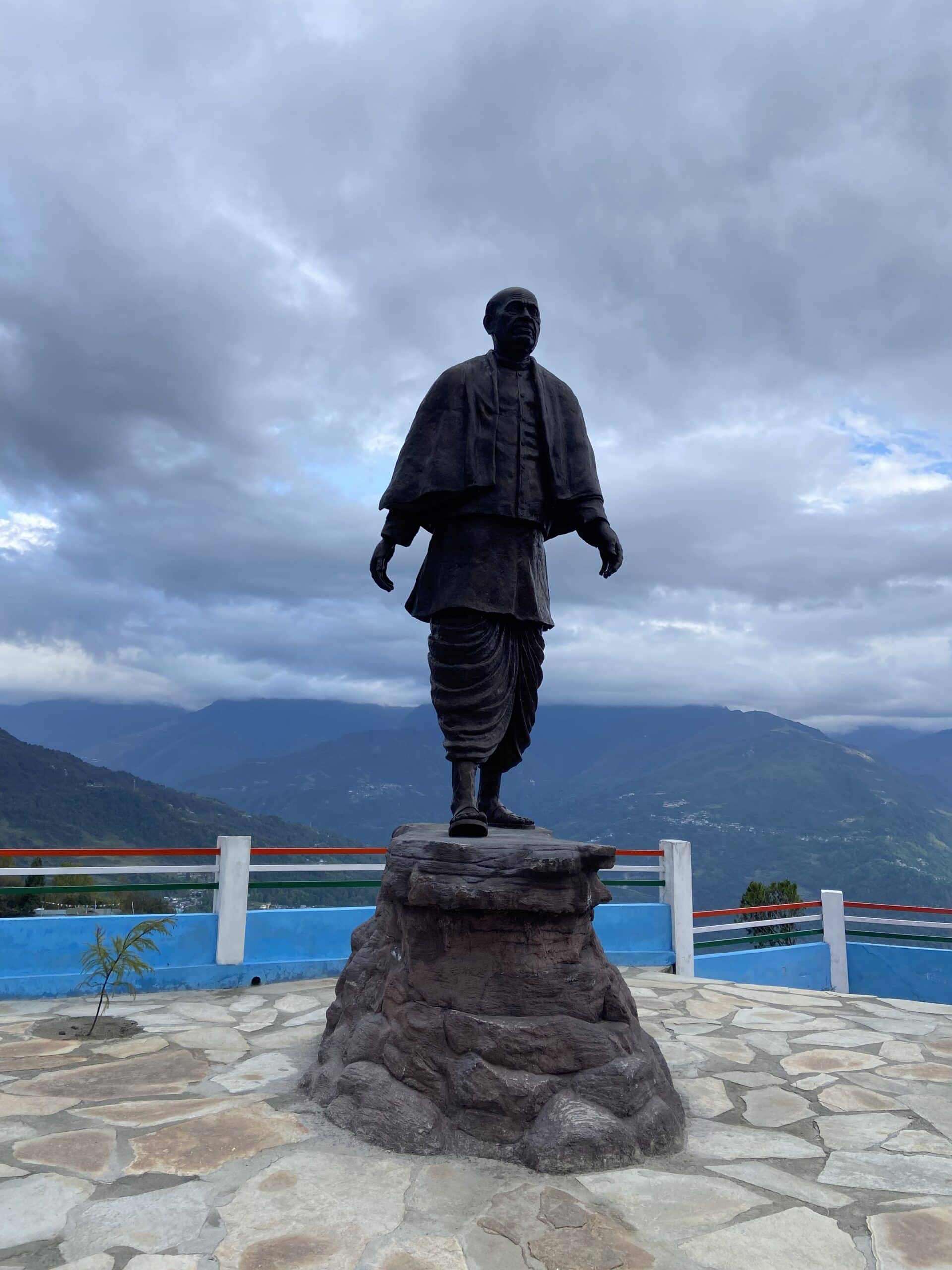
After Chinas annexation of Tibet in 1950, there was an increasing recognition of the expansionist moves of China, particularly by then the Deputy Prime Minister and Union Home Minister Sardar Vallabhai Patel. By December 1950, it was informed to the advisor that the Government had decided to establish a post at Tawang, as this part needed to be secured and brought under Indian administration.
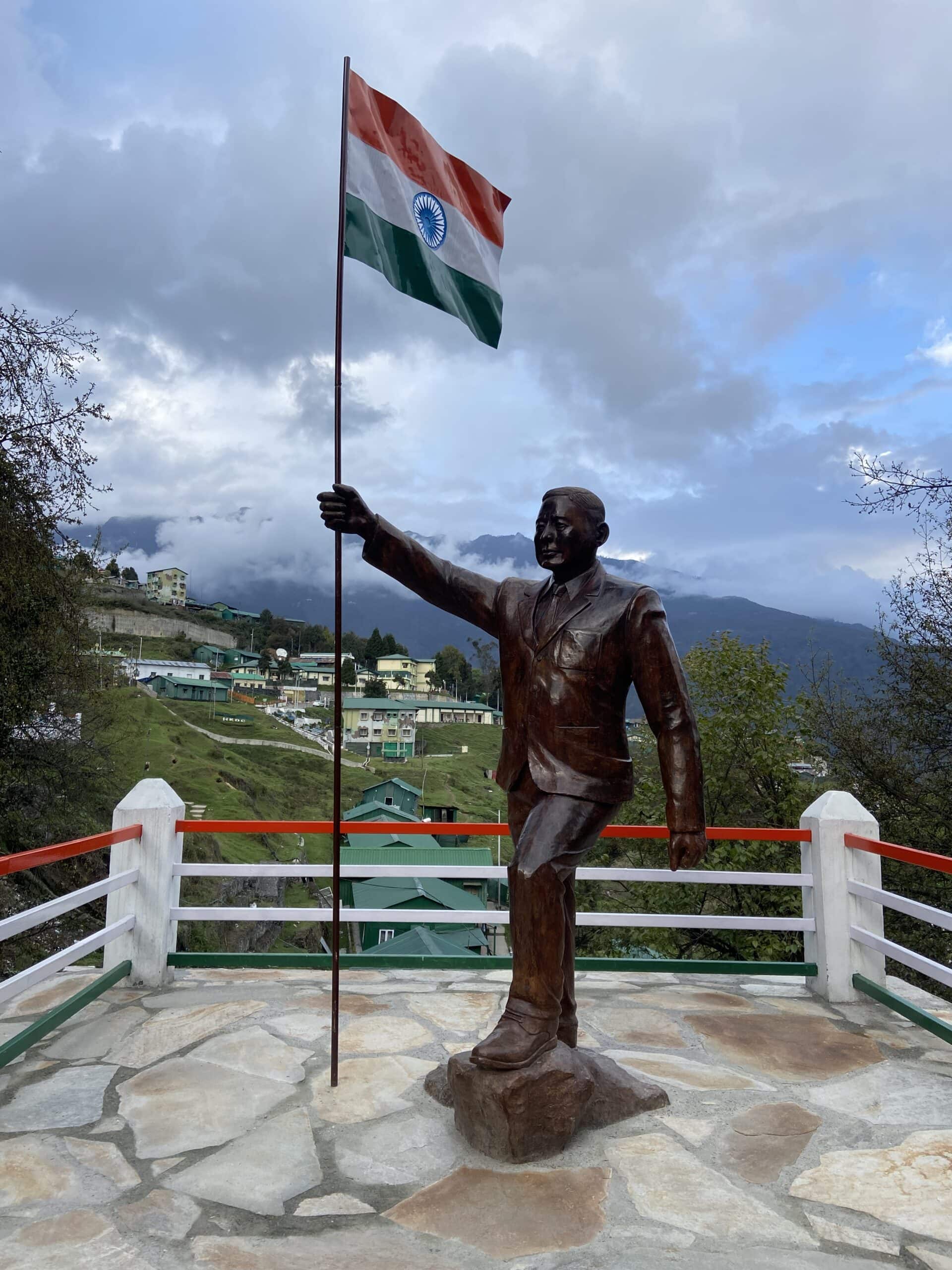
The Governor of Assam Jairamdas Daulatram summoned Major Ralengnao Bob Khathing, who had recently been appointed as an Assistant Police Office in the Indian Frontier Administrative Service.
Major Khathing was to occupy Tawang and establish a post there, communicate to the people of Tawang that none of their religious practices will be interfered with and that there will be no forced labour and everything needed will be duly paid for. He was to come up with a concrete proposal regarding reduction or abolition of existing taxes and he was to conduct the operation with tact, firmness and discretion, a feat Major Bob Khathing accomplished without the use of force or coercion.
It was very interesting to know about the history of Tawang’s inclusion into India and the role of Major Khathing, and also the culture of Monpa people.
Below are a few pictures of this museum and its exhibits.

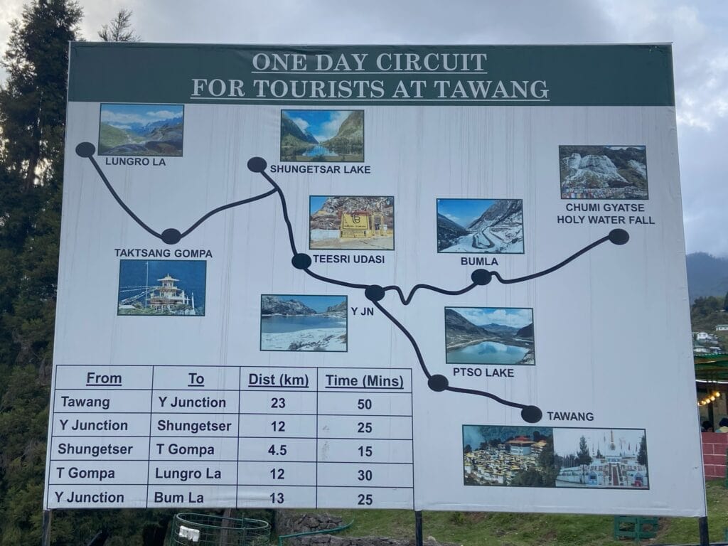
As we came out of the Khathing Museum, we saw this board showing various places of interest in Tawang. As we had the whole day the next day, we decided to use this as a reference for sightseeing.
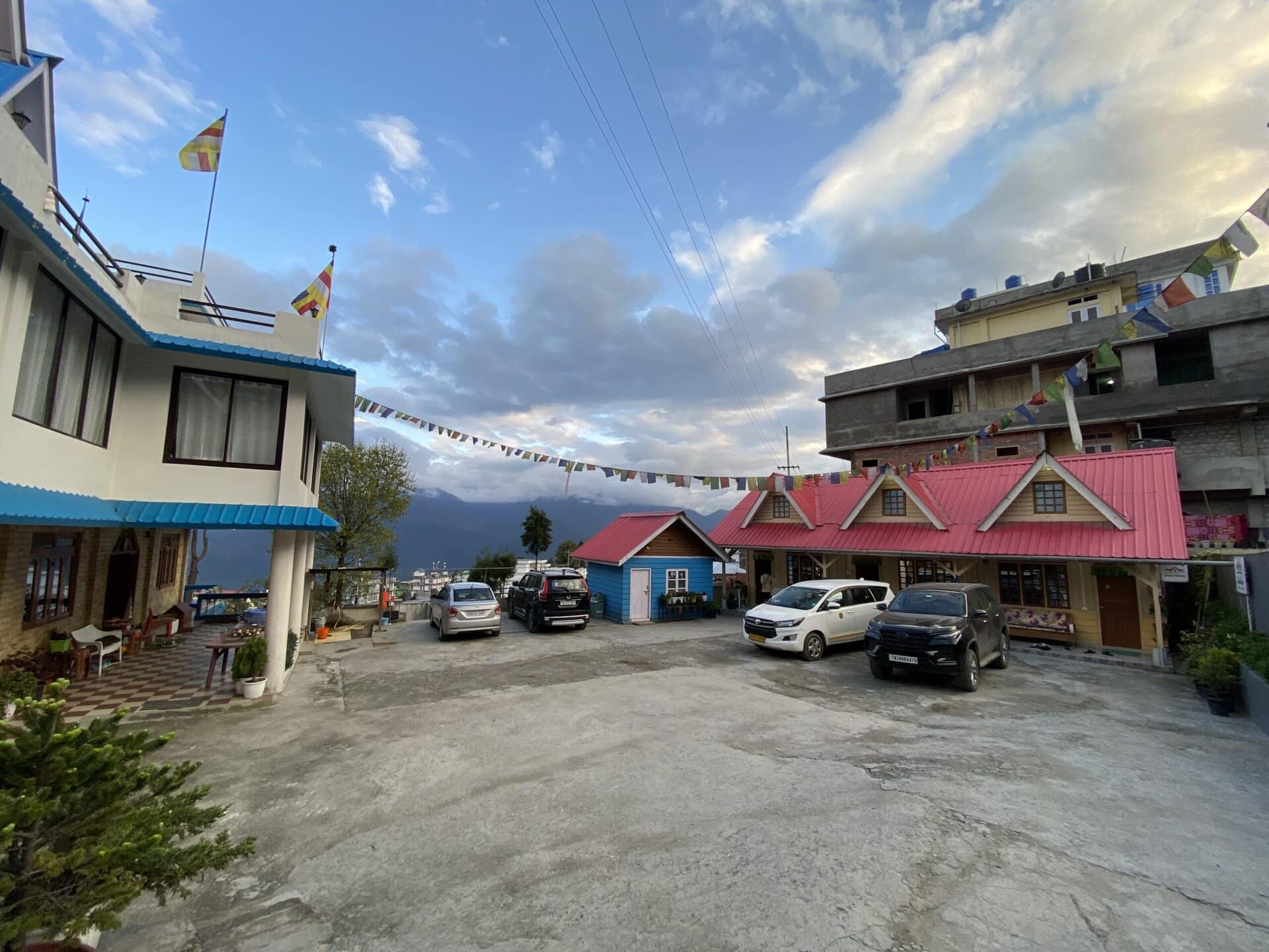
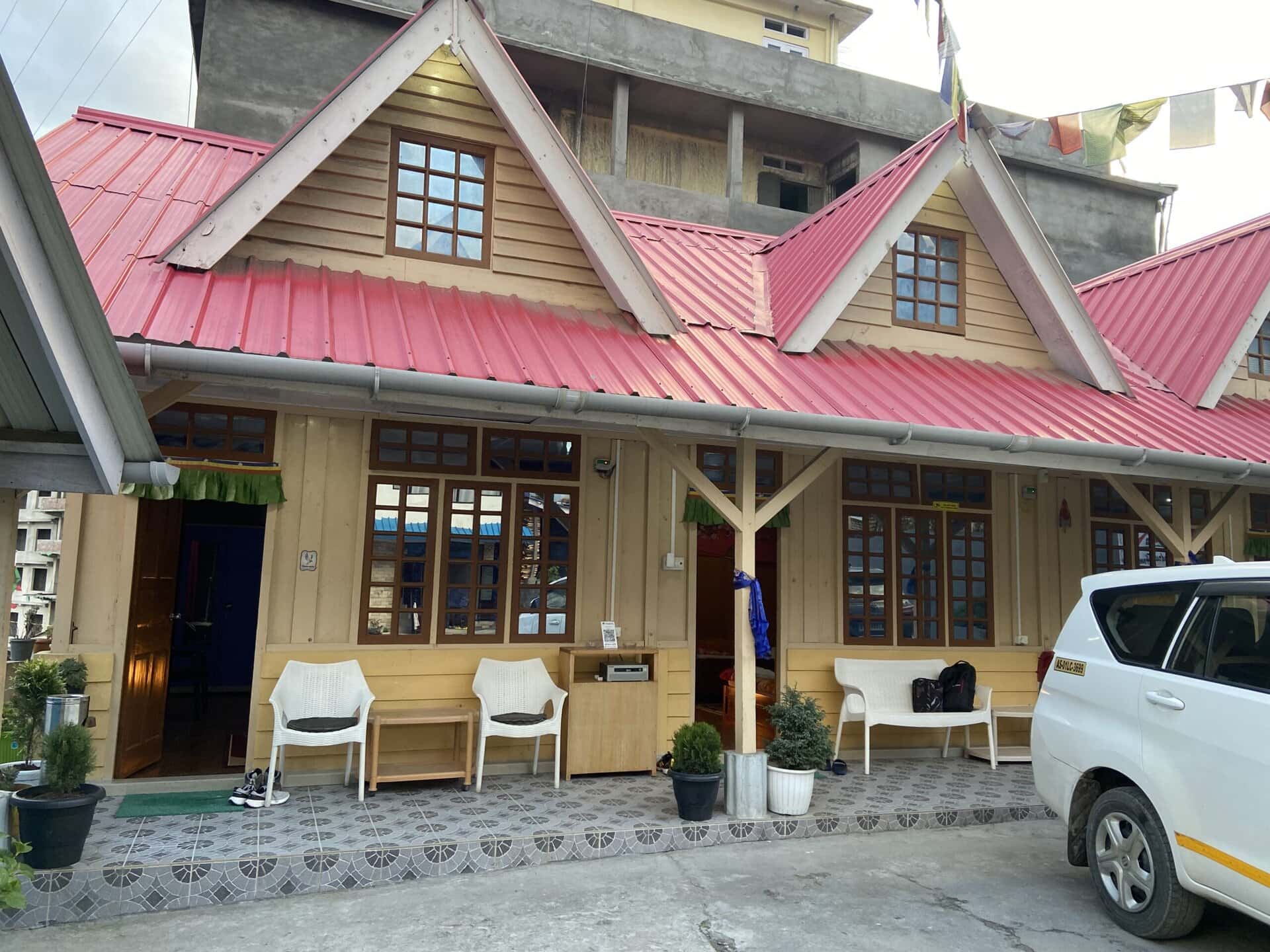
After this, we drove to our homestay, The Dondrub Homestay which was very close to the war memorial.

Day – 10 Sightseeing in Tawang
We had the whole day in Tawang for sightseeing. Before I get to the sightseeing part, I would like to mention about the permit required to visit Bumla pass and the surrounding areas and how I missed this.
Permit to Bumla Pass
Visiting Bumla Pass, which lies close to the India-China border, requires a special permit due to its restricted location. When I booked our homestay in Tawang, the host had casually mentioned helping with the permit for Bumla, and I mistakenly assumed it could be arranged using my existing Inner Line Permit (ILP).
However, when I reached the homestay, I learned that the Bumla Pass permit is entirely separate. If you hire a local cab for sightseeing, the driver usually arranges the permit on your behalf. But since I intended to drive my own car, I had to get this pass myself. Getting the pass involves two steps. First, I have to visit the Deputy Commissioner’s office (DC Office) to obtain an NOC by submitting personal IDs and vehicle documents (RC, Insurance, etc.). The next step is to take it to the Army office to get the final clearance.
Unfortunately, I had arrived too late in the evening to complete this process the same day, and with limited time, I had to skip Bumla and the nearby Holy Waterfall – places that I will come back to visit in the future!
The road leading toward Bumla Pass branches at a spot called Y-Junction. The right fork leads to Bumla and Holy Waterfall, both of which require permits. The left fork takes you to several other scenic spots that do not require a permit, so we chose to explore that direction instead.
PT Tso Lake
The first place we visited was the PT Tso lake. There wasn’t anything interesting here. It was just a lake with nothing nearby. There is an unoccupied building that is on the bank of the lake. Not sure if this is some new building that will become a restaurant. We spent 10 to 15 minutes here and clicked some pictures and drove on. But it was good view with thin layer of snow everywhere around.


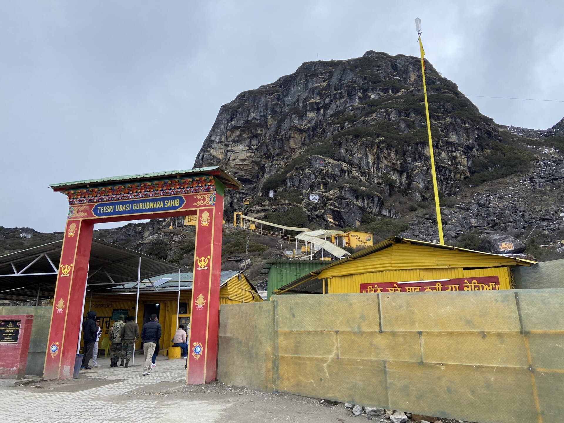
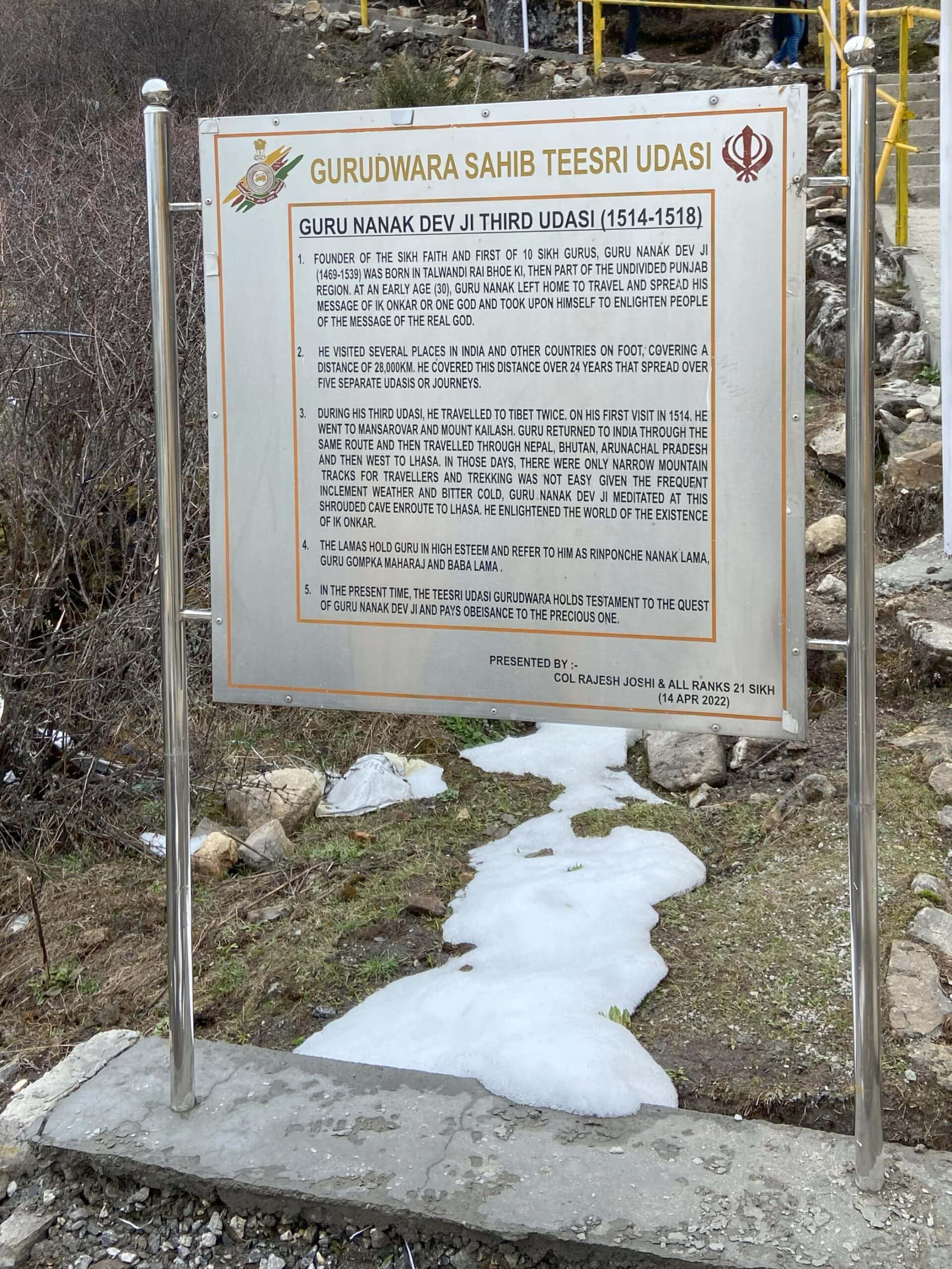
Teesri Udasi
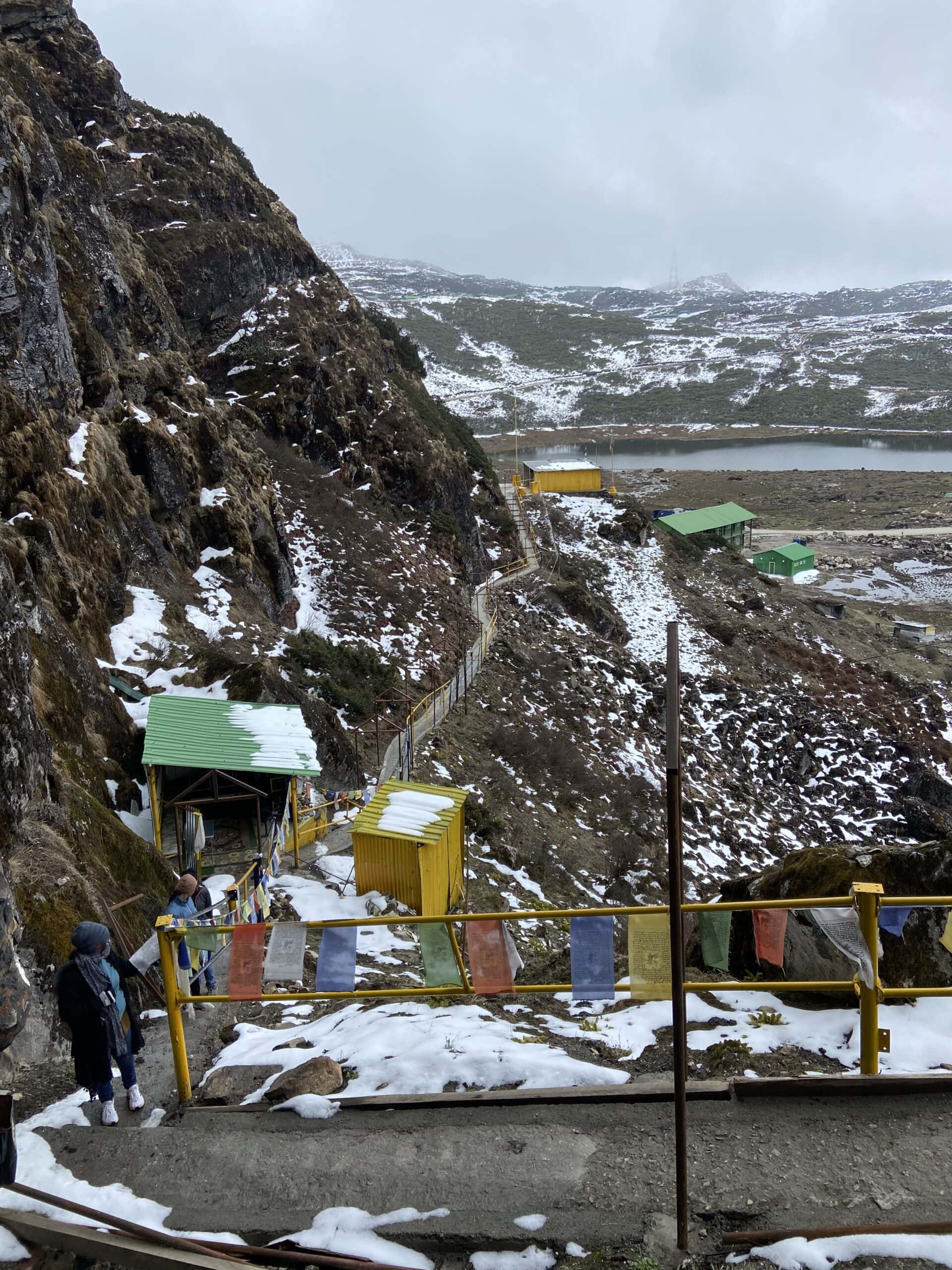
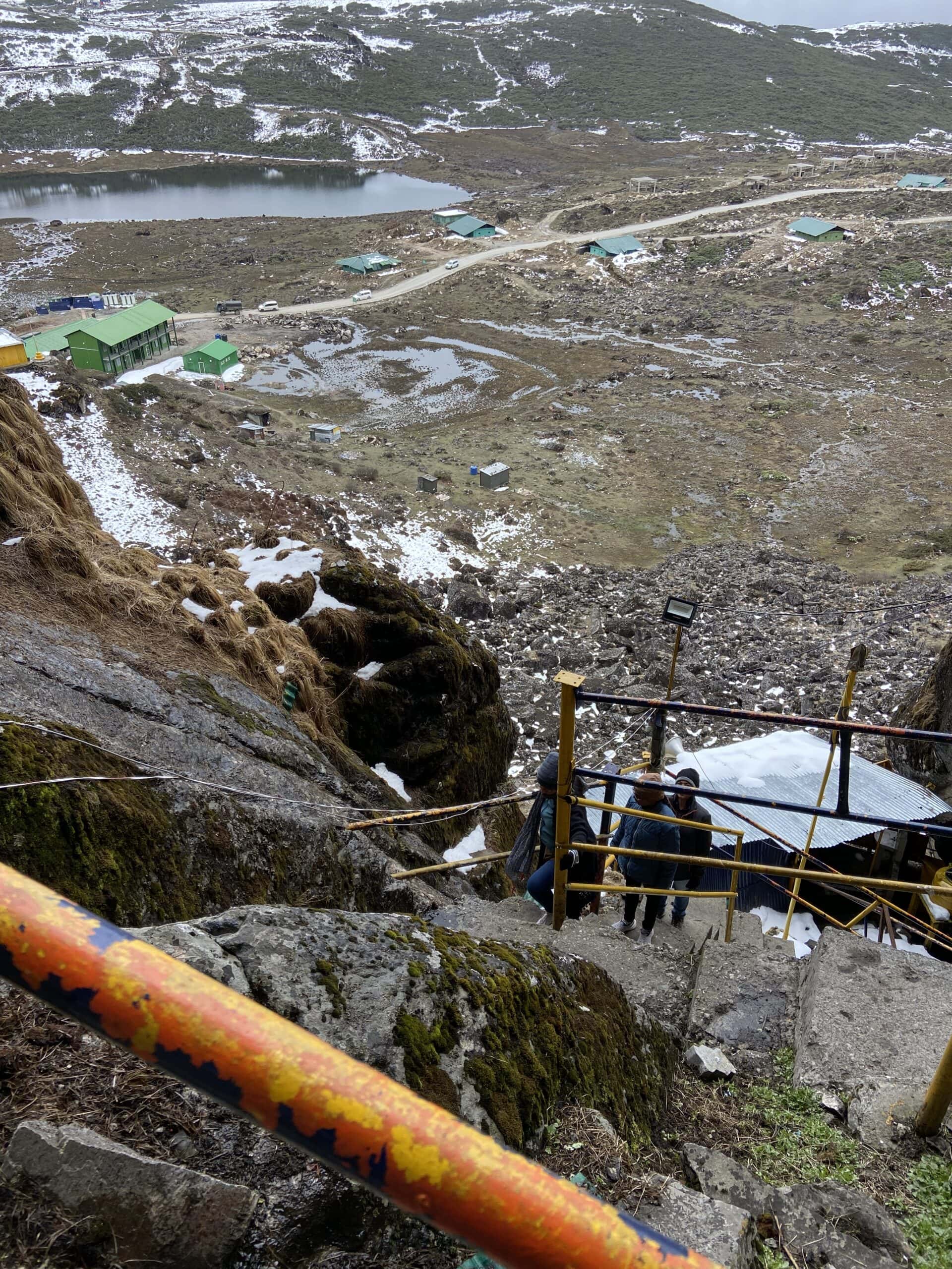
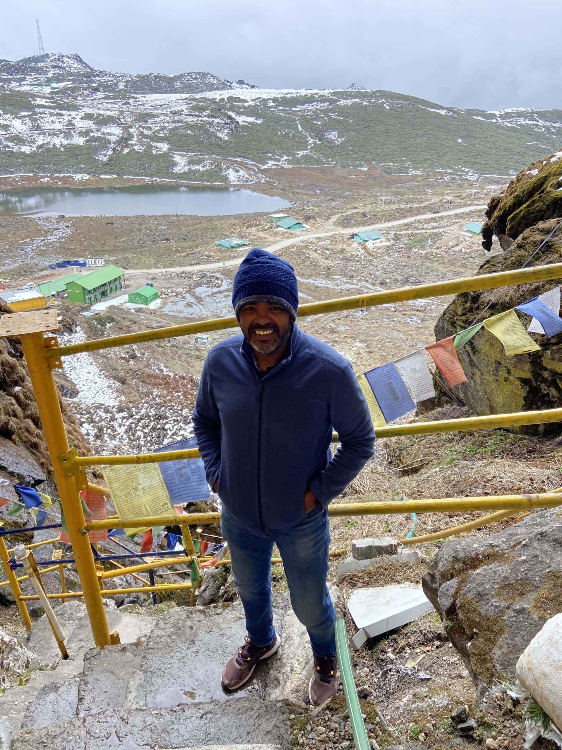
After our visit to Y-Junction, we drove through some scenic, snow-covered roads to reach Teesri Udasi, a spiritually significant spot on a mountain slope.
The term “Teesri Udasi” refers to the Third Udasi, one of the four long journeys taken by Guru Nanak Dev Ji, the founder of Sikhism. Between 1514 and 1518, he is believed to have travelled through parts of the Himalayas, including areas that are now Arunachal Pradesh, Sikkim, Nepal, Tibet, and Ladakh. During this journey, he is said to have visited Tawang, where he shared his teachings with local communities.
The Gurudwara is set inside a small cave, around 13,000 feet above sea level. Getting there involves a steep climb up steps cut into the rock. The air was thin, and it didn’t take long to feel the lack of oxygen. An army officer at the base advised us to go slow and take breaks every 10–15 steps. That turned out to be good advice.
I don’t know the exact elevation gain, but judging by the views from the top, it must have been around 200 to 300 feet. The effort was completely worth it – for the views, and for the sense of satisfaction after reaching the top. At the base, the army was serving hot tea and snacks. After the tough climb, that tea really hit the spot.
Below are a few pictures from Teesri Udasi, and the scenic routes we drove through.


T-Gompa and Madhuri Lake
After visiting Teesri Udasi, we continued along the winding mountain road toward Taktsang Gompa, also known as T-Gompa or the Tiger’s Den. The monastery is about 45 to 50 kilometers from Tawang, located at an altitude of around 12,500 to 13,000 feet. The road to it was scenic, with pine trees on either side and views of distant peaks.
The monastery is believed to be the place where Guru Padmasambhava (or Guru Rinpoche), the founder of Tibetan Buddhism, meditated in the 8th century. The name “Taktsang” means “Tiger’s Den,” referring to the legend that Guru Rinpoche arrived here riding a tigress.
The last 5 kilometers was a broken, unpaved stretch. But with the Fortuner’s 4×4, Tough Dog suspension, and good ground clearance, the drive was manageable. We reached around 1:15 PM, just after the monastery had closed. So we couldn’t go inside, but we stayed for a while, soaking in the views and the quiet around us.
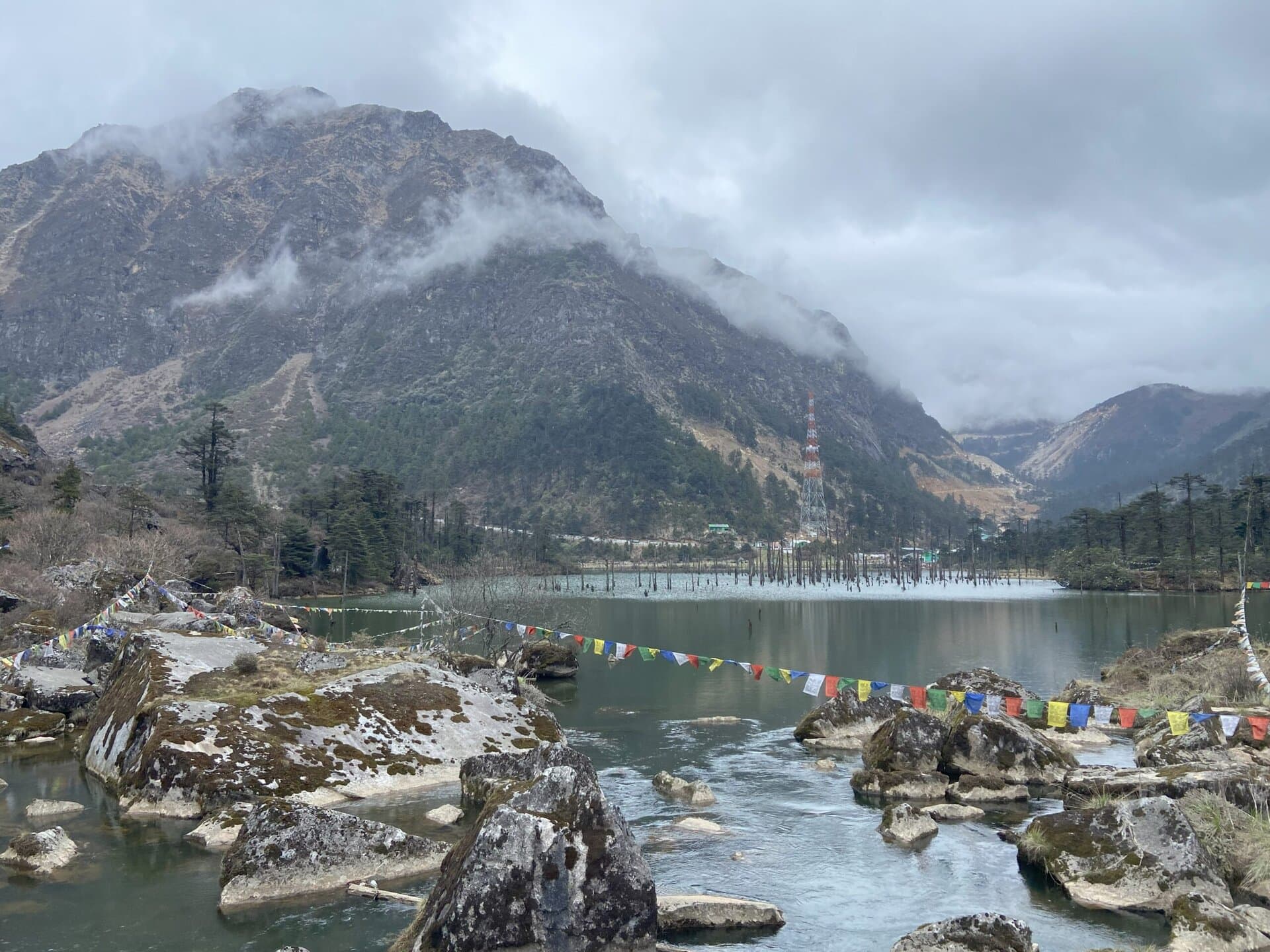
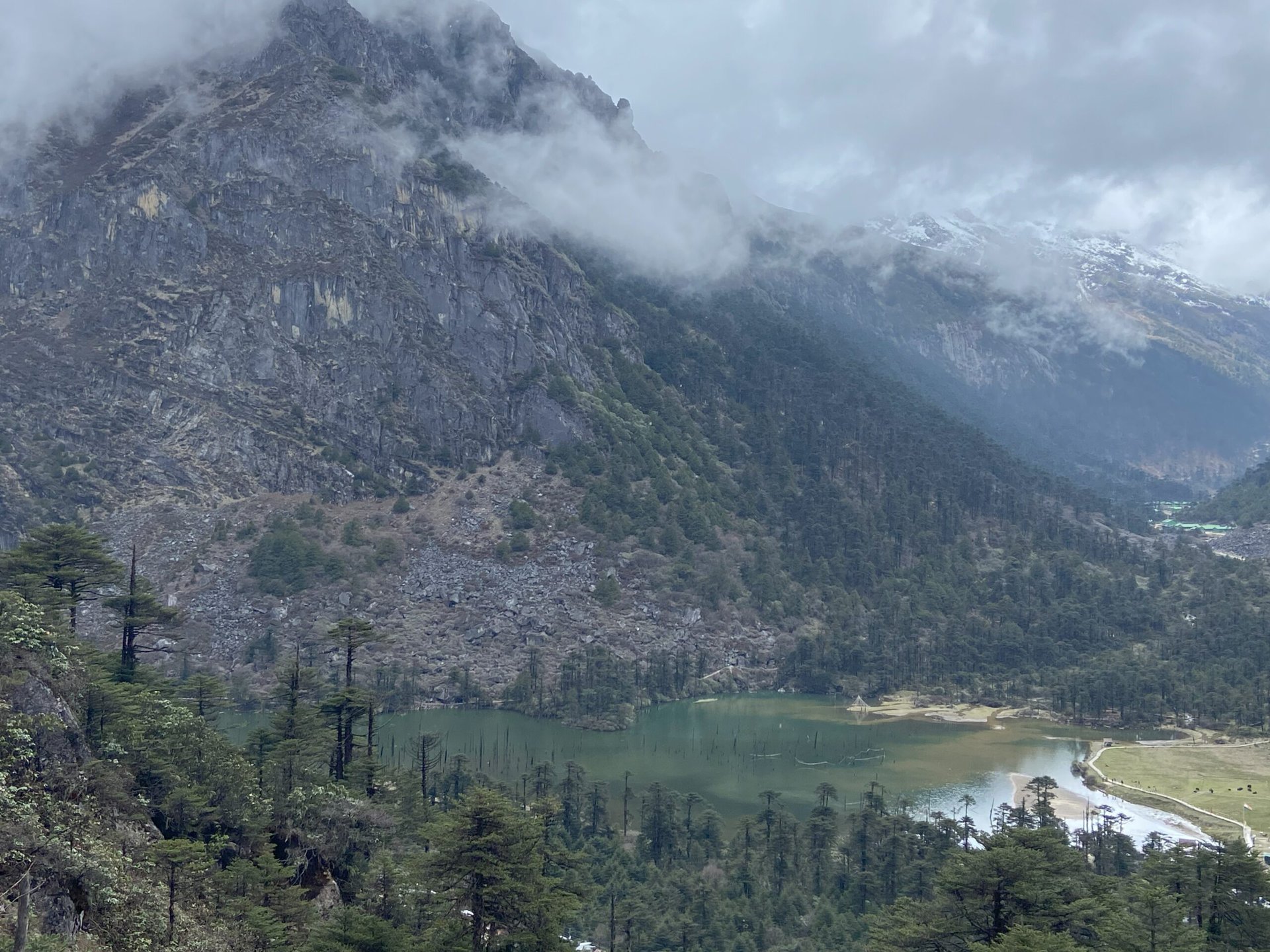
On the way back, we stopped at a few viewpoints overlooking Sangetsar Lake, also known as Madhuri Lake. The lake sits at an altitude of about 12,165 feet and was formed after a strong earthquake submerged part of a forest. Even now, you can see dead tree trunks rising out of the water, giving it a still, otherworldly feel.
The lake became popular after a song from the 1997 film Koyla, featuring Shah Rukh Khan and Madhuri Dixit, was shot here. Since then, the name Madhuri Lake has stuck.
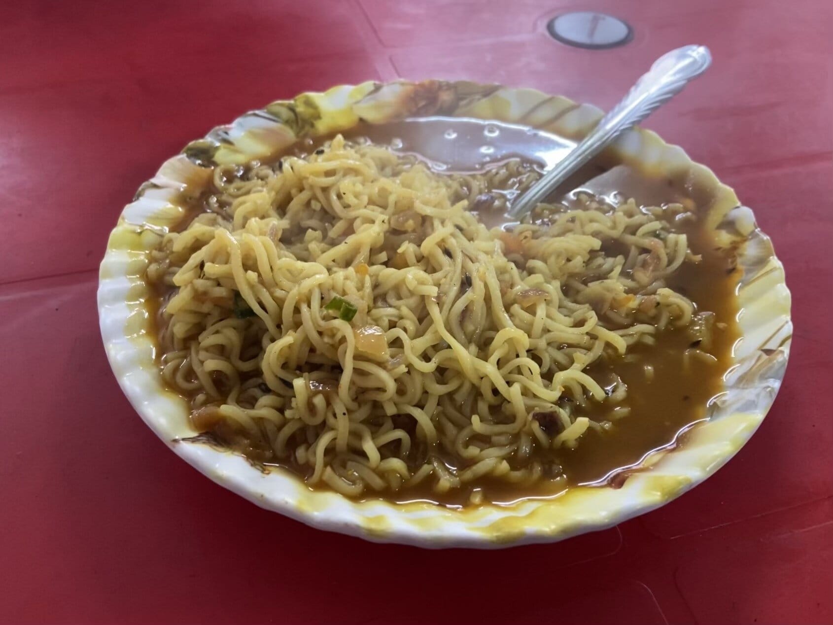
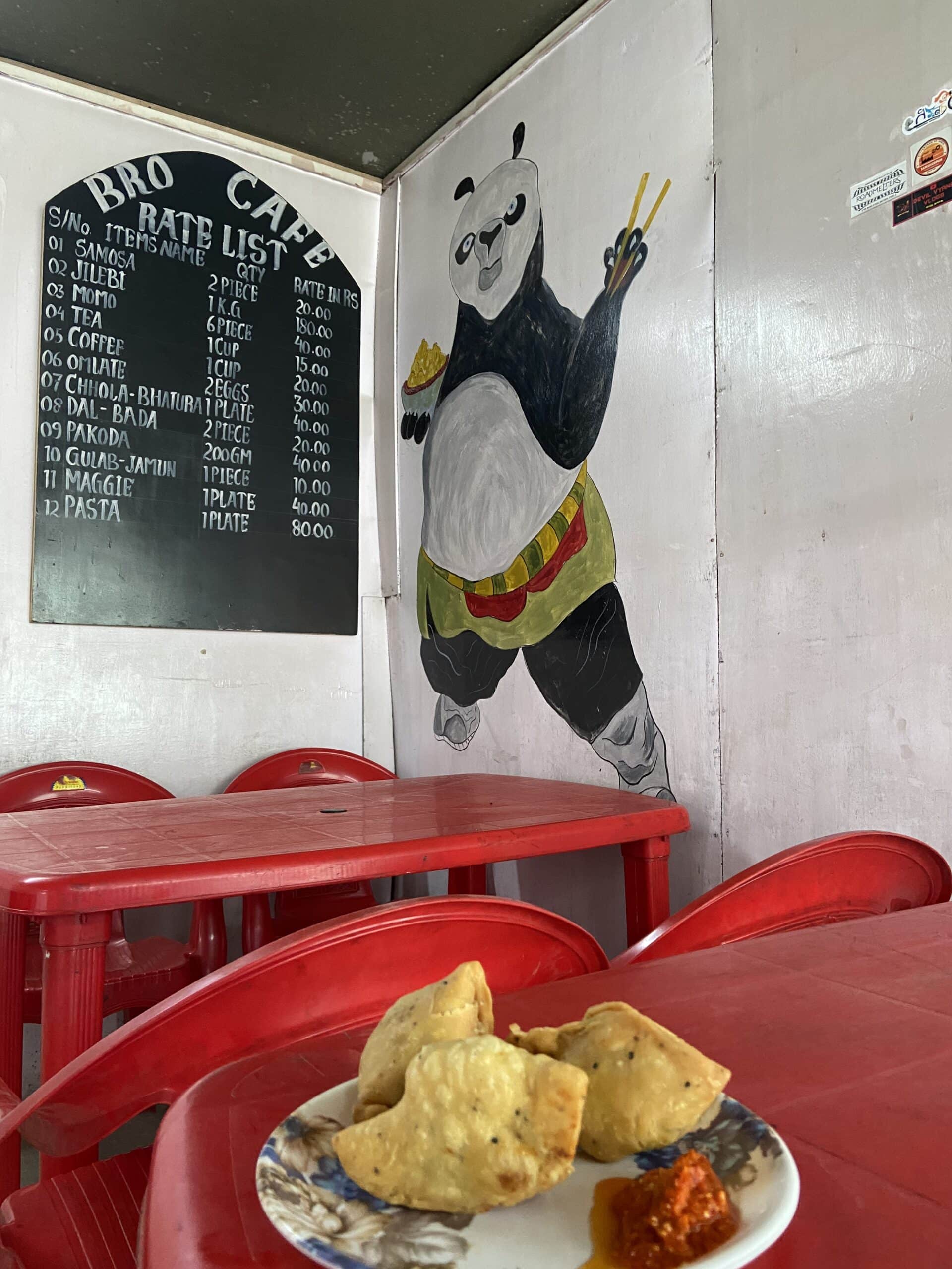
On our way back to Tawang, we stopped at a small BRO canteen. We had a plate of samosas and some hot Maggi noodles—just the thing after a long drive in the mountains.
Below are a few pictures of the road to T-Gompa, the T-Gompa, and some views of Madhuri lake

Giant Buddha Statue
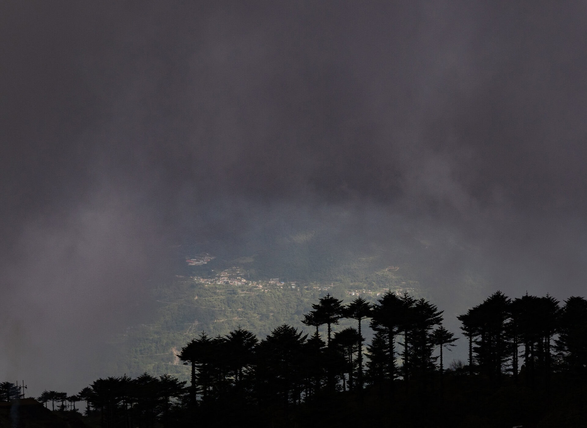
After this, we drove back to Tawang. It had started raining, and as we got closer, we saw Tawang town lit by golden sunlight through a break in the dark clouds. On the other side, the snow-covered mountains were partly hidden behind drifting mist. It felt like we were driving through the clouds.
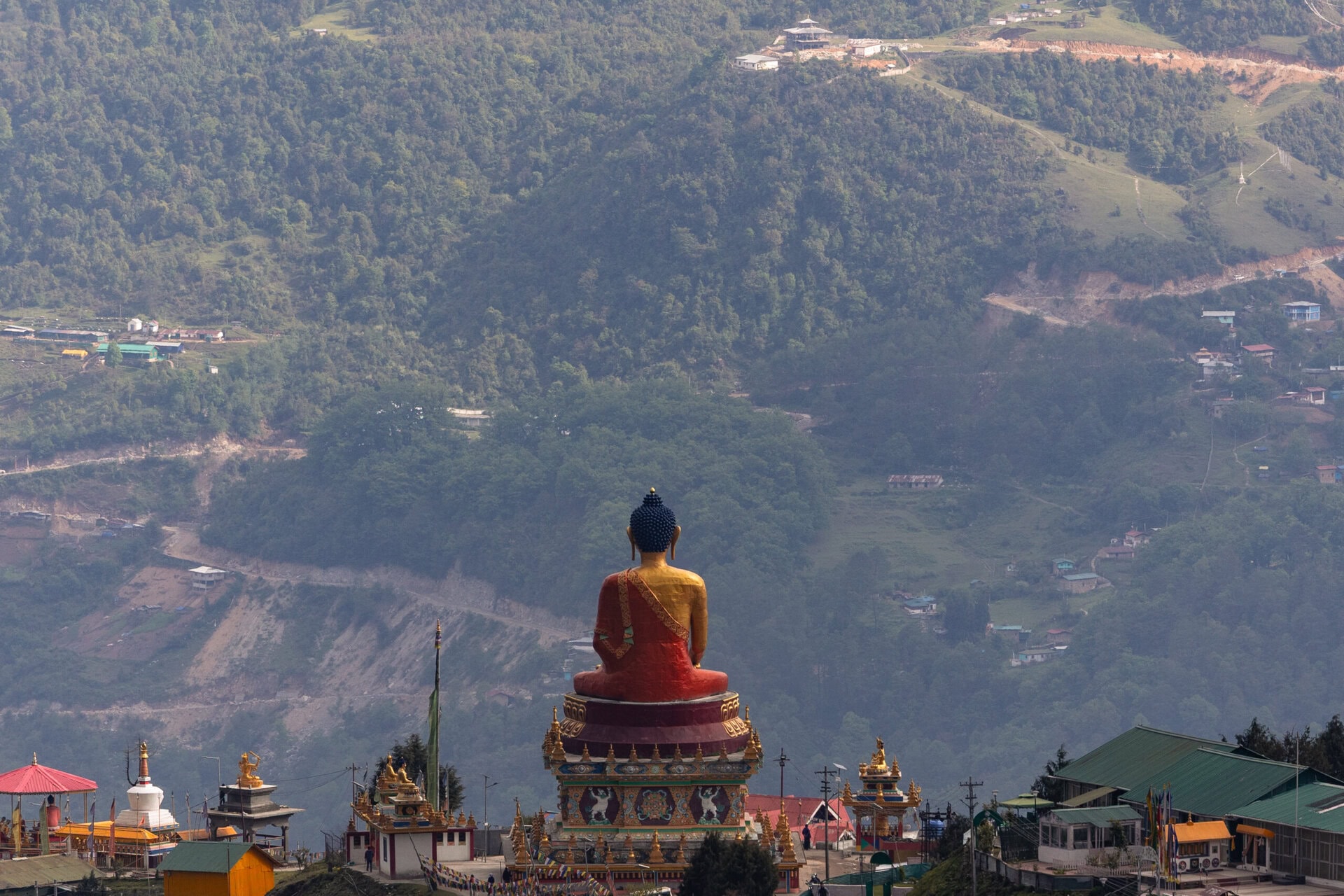
As we neared the town, we saw the large Buddha statue overlooking the valley and decided to stop.
The statue is located on a small hill near the Tawang Circuit House, and offers wide views of the Tawang Valley and the surrounding Himalayas. It stands around 30 feet tall, made of gilded bronze, and can be seen from different parts of the town. The setting is quiet and peaceful —deal for a short break and some quiet reflection. The statue was consecrated in 2015 by H.E. Thegtse Rinpoche, and holds spiritual importance for the local Buddhist community.


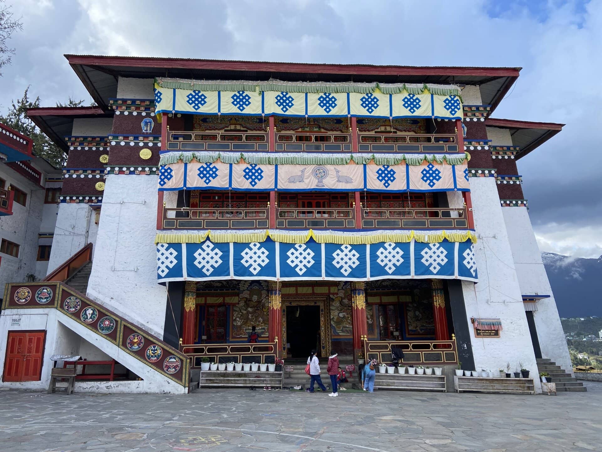
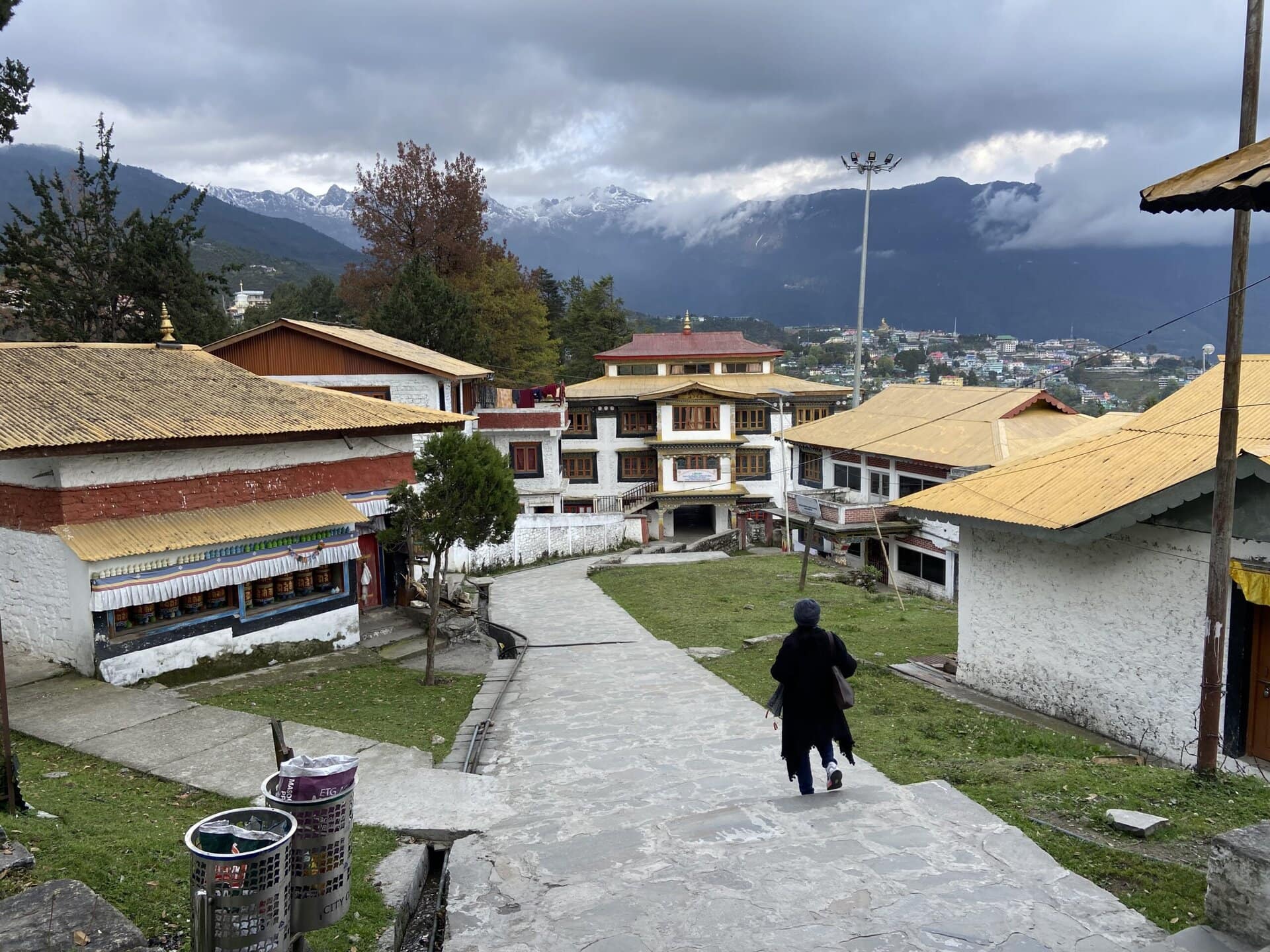
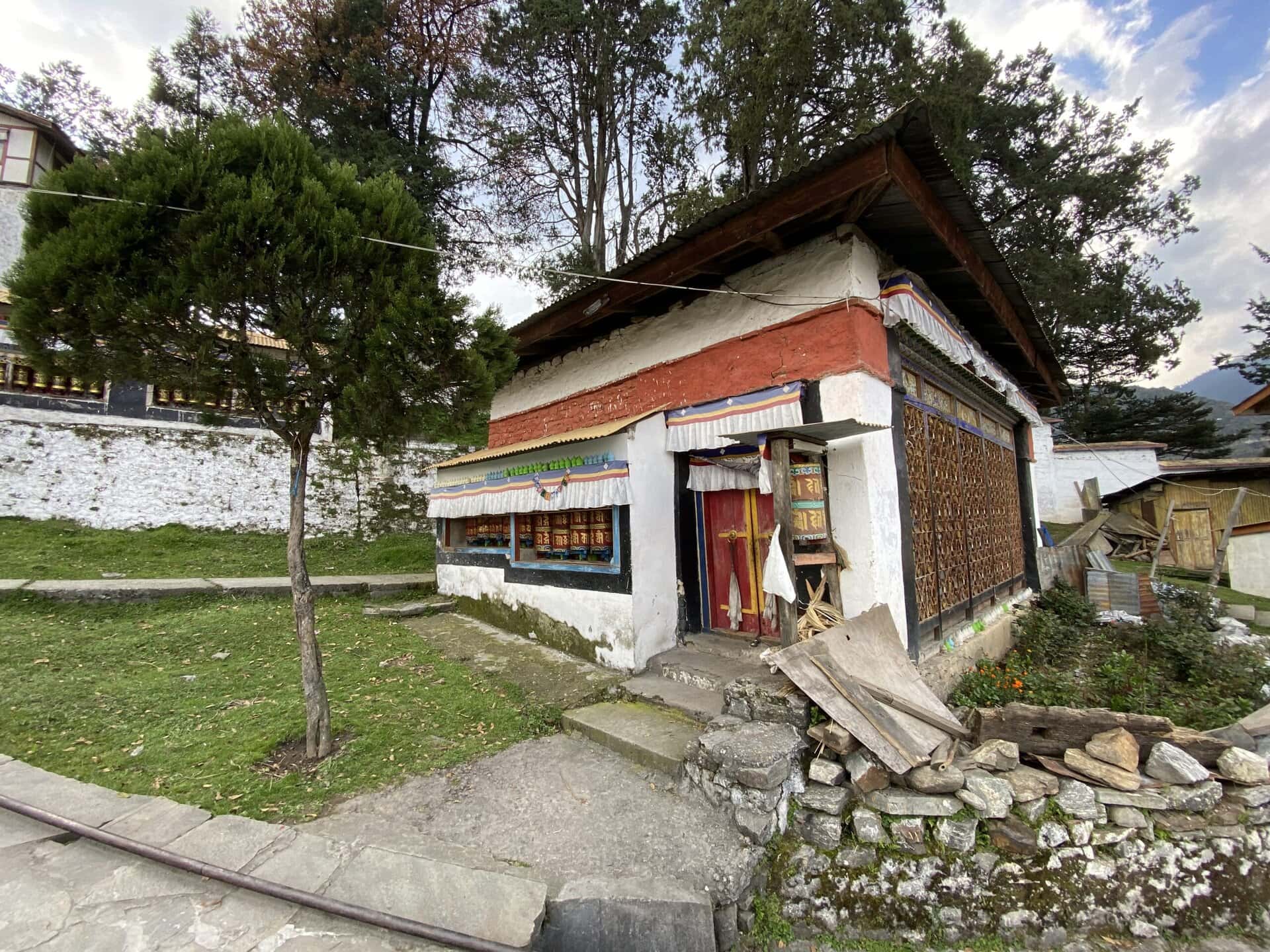
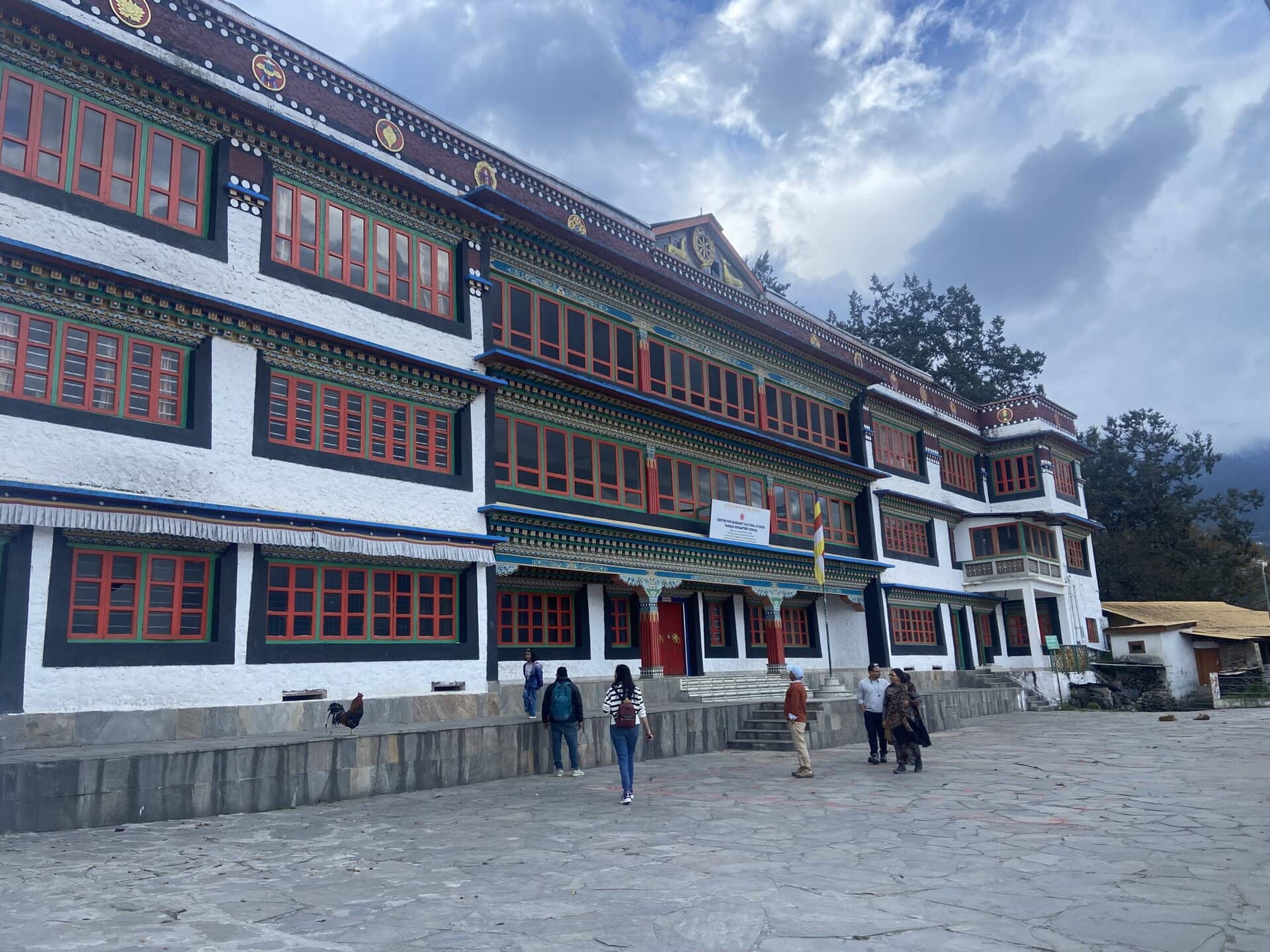
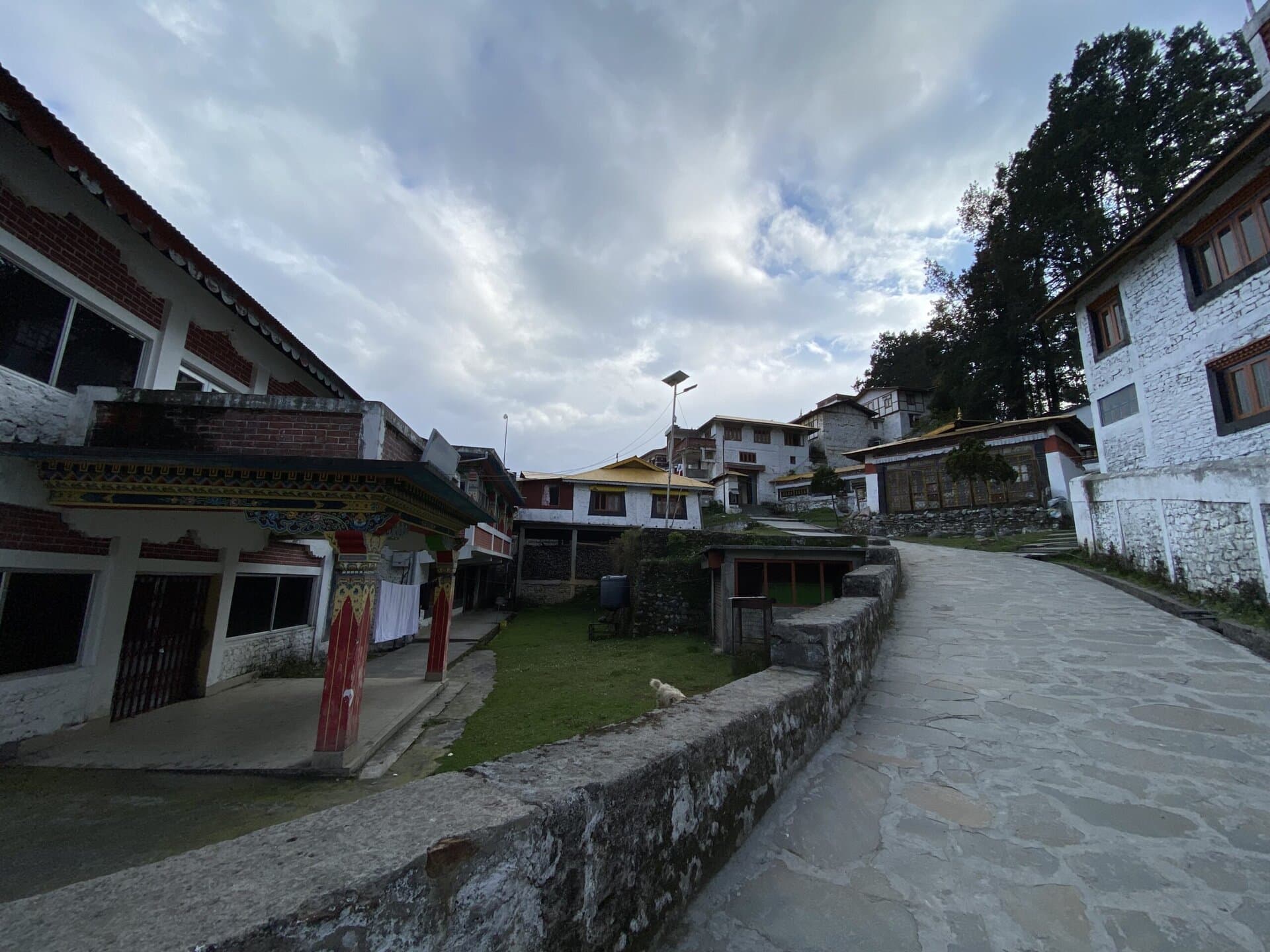
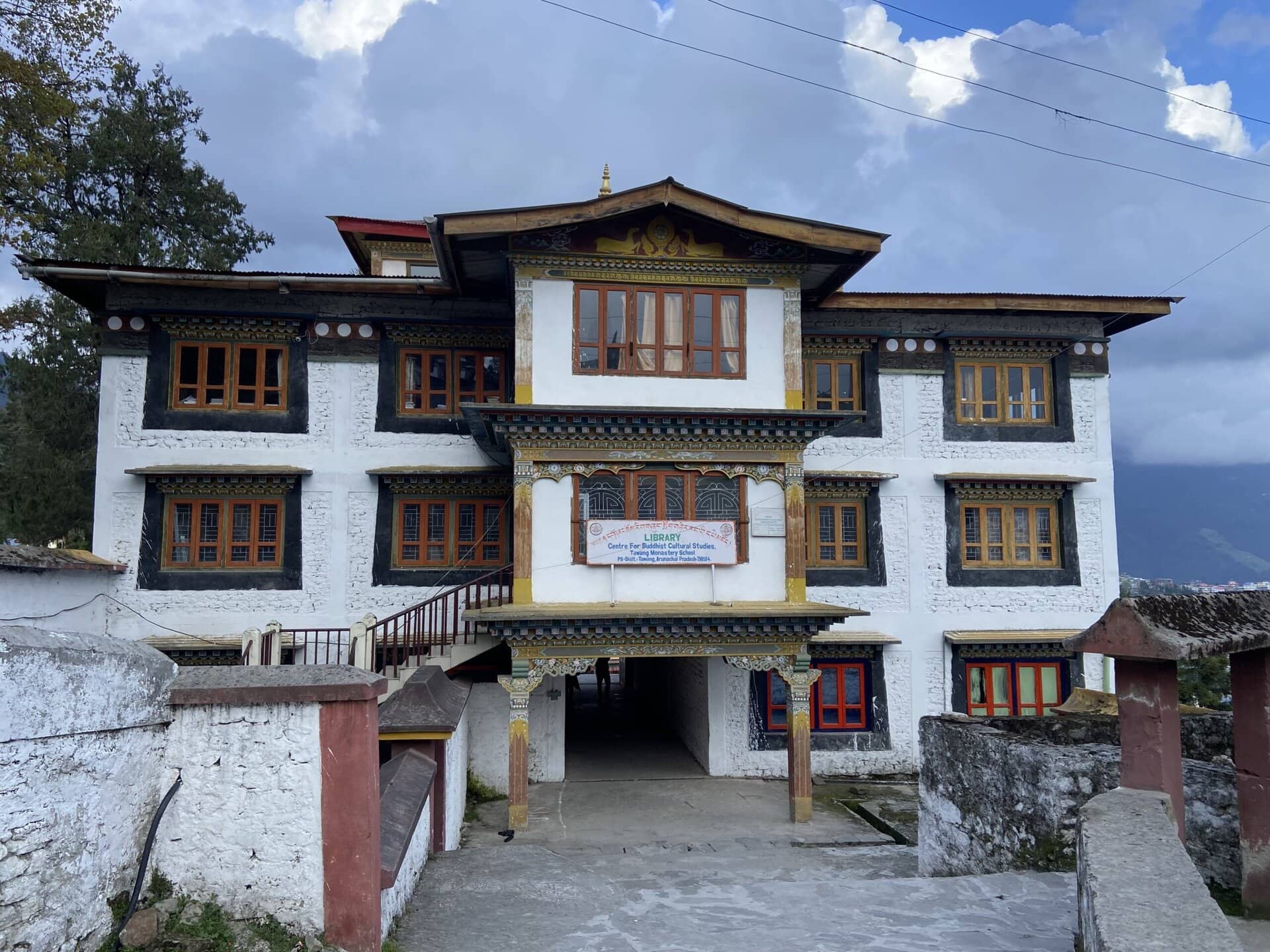
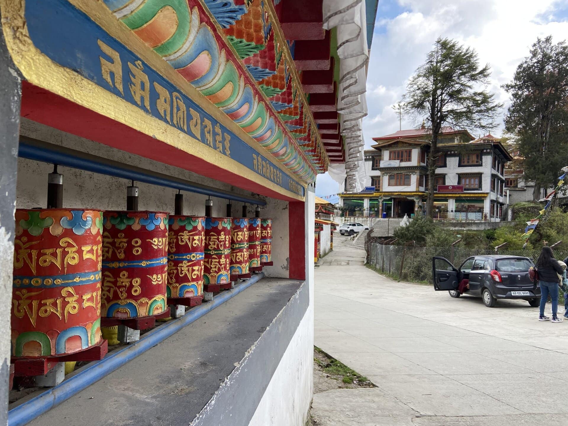
Tawang Monastery
The last place we visited in Tawang was the Tawang Monastery.
Also known as Gaden Namgyal Lhatse, this is the largest Tibetan Buddhist monastery in India and the second-largest in the world after the Potala Palace in Lhasa. It was founded in 1680–1681 by Merak Lama Lodre Gyatso, under the guidance of the 5th Dalai Lama, and belongs to the Gelug school of Vajrayana Buddhism.
The monastery is located at an altitude of around 10,000 feet and overlooks the Tawang Chu valley. It’s a large complex, surrounded by a 925-foot-long wall, with about 65 residential buildings that house around 450 monks. The main prayer hall is a three-story building, and the entrance gate, called the Kakaling, is painted in bright colours in traditional Tibetan style.
Visitors are allowed inside the main prayer hall, which has a large Buddha statue and several rows of seating where the monks gather for prayer. The other parts of the monastery are not open to the public, but we were able to walk through the narrow lanes inside and see many of the buildings from the outside.


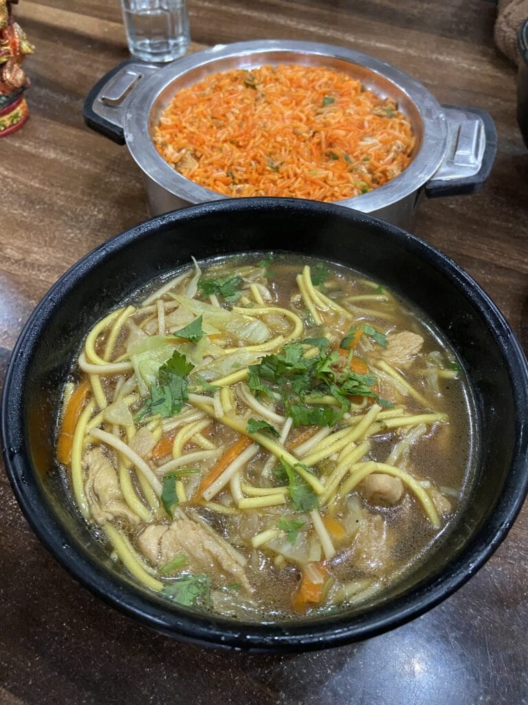
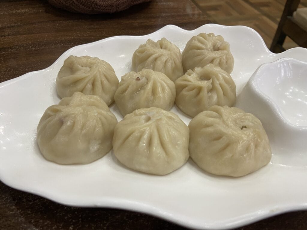
After this, we went to Dragon Restaurant in the main market area and had some tasty local dishes like momos, thukpa and fried rice. After this, we returned back to our homestay and called it a day.

Day 11: Drive from Tawang to Tezpur
My original plan was to stay near Sangti Valley on Day 11, explore a few places nearby, and then drive to Shillong on Day 12. But with the rains and slower road conditions, I realised that driving from Sangti to Shillong would take too long. So, I changed plans and decided to drive till Tezpur instead.
That turned out to be a good call. We left our homestay in Tawang after breakfast and took the tunnel route this time, bypassing Sela Pass. There was heavy fog near the tunnels, which slowed us down quite a bit. As we got closer to Dirang, it started to rain—and it kept raining all the way till Tezpur. We came across quite a few waterlogged sections on the road.
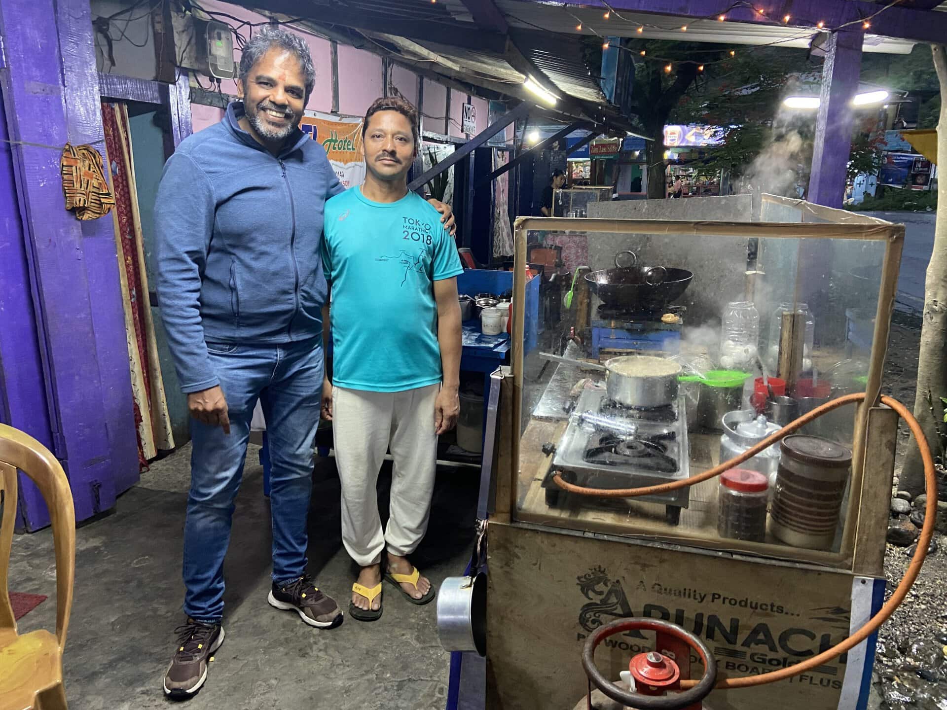
We stopped for lunch at Bomdila, where we had a very good chicken thali. Later in the evening, we took a short tea break. The tea shop owner noticed the Tamil Nadu registration on my car and asked where I was from. When I told him, he smiled and said he was from Assam, but had worked in Kanyakumari for 10 years—and spoke fluent Tamil. These are the small interactions that stay with me on road trips.
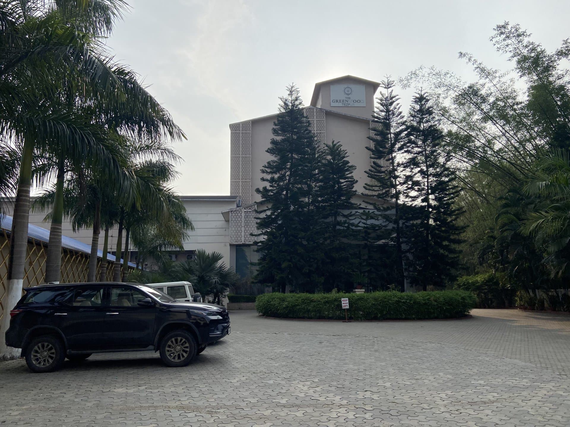
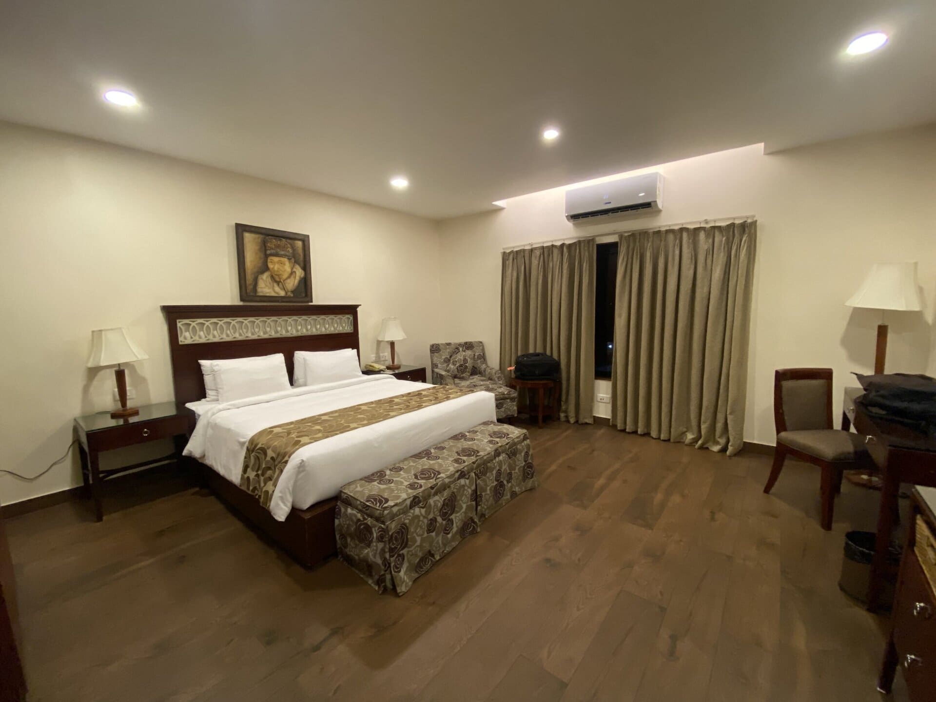
We reached Tezpur by around 7 PM and checked into Greenwood Hotel. After dinner, we called it a day. I didn’t take many photos on this stretch. The next day, our journey into Meghalaya would begin.

With this, our journey in Arunachal comes to an end. I will cover our journey in Meghalaya and my return drive to Coimbatore in Part 3 of this series.
Closing this part with a small video compilation of the various roads I drove in Arunachal.
To be continued in Part 3…
Discover more from graaja.blog
Subscribe to get the latest posts sent to your email.
2 Comments